


Directions
From the west, take Highway 2 east through Monroe and over Stevens’ Pass. Turn right on Icicle River Road and follow for approximately 8 miles. The campground will be on the left.
From the east, take Highway 2 west through Leavenworth. Turn left on Icicle River Road and follow road approximately 8 miles to the campground on the left.
Phone
509-763-0700
Activities
BIKING, CAMPING, FISHING, HIKING, WILDLIFE VIEWING, SWIMMING SITE
Keywords
EIGH,OKANOGAN – WENATCHEE NF -FS
Related Link(s)
Washington State Road Conditions
Overview
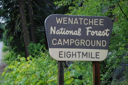
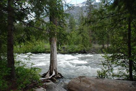
Nestled in a forest canopy of pine and fir on the banks of Icicle Creek, Eightmile Group Campground in Okanogan-Wenatchee National Forest offers a peaceful setting for groups and large gatherings.
Recreation
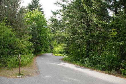
Eightmile Group Campground offers outdoor enthusiasts the opportunity to hike, fish, bike and enjoy a long list of outdoor recreational activities throughout the year. This campground has plenty of trails to explore by bike.
Anglers may want to cast a line into the deep pools at nearby Toketie Lake. Populations of rainbow and cutthroat trout find habitat in this somewhat secluded lake.
The nearby Fourth of July Trail offers hikers expansive ridge line views and challenging terrain. Beginning in the forest at 4,000 feet, the trail quickly climbs in elevation, out of the trees into more open, arid landscapes. The trail continues, traversing through mountain meadows with spectacular views of the Stuart Mountain Range and Icicle Valley. At 10.6 miles, this is a solid day hike, though backpackers can hook up connecting trails to continue for multiple days though adjacent wilderness settings.
Facilities
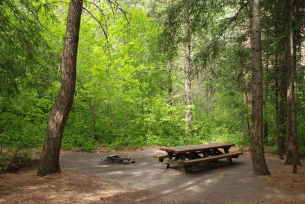
Eightmile Group Campground has one large site that can accommodate up to 70 guests and 25 vehicles. The site is equipped with picnic tables, a group campfire ring, drinking water and vault toilets.
Natural Features
Okanogan-Wenatchee National Forest offers stunning scenic views, with high, glaciated alpine peaks, valleys of old growth forest and rugged shrub-steppe country making up the diverse landscape. Elevations range from below 1,000 feet to over 9,000 feet.
More than 700 lakes and mountain ponds dot the glacier-carved terrain of nearby Alpine Lake Wilderness. Tree-covered valleys give way to rocky ridges and rugged peaks along the crest of the Cascades. Many peaks and slopes are permanently cloaked in snowfields. From wet forests of Douglas fir, cedar, and an understory of salal and berries, to firs and mountain hemlock, the landscape opens up to expansive meadows matted with low growth and ends with dry forestland of ponderosa pine and grasses.
Congress designated the Alpine Lakes Wilderness in 1976 with a total of 362,789 acres. Prior to designation, aggressive mining and logging operations punched numerous access roads into the area, creating a wildly irregular boundary to this popular area.
Nearby Attractions
Visitors enjoy the North Cascades and Mt. Rainer National Parks, where interpretive programs and exhibits offer education about the diverse landscape and history of the area.
Guests can also explore the area’s colorful railroad and mining history at the Steven’s Pass Historic District, or hit the slopes at Steven’s Pass Ski Area.