CAROLINA HEMLOCKS REC AREA, NC Campground Reservation, Info, Images, Map, Directions

CAROLINA HEMLOCKS REC AREA, North Carolina Campground Images, Info & Reservations

Directions

From Asheville, North Carolina, take I-26 west to exit 9, onto 19 east toward Burnsville. Follow 19 to Micaville and turn right onto Highway 80. Follow 80 south approximately 8 miles to the Carolina Hemlocks Recreation Area.

Phone

828-675-5509

Activities

BIKING, CLIMBING, CAMPING, INTERPRETIVE PROGRAMS, FISHING, HIKING, PICNICKING, WATER SPORTS, SWIMMING SITE

Keywords

CAHE,NFs IN NORTH CAROLINA – FS

Related Link(s)

Rec Area Info & Images

Forest Service Concessionaire

North Carolina State Tourism

North Carolina State Road Conditions

Overview

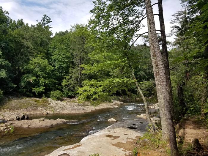
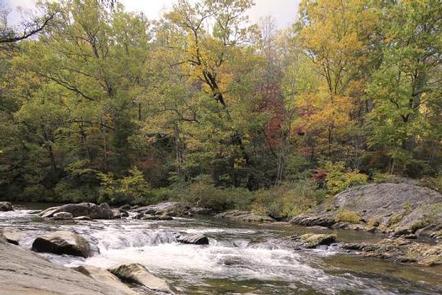
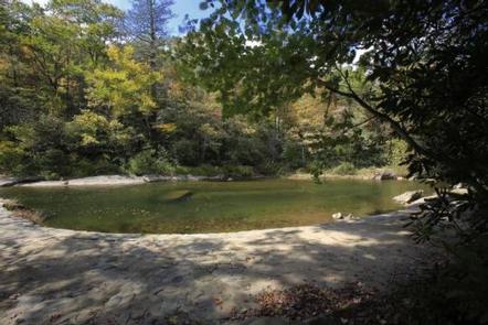
Carolina Hemlocks Recreation Area sits in the scenic mountains of Pisgah National Forest. This is a great place for small to medium-sized groups to swim, fish, tube, hike, camp, picnic and simply relax in the cool shade of the forest.

Recreation

The river provides endless hours of fun for families and water enthusiasts, including swimming and tubing. Anglers can also try their luck for trout and smallmouth bass from the shore. Picnickers will enjoy relaxing in the shaded picnic shelter set amidst the deep woods. After eating, visitors can take a leisurely walk along a one-mile trail or get a workout on a 3.8-mile trail.

Facilities

Carolina Hemlocks Recreation Area offers 35 primitive campsites, sites equipped with picnic tables, tent pads, lantern posts and campfire rings with grills. The facility provides hot showers and restrooms with flush toilets. Campers can purchase firewood, ice, tee shirts, souvenirs and rent tubes.

Natural Features

As the name suggests, Carolina Hemlocks Recreation Area is shaded by a thick hemlock forest with a mix of deciduous trees and rhododendrons. The facility is adjacent to the South Toe River and sits at an elevation of 2,900 feet.

Nearby Attractions

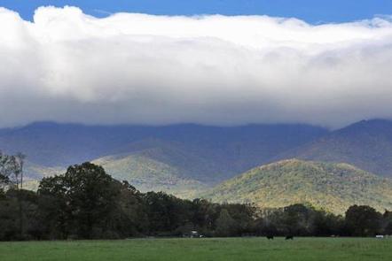
Visitors can enjoy scenic driving along the Blue Ridge Parkway or hiking in Mount Mitchell State Park.

Reservation

More from CampingHiking.net:

JOHN F KENNEDY, Arkansas Campground Images, Info & Reservations

Directions From Heber Springs, AR, take SR-25 north 4 miles, cross the dam, and turn right on the second road. Phone 501-250-0481 Activities CAMPING, WILDLIFE VIEWING Keywords JOHN,JFK,GREERS FERRY LAKE,GREERS FERRY LAKE Related Link(s) Rec Area Info & Images Arkansas State Tourism Arkansas State Road Conditions Overview John F. Kennedy

CEDAR RIDGE (TX), Texas Campground Images, Info & Reservations

Directions From Interstate 35 in Temple, Texas take State Highway 36 west towards Gatesville. Turn left on Cedar Ridge Park Road and continue into the park and campground area. Phone 254-986-1404 Activities BOATING, CAMPING, SWIMMING SITE Keywords CEDR,BELTON LAKE,LAKE BELTON,BELTON LAKE Related Link(s) Rec Area Info & Images Texas State

EAGLE GLACIER CABIN, Alaska Campground Images, Info & Reservations

Directions Located 23 miles northwest of Juneau. Access by the Amalga trail, 5.5 miles to the cabin from mile marker 27.3 on the Glacier Highway. The trailhead is on the north end of Eagle River Bridge and follows upstream on north side of Eagle River. The cabin is also accessible

DOYLE CREEK CAMPGROUND, Wyoming Campground Images, Info & Reservations

Directions From Buffalo, WY, take US Hwy 16 west 24 miles to County Rt. 3 (Hazelton Road). Turn left onto Hazelton Rd., and go 6.2 miles to campground turn off. Turn left and go 0.3 miles. Phone 406-587-9054 Activities BIKING, BOATING, CAMPING, FISHING, HIKING, WILDLIFE VIEWING, OFF ROAD VEHICLE TRAILS,