THIRD CREEK GROUP SITE, ID Campground Reservation, Info, Images, Map, Directions

THIRD CREEK GROUP SITE, Idaho Campground Images, Info & Reservations

Listen

Directions

From Malad, travel 3.5 miles north on I-15 to exit 17. Turn east onto Weston Highway and continue for 7 miles to Upper Deep Creek Reservoir. Turn left on Forest Road 231. Go one mile to Third Creek Group Site Campground.

Phone

208-236-7500

Activities

BIKING, CAMPING, HIKING, HORSEBACK RIDING, WILDLIFE VIEWING

Keywords

THIC,Deep Creek,Third Creek Campground,Third Creek Group Site,CARIBOU-TARGHEE NF – FS

Related Link(s)

Rec Area Info & Images

Idaho State Tourism

Idaho State Road Conditions

Overview

Third Creek Group Campground is located just 12 miles northeast of Malad, Idaho, on the Weston Highway near Deep Creek Reservoir. Visitors enjoy exploring the local trail system and fishing at Deep Creek.

Recreation

Third Creek Trailhead is adjacent to the campground, complete with hitching racks for horses. It accesses the Oxford Peak Trail System and is open to hikers, bikers, motorcyclists and off-road vehicle users as well.

Deep Creek Reservoir offers good trout, as well as boating and swimming opportunities.

Facilities

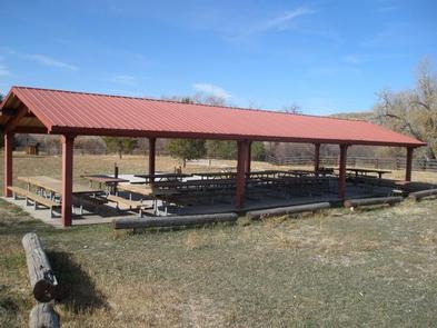
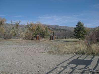
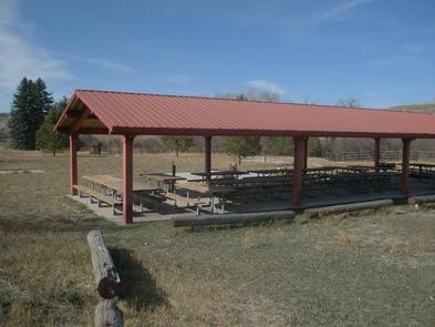
This year-round campground contains one group site that can accommodate up to 125 people. A large picnic shelter, tables and grills are provided, as are vault toilets and drinking water.

Weston Highway is paved and the one-mile stretch of road to the campground is a good gravel road with easy access for RVs and trailers.

Natural Features

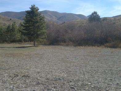
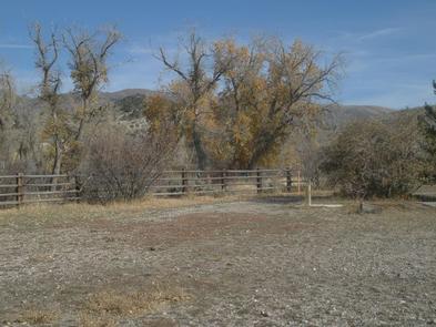
The group site lies in an open, flat area in Weston Canyon at an approximate elevation of 5,000 feet. Pines and hardwoods are scattered around the edges of the campground, which receives snow through the winter.

Reservation

More from CampingHiking.net:

LUPINE SHELTER, Montana Campground Images, Info & Reservations

Listen Directions From Wise River, Montana, take the Pioneer Mountains Scenic Byway approximately 25 miles south. Phone 406-832-3178 Activities BIKING, CAMPING, FISHING, HIKING, WINTER SPORTS, WILDLIFE VIEWING Keywords LUPI,LUPINE,SHELTER,BEAVERHEAD-DEERLODGE NF -FS Related Link(s) Rec Area Info & Images Montana State Tourism Montana State Road Conditions Overview Lupine Shelter is a

PERRY SOUTH CAMPGROUND, Oregon Campground Images, Info & Reservations

Listen Directions From Sisters, travel 5.6 miles northwest on Hwy 20. Continue 20.8 miles north on Forest Road 11, then 5.0 miles east on Forest Road 1170, and then 2.6 miles northwest of Forest Road 64. Phone 503-464-8515 Activities BIKING, BOATING, CAMPING, FISHING, HIKING, WATER SPORTS, WILDLIFE VIEWING, DAY USE

Verlot Campground, Washington Campground Images, Info & Reservations

Listen Directions From Seattle, go north on I-5 to Everett. Take Exit 194 onto Highway 2. Head north at Highway 204 toward Lake Stevens. Turn north on Highway 9. Turn east on Highway 92 to Granite Falls, WA. Campground is 10.8 miles east of Granite Falls. Phone 360-804-1103 Activities CAMPING

NEWBERRY GROUP CAMP SITE, Oregon Campground Images, Info & Reservations

Listen Directions From Bend, travel 23.5 miles south on Hwy 97, then 13.9 miles east on County Road 21. From Lapine travel north on Hwy 97 for 5 miles to Road 21. Take Road 21 east for 15 miles. Phone 541-383-5300 Activities BIKING, BOATING, CAMPING, FISHING, HIKING Keywords NEWB,DESCHUTES NF