CAPPS CROSSING, CA Campground Reservation, Info, Images, Map, Directions

CAPPS CROSSING, California Campground Images, Info & Reservations

Listen

Directions

From Pollock Pines, take Sly Park Road (County E16) 4.3 miles south to Mormon Emigrant Trail. Turn left onto Mormon Emigrant Trail and drive 11.2 miles east to North-South Road. Turn right onto North-South Road and drive 7 miles south to the campground. The entrance to Capps Crossing will be on the left.

Phone

831-245-6891

Activities

CLIMBING, CAMPING, HIKING, ROCK CLIMBING

Keywords

CAPP,ELDORADO NF – FS

Related Link(s)

Rec Area Info & Images

California State Road Conditions

California State Tourism

Forest Service Concessionaire

Overview

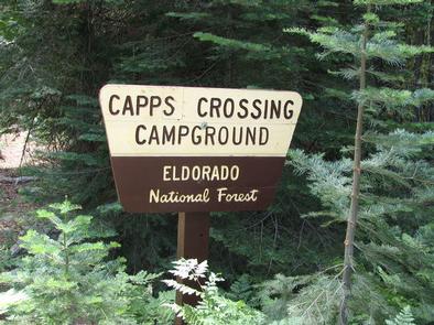
Capps Crossing is located on the North Fork of the Cosumnes River. The campground is located in a forested area and is well shaded during the day. Hiking trails and rock climbing areas are nearby.

Recreation

Wading is possible in the North Fork Cosumnes River. Fishing is an option and a good spot for swimming is nearby. While exploring the river, it’s not uncommon to see people panning for gold. Gold-seeking hobbyists maintain the excitement of the old days of gold mining in the region.

Facilities

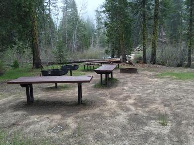
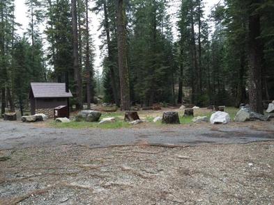
Capps Crossing is a unique campground. It is designed for groups, by reservation, and can accommodate 42 people. When the campground is not reserved for groups, the individual sites may be used on a first-come, first-served basis. Individual sites are limited to one vehicle and six people. Campsites 2-5 are for tents only and sites 1, 6, and 7 can fit RVs. Individual sites are arranged in a single loop that forms the group site.

Natural Features

Capps Crossing sits at an elevation of 5,100 feet, in the shade of cedar and fir trees. A Mediterranean climate extends over most of the forest, creating warm, dry summers and cold, wet winters.

Nearby Attractions

Visitors enjoy taking scenic drives to many overlooks in the area. Fishing, hiking, bird watching, and close proximity to off-highway vehicle routes are some of the attractions of Capps Crossing.

Reservation

More from CampingHiking.net:

DAM WEST DAY USE, Illinois Campground Images, Info & Reservations

Listen Directions From I-70, take State Route 127 south to Carlyle and turn east on Williams Road/1840 E. Williams Road will turn into Lake Road/1430 N. Continue on Lake Road south to the day use area, located on the left. Phone 618-594-5253 Activities BIKING, BOATING, CAMPING, INTERPRETIVE PROGRAMS, FISHING, HIKING,

HUNTERS GROUP SITE, Washington Campground Images, Info & Reservations

Listen Directions Take State Highway 2 west of Spokane for 32 miles to the town of Davenport. Turn north on State Highway 25 and travel 37 miles. Follow signs for the campground. Turn left (west) on Campground Road in the town of Hunters. Phone 509-754-7889 Activities BOATING, HISTORIC & CULTURAL

GRAND VIEW, Idaho Campground Images, Info & Reservations

Listen Directions From Ashton, Idaho, head east out on ID-47 (Mesa Falls Scenice Byway). Stay on the main road – it will make one big curve and head north, then cross Warm River (don’t turn right onto the Fish Creek Road). Turn left at the Lower Mesa Falls Overlook. The

SOUTH FORK (UT), Utah Campground Images, Info & Reservations

Listen Directions South Fork is located approximately 7 miles east of Huntsville, Utah, on Highway 39. From I-15, take the 12th Street exit and continue through Ogden Canyon. Continue on Highway 39 toward Monte Cristo. Phone OGDEN RANGER DISTRICT 801-625-5112 OR UTAH RECREATION COMPANY 385-273-1100 OR SOUTH FORK 801-745-4446 Activities

ANNA CREEK CABIN, Montana Campground Images, Info & Reservations

Listen Directions Anna Creek Cabin is located 30 miles from Hungry Horse, MT on the West Side Hungry Horse Reservoir Road (895). From Hungry Horse, turn south on Road 895, cross the Hungry Horse Dam and continue 29 miles on the west side of Hungry Horse Reservoir to the cabin.