

Directions
From Naches, WA travel west on State Route (SR) 12 for 4.4 miles. Continue straight onto SR 410 W for 26.5 miles. From Enumclaw, WA depart SR 164/Griffin Ave toward Wells St. After ½ mile turn left onto SR 410/Roosevelt Ave. Follow SR 410 approximately 67 miles east. The campground is on the south side of SR 410 near milepost 89.
Phone
(509) 653-1401
Activities
WILDLIFE VIEWING, BIRDING
Keywords
INDF,Indian Flat Site,Indian Flat,OKANOGAN – WENATCHEE NF -FS
Related Link(s)
Washington State Road Conditions
Overview
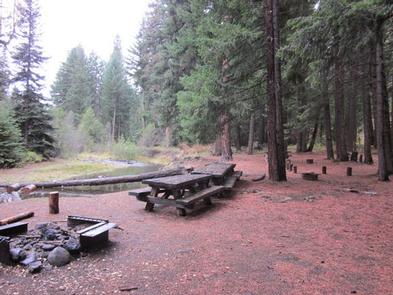
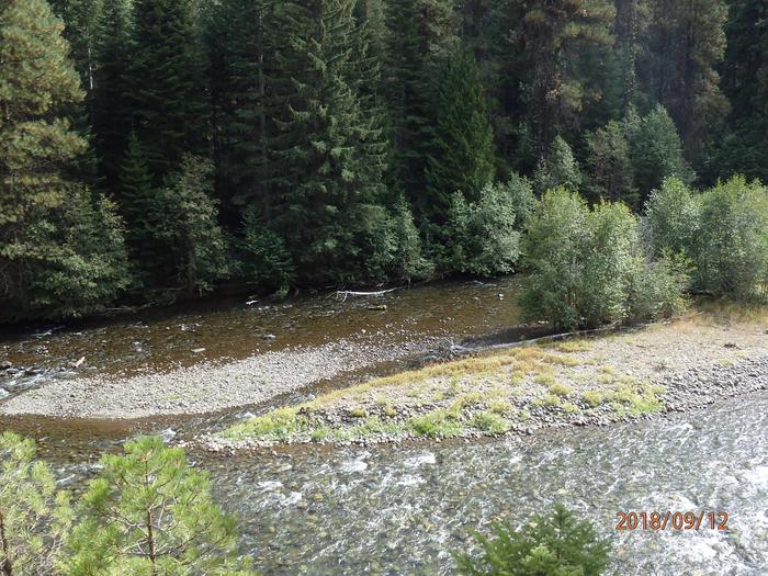
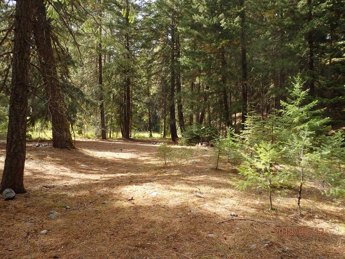
Indian Flat Group Campground is set on the banks of the Bumping River in the eastern foothills of the Cascades mountain range. Situated beneath a towering mixed conifer forest, this site offers a wonderful setting for large groups looking for a secluded camping experience.
Recreation
Indian Flat Group Campground is within 10 miles of opportunities to hike, mountain bike, ride horses, ski, raft and enjoy a multitude of outdoor recreational activities throughout the year. Nearby Bumping Lake offers visitors opportunities to boat, fish, swim or simply relax on its sandy beach. The American Ridge Trail offers hikers, overnight backpackers and horseback riders fantastic opportunities to absorb some of the area’s stunning beauty. Extending from Bumping River to the notable Pacific Crest trail, the American Ridge Trail offers over 26 miles of towering forests, stretches of meadows, alpine lakes and fantastic ridge line views.
Facilities
Indian Flat Group Campground has one large site and several other spur sites that extend around a campground loop. The campground accommodates up to 65 people and 22 vehicles. The site is equipped with picnic tables, campfire rings and four vault toilets. Drinking water is available at this site.
Natural Features
Okanogan National Forest offers stunning scenic views, with high, glaciated alpine peaks, valleys of old growth forest and rugged shrub-steppe country making up the diverse landscape. Elevations range from below 1,000 feet to more than 9,000 feet. Precipitation varies greatly throughout the area, ranging from approximately 140 inches along the Cascade Crest to only 10 inches along the eastern edge. Visitors can expect many days of warm, sunny weather in the summer, and winters with clear skies and plenty of snow. The surrounding undeveloped wilderness, clean streams and diverse forests support an abundance of wildlife, including deer, squirrels, native fish, black bear and migratory birds. Goat Rocks Wilderness is a stunning adventure for those wanting to traverse higher elevations. Peaks within the area are remnants of an extinct volcano, taking the name “Goat Rocks,” in honor of the numerous mountain goats traversing this isolated region. Gilbert Peak is the highest summit in this area, at an elevation of 8,184 feet.
Nearby Attractions
Boulder Cave National Recreation Trail is one of the most popular places in the Naches District. Visitors can walk the accessible trail along the river or explore Boulder Cave. Interpretive signs along the trail explain the geology, plants, animals and fire history of the area. Visitors enjoy Mt. Rainer National Park, where interpretive programs and exhibits offer education about the diverse landscape and history of the area. The Pacific Crest Trail (PCT), one of the world’s premier National Scenic Trails, showcases some of North America’s most fantastic scenery winding its way its way from Mexico to Canada through California, Oregon and Washington, is accessible near the campground. Visitors will also enjoy traversing the Chinook Scenic Byway, considered one of Washington’s premier driving excursions. Spectacular views of Mount Rainier and surrounding landscape dominate this 92-mile journey.