

Directions
From North Seattle take US-2 to Wenatchee. From Tacoma/South Seattle take 1-90 to exit 85 and take WA-970, US-97 and US-2 to Wenatchee. From Wenatchee, at the junction of U.S. Highway 2 and Washington State Route 97A, travel north 17 miles along the west bank of the Columbia River. Turn left 100 yards north of the Entiat River Bridge onto Entiat Valley Road (Chelan County Route 19). Continue west/northwest just over 11 miles and turn left on Mad River Road (Chelan County Route 19). Continue up Mad River Road for almost three miles, to its junction with Forest Road 5700. Continue 2 miles to the campground.
Phone
509-784-4700
Activities
FISHING, HIKING, HORSEBACK RIDING, OFF HIGHWAY VEHICLE, WILDLIFE VIEWING, MOUNTAIN BIKING, BIRDING
Keywords
PNFL,OKANOGAN – WENATCHEE NF -FS
Related Link(s)
Washington State Road Conditions
Overview
Pine Flats Group Campground is located next to the Mad River within the Pine Flats Campground, in the Okanogan-Wenatchee National Forest, Entiat Ranger District. Visitors have easy access to nearby multiple-use trails. Birding and wildlife viewing are popular activities.
Recreation
The campground offers great nearby access to trail opportunities for hikers, horseback riders, mountain bikers and motorcyclists. The Lower Mad River Trail (#1409) starts next to the campground. This 14-mile long trail leads to the upper Mad River meadows area and Klone Peak. Spring time wildflower viewing is a popular activity while hiking up the trail.
Facilities
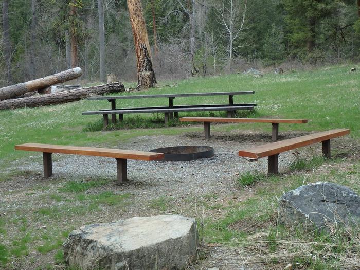
The campground offers one group site that can accommodate up to 40 people and six first-come first-serve single family sites. Picnic tables and campfire circles are provided, as are vault toilets and drinking water. Garbage service is provided during the main summer season. Please ‘pack it in – pack it out’ if cans are full or your group produces more than the cans can accommodate.
Natural Features
The campground is situated on the banks of the Mad River, at an elevation of 1,621 feet. Ponderosa pines tower over the campground. The group site is adjacent to an open meadow with great wildflowers during the spring bloom season and the Mad River. The surrounding forest provides excellent habitat for a wide range of wildlife. Visitors may catch glimpses of mule deer, moose, bald and golden eagles and a variety of woodpeckers and owls.