BLACK ROCK, ID Campground Reservation, Info, Images, Map, Directions

BLACK ROCK, Idaho Campground Images, Info & Reservations

Listen

Directions

From Idaho City, travel north on State Highway 21 for about two miles, to the Granite Creek/Rabbit Creek Road No. 327. Turn right and travel east for 18 miles on Road No. 327, to the campground.

Phone

208-392-6681

Activities

BIKING, CAMPING, FISHING, HIKING, WILDLIFE VIEWING, SWIMMING SITE

Keywords

BLRK,BLACK ROCK CAMPGROUND,BOISE NF – FS

Related Link(s)

Rec Area Info & Images

Idaho State Road Conditions

Idaho State Tourism

Overview

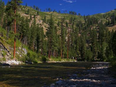
Black Rock Campground is located 20 miles from Idaho City, on the North Fork Boise River, at an elevation of 4,300 feet. Visitors enjoy fishing, swimming and exploring local trails.

Recreation

The North Fork Boise River offers rainbow trout fishing in a beautiful natural setting. Many swimming holes can be found within a short distance of the campground.

Numerous trail opportunities for hiking, mountain biking, horseback riding and dirt biking can be found in the vicinity.

Facilities

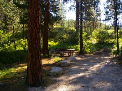
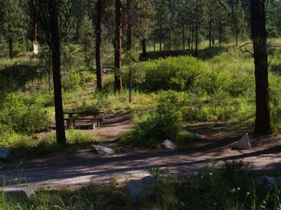
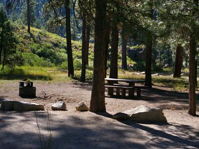
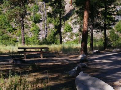
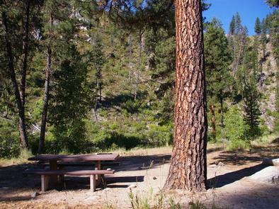
The campground contains several single-family campsites, each equipped with a picnic table and campfire ring. Some sites also have grills. Vault toilets, drinking water and trash collection are provided within the campground. Roads and parking spurs are dirt.

Natural Features

The campground sits on the banks of the North Fork Boise River, where ponderosa pines tower over the area. Most campsites have partial shade, but little privacy from other campers. A variety of wildlife makes its home around the campground.

Reservation

More from CampingHiking.net:

SAVENAC COOKHOUSE, Montana Campground Images, Info & Reservations

Listen Directions From Missoula, travel west on Interstate 90 for 90 miles, to Haugan (Exit 16). Turn right at the stop sign. At the frontage road turn right, then take the first left, crossing the cattleguard. Signs are onsite if needed. Maps are available online or for purchase by calling

PINNACLES CAMPGROUND, California Campground Images, Info & Reservations

Listen Directions Pinnacles National Park is located 32 miles south of Hollister, CA on Hwy 25 and 29 miles northeast of King City, CA on Hwy 25. Campground is located on the east side of Pinnacles National Park off Hwy 25. Phone 831-200-1722 OR GO TO WWW.VISITPINNACLES.COM Activities CLIMBING, CAMPING,

WHITTEN PARK, Mississippi Campground Images, Info & Reservations

Listen Directions From Interstate 22 , take Highway 25 (exit 104). Then turn left at the first red light, then turn left onto Access Road at the next traffic light. Go north 4 miles. Campground is on the left side of the road within the Jamie L. Whitten Historical Center

ADAMS RANGER STATION, Idaho Campground Images, Info & Reservations

Listen Directions There are two ways to access this cabin in the summer: 1) From the town of Grangeville, turn south on the Grangeville-Salmon Road and follow the signs toward Gospel Hump and Salmon River. At mile marker 29, turn left (east) onto Hungry Ridge Road #309 and drive approximately

MILLER CABIN, Montana Campground Images, Info & Reservations

Listen Directions From Townsend, Montana: Turn east from US Highway 287 onto US Highway 12 for approximately 3 miles. Turn north on State Highway 284 for approximately 15 miles. Turn northeast onto Forest Road 287, Confederate Gulch, travel on Forest Rd 287 for approximately 8 miles. Arrived at location. Junction