
Directions
From the south, take Highway 99 to Bakersfield. Take the Highway 178 exit and travel east toward the Kern River Canyon. Follow Highway 178 for approximately 40 miles to the town of Lake Isabella. From Lake Isabella, take Highway 155. Continue past the town of Wofford Heights to Kernville. At the stop sign in Kernville, turn right onto Sierra Way. Proceed 4 miles. Camp 9 is on the right side of the road.
Phone
760-376-3781
Activities
BIKING, BOATING, CAMPING, FISHING, WATER SPORTS, FISH HATCHERY, SWIMMING SITE
Keywords
LAK9,CAMP 9,CAMP NINE,LAKESIDE,CAMP 9 LAKESIDE,SEQUOIA NF – FS
Related Link(s)
California State Road Conditions
Overview
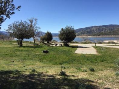
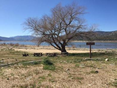
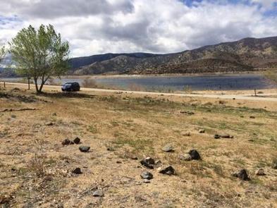
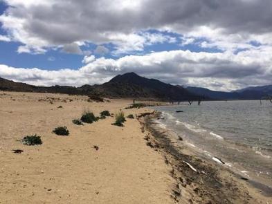
Camp 9, a year-round facility, rests on the shores of Lake Isabella, a high desert reservoir. Its proximity to the lake and the Upper Kern River makes the facility popular among boaters, rafters and anglers. The camp is also a favorite among RV campers, with ample parking available to accommodate both trailers and motorized watercraft.
Recreation
Anglers enjoy fishing on both Lake Isabella and the Upper Kern River. Boating, kayaking and swimming are also popular activities. A seasonal boat ramp and dock are available within the day use area in the campground.
Facilities
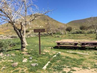
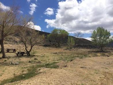
Camp 9 offers over 100 single campsites, available on a first-come, first-served basis. Additionally 11 group sites are available by reservation. Some sites are on the lakeshore, while others are set further back but have views of the lake. A few cottonwood trees are found in the campground, but shade is limited; plan on bringing protection.
The group sites offer two picnic tables each, campfire rings, portable toilets, and paved parking. Group sites 1, 2 and 6-11 have drinking water. Group sites 1 and 2 have shade shelters. Sites 1-5 each have a locked gate for security.
An RV dump station ($10 fee), fish cleaning station and boat ramp with floating dock are also available within Camp 9 Recreation Area.
Natural Features
The campground sits on the north shore of Lake Isabella, an 11,000-acre reservoir, at an elevation of 2,600 feet and is a short drive to the Upper Kern River.
In the spring and early summer, a breeze can come up in the afternoons, but the mornings are quiet and calm. Fall and winter are perhaps the most beautiful time of year at Camp 9, with temperatures ranging from the 60s in the day to low 40s at night.
Sequoia National Forest, located at the southern end of the Sierra Nevada in central California, is named for the giant sequoia, the world’s largest tree, which grows in more than 30 groves on the forest’s lower slopes. The forest encompasses about 1.1 million acres. Elevations range from about 1,000 to 12,000 feet, creating precipitous canyons and mountain streams with spectacular waterfalls, such as Salmon Creek Falls and Grizzly Falls.
Nearby Attractions
The Upper Kern River is a short drive away, with additional fishing opportunities. Rafters and kayakers also enjoy the river.