
Directions
From I-75, take Highway 40 east through Ocala and Silver Springs for approximately 36 miles to the Juniper Springs Recreation Area.
From I-95, take the Ocala/Silver Springs Exit (Highway 40) west for approximately 37 miles to the Juniper Springs Recreation Area.
From the intersection of Highway 40 and Highway 19, the campground is 4.5 miles west on Highway 40. The entrance is on the north side of Highway 40.
Phone
352-625-3147
Activities
BOATING, HISTORIC & CULTURAL SITE, CAMPING, INTERPRETIVE PROGRAMS, FISHING, HIKING, WATER SPORTS, WILDLIFE VIEWING, DAY USE AREA, SWIMMING SITE
Keywords
JUSP,OCALA NATIONAL FOREST,LAKE GEORGE DISTRICT,SEMINOLE DISTRICT,NFs IN FLORIDA – FS
Related Link(s)
Overview
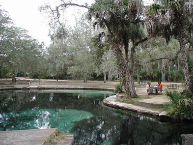
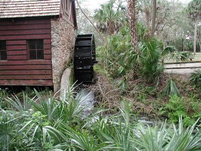
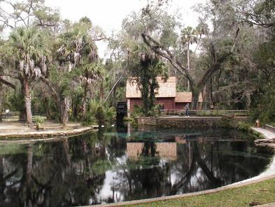
Juniper Springs Campground is one of the most popular campgrounds in the Ocala National Forest. The location offers deeply shaded sites within walking distance of some of Florida’s most beautiful natural springs. The surrounding recreation area has plenty of activities to entertain visitors, including swimming, picnicking, canoeing, snorkeling, hiking, birding and wildlife viewing.
This campground was named one of Reserve America’s Top 100 Family Campgrounds in the United States.
Recreation
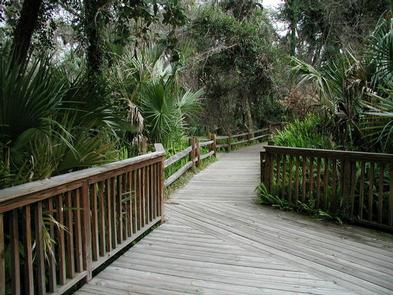
Visitors love swimming in a warm natural pool found in the day use area. Canoeing is also extremely popular year-round. The 7-mile journey down Juniper Run offers a unique perspective on the Juniper Prairie Wilderness. Private canoes can be used, or canoes can be rented from the concessionaire.
Back on land, campers can spend a day in the woods on a segment of the statewide Florida Trail, or walk a shorter nature trail within the facility. Interpretive programs are available during summer months.
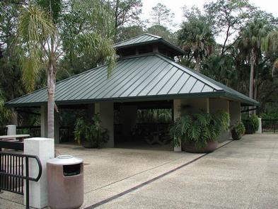
Facilities
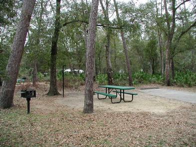
The facility is divided into a day use area and campground. Campsites are arranged into three loops near the creek and springs. All sites are shaded and equipped with a picnic table, grill, campfire ring, lantern post and space for tents. There are no sites with full hookups. Other amenities include hot showers, flush toilets and dump station.
A convenience store with camping supplies, beach supplies, food, drinks and ice cream is nearby. Restaurants, shopping and gas are just 10 miles from campground.
Natural Features
The natural springs are at the heart of this recreation area. Hundreds of bubbling springs emerge from crevices in the earth beneath a dense canopy of palms and oaks – an oasis within the heart of the desert-like Big Scrub ecosystem for which the national forest is known.
Abundant wildlife inhabitant the area, including alligators, turtles, deer, black bear, turkey, raccoons and numerous species of birds, as well as uncommon species like the albino gray squirrel, river otters and American eels.
Nearby Attractions
Lake George and its many activities are just a short drive away. The Ocala National Forest is also notable for its extensive off-road trail system catering to both ATV enthusiasts and Jeeps, as well as being a traditional destination for deer hunters from around Central Florida. These opportunities are available nearby.