

Directions
From Council, drive 12 miles northwest on the paved Council-Cuprum Road 002, then 12 miles southwest on the gravel Buck Park Road 055 (high-clearance vehicles are necessary for passage). Continue 0.2 miles south on Buck Park Spur. Expect large rocks and a narrow, one-way road. Buck Park is a 1.5-hour drive from Council, Idaho.
Phone
208-549-4200
Activities
CAMPING, HIKING, HORSEBACK RIDING, HUNTING
Keywords
BUPC,CUDDY,CUDDY CABINS,PAYETTE NF – FS
Related Link(s)
Overview
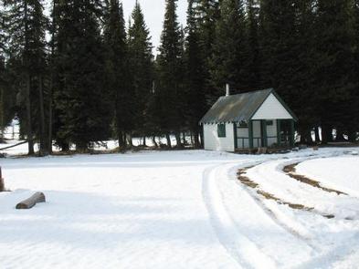
Buck Park Cabin is located on Cuddy Mountain, in the Payette National Forest of central Idaho. Guests enjoy the remote area for its hunting opportunities and abundance of hiking, biking, horseback riding and off-road vehicle trails.
Recreation
The cabin sits near small Rush Lake, which offers fishing opportunities. Hornet and Lower Hornet lakes are a short distance away.
Hikers, mountain bikers, horseback riders and off-road enthusiasts will find several motorized and non-motorized trails in the surrounding area. Click here for an Idaho OHV safety message.
Facilities
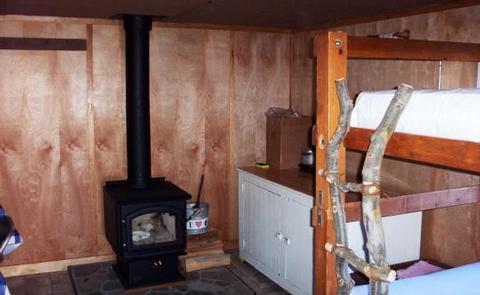
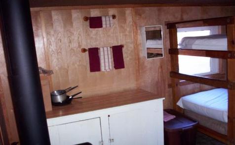
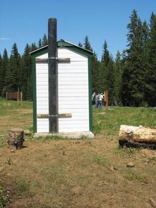
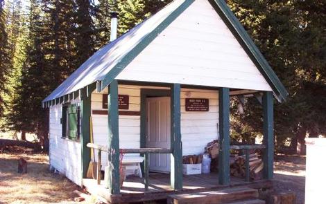
This very rustic cabin can accommodate a maximum of three people. Metal cots are provided, but guests must bring their own sleeping bags. A wood stove is provided for heat and cooking. No plumbing or electricity is available. A vault toilet is located outside. Guests must bring water, food, bedding and firewood.
Horse corrals and hitching racks are available within the cabin complex.
Natural Features
The cabin sits at an elevation of 7,280 feet within Buck Park, a scenic meadow surrounded by a dense conifer forest. Rush Lake, Hornet and Lower Hornet reservoirs are nearby.
The Payette National Forest encompasses some of Idaho’s most beautiful and diverse country. Located in west-central Idaho, north of Boise, the 2.3-million-acre forest extends 100 miles west to east, from Hells Canyon to the Middle Fork Salmon River, and 70 miles north to south, from the Salmon River to the Weiser River.