
Directions
W 3853 US-2 Moran Michigan 49760
From Mackinac Bridge, take Highway 2 approximately 18 miles west to the campground entrance.
Phone
906-203-9872
Activities
BOATING, CAMPING, HIKING, WILDLIFE VIEWING, SWIMMING SITE
Keywords
LAKM,LAKE MICHIGAN CAMPGROUND,MICHIGAN LAKE CAMPGROUND,UPPER PENINSULA MICHIGAN LAKE,LAKE MICHIGAN IN THE UPPER PEN,LAKE MICHIGAN AT ST IGNACE,LAKE MICHIGAN,HIAWATHA NF – FS
Related Link(s)
Michigan State Road Conditions
Overview
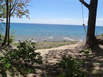
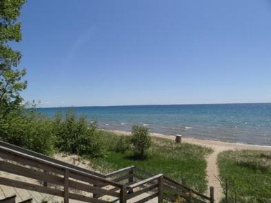
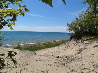
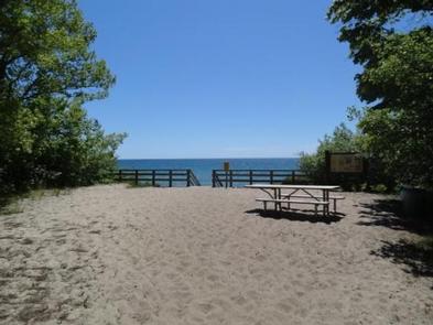
Lake Michigan Campground at St. Ignace provides great views and unlimited access to Lake Michigan. The area has excellent trails, winding hikers through ancient sand dunes, windswept foundations and a variety of vegetation.
Recreation
The campsites are located between 20- to 30-foot high sand dunes and are just steps away from great body-surfing waves, that crash onto the lake’s sandy beaches during commonly high winds. Lake Michigan does offer fishing, but anglers tend to prefer Brevort Lake better, for its catches of walleye, pike, bass, perch and crappie. Campers at Lake Michigan have access to the popular Sand Dunes Cross-Country Ski Trail, as well as the North Country National Scenic Trail, which connects a host of natural areas, from valleys to hilltops, prairies to forests and everything in between. Both trails offer miles of terrain, keeping hikers busy for as long as they choose.
Facilities
The campground offers many shaded and open sites for tent and RV camping. Some sites are available on a first-come, first-served basis. Picnic tables and campfire rings with grills are provided.
Accessible vault toilets are available, as well as drinking water. Hookups are not provided. Parking spurs are comprised of grass and dirt. A trash collection bin is available at the campground and a dump station can be found at Brevort Lake.
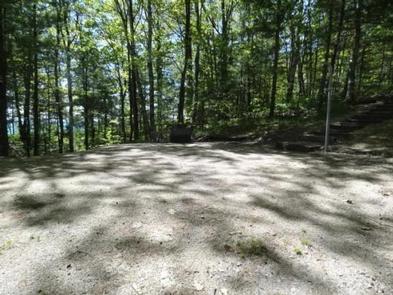
Natural Features
The campground stretches along a bluff between the highway and the lake. Dunes, waves, sand and wind are the primary environmental factors present. Visitors enjoy watching shorebirds, like the Spotted Sandpiper, which can often be seen running up and down the beaches throughout the day.
Nearby Attractions
Brevort Lake is about five miles from the campground. St. Ignace is about 18 miles from the campground and is the closest town.
Charges & Cancellations
Please cancel 7 days in advance if you need to cancel your reservation. Reservation sites cannot be traded for walk up sites.