
Directions
From Encampment, Wyoming, travel west on State Highway 70, approximately 26 miles to the Sandstone Work Center. Turn right into Work Center compound and the Sandstone Cabin will be located on your left.
From Baggs, Wyoming, travel east on State Highway 70, approximately 32 miles to the Sandstone Work Center, which will be located on the north side of the highway (left). The Sandstone Cabin is located on the left.
Access to Sandstone is entirely on paved roads, including the circle driveway within the Sandstone Work Center.
Phone
307-326-5258
Activities
BIKING, CAMPING, FISHING, HIKING, HORSEBACK RIDING, HUNTING, WILDLIFE VIEWING
Keywords
SACA,SANDSTONE WORK CENTER,SANDSTONE RANGER STATION,MEDICINE BOW-ROUTT NF-FS
Related Link(s)
Overview
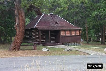
Sandstone Cabin is located west of Encampment, Wyoming, offering guests a unique lodging experience in the Medicine Bow-Routt National Forests. The cabin is typically open from mid-June through October, offering a variety of recreational activities in a beautiful mountain setting.
This rustic cabin is located along the scenic Battle Highway, State Highway 70, which makes for easy access by car. Many amenities are offered, but guests will need to bring some of their own supplies and gear.
Recreation
Hiking, fishing, mountain biking, horseback riding and hunting can be found within the vicinity. Several trailheads are an easy drive from the cabin.
Anglers will enjoy fly fishing for cutthroat and brook trout at Battle Creek within walking distance from the cabin.
Facilities
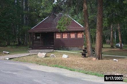
The historic cabin is furnished with double beds and bunk beds with mattresses and can accommodate up to six people. Other amenities include a propane cook stove, refrigerator, heater and lights. The kitchen is equipped with basic cooking and eating utensils and cookware. Solar panels provide limited power for lights and small appliances. The bathroom has a shower and flush toilet.
Water is available on-site, though it is advised that guests bring their own for drinking. A picnic table and campfire ring provide a delightful area for outdoor dining.
Guests need to provide their own food, sleeping bags, lanterns or flashlights, pillows, towels, dish soap, matches, first aid kit, toilet paper and garbage bags. All trash and food should be packed out, and guests are expected to clean the cabin before leaving. .
No pets are allowed within the building. Pets must be on leash or lead outside to protect wildlife. Pet must be cleaned up after by owner.
Natural Features
From open, high expanses to valleys and canyons that rise steeply to snowy ranges, the Medicine Bow-Routt National Forests encompass mountain ranges, tributaries to the North Platte River and the Colorado River, and a mix of forested ecology with spruce, lodgepole pine, subalpine fir, aspen and shrub lands.
Sandstone Cabin sits in a clearing surrounded by a mixture of lodgepole pine, aspen and mixed conifer forest at an elevation of 8,200 feet. Wildlife viewing is abundant in the area, including elk, deer and moose.
Nearby Attractions
Battle Highway, which passes right by the cabin, is a scenic drive featuring historic copper mining sites that were developed from 1897-1908 in the Sierra Madres. The drive is about 58 miles, beginning in Baggs, Wyoming and ending in Riverside, Wyoming. Interpretive signs along the route explain points of interest.