
Directions
From Burns, travel North on Highway 395 approximately 55 miles to County Road 63. Turn left on County Road 63 to the junction of Forest Service Road 21. Take a right onto Forest Service Road 21 and travel approximately 16 miles to the guard station. From John Day, OR., travel approximately 18 miles west on US Highway 26 to the junction with Forest Road 21. Turn south (left) on Forest Road 21, travel 12 miles to the guard station.
Phone
541-820-3800
Activities
HISTORIC & CULTURAL SITE, CAMPING, FISHING, HIKING, HUNTING, WILDLIFE VIEWING, BIRDING
Keywords
MCWC,MALHEUR NF – FS
Related Link(s)
Overview
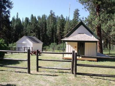
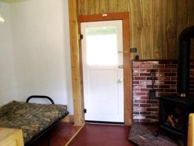
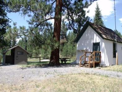
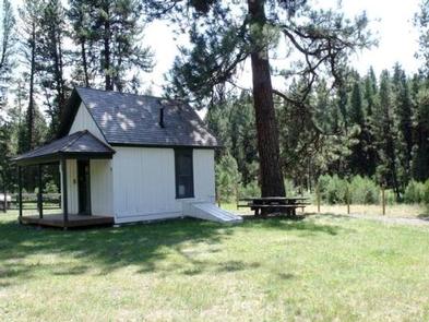
Murderer’s Creek Guard Station is in the heart of the Malheur National Forest, in central Oregon. It makes an excellent base camp for back country recreating, and is a cozy retreat for a couple and a fun opportunity to imagine the life of the early day forest rangers. The historic guard station is one of the oldest standing buildings in the forest. The cabin contains some modern amenities and can be accessed by vehicle. Guests are responsible for their own travel arrangements and safety, and must bring several of their own amenities.
Recreation
Viewing wildlife and birds is popular in the area, as is hunting not far from the facility. Guests can hike area trails, explore the Cedar Grove Botanical Area and fish Murderer’s Creek and South Fork John Day, though area creeks run dry toward summer’s end.
Facilities
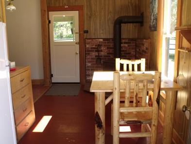
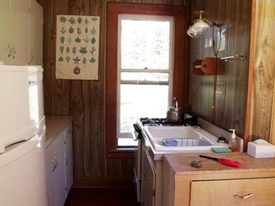
The one-room cabin is equipped with one futon that sleeps two people. It has a table and chairs, a propane cook stove, propane refrigerator and propane heater inside the cabin. Basic cooking pots, utensils and tableware are also provided. There is a garage building and room to park an RV in the adjacent driveway. A newer style vault toilet is located outside. Guests will need to bring water for drinking, cooking and cleaning purposes, as well as bedding, flashlights or a lantern for emergencies, a first aid kit, towels, garbage bags and dish soap, among other necessities. Guests will need to clean the cabin and carry out all trash before leaving.
Natural Features
The guard station is located approximately 32 miles from the town of John Day. It sits at an elevation of about 5,000 feet. The facility was built in 1913 and was originally used as a fire guard station. It was in use by Forest Service officials until the late 1990s. Murderer’s Creek, a small creek that runs east and west along the southern base of Aldrich Mountain, is nearby the cabin. The guard station is surrounded by open meadows and timbered areas of ponderosa pine and mixed conifer. Abundant wildflowers dot the Cedar Grove Botanical Area, a 26-acre cedar grove on the northeast slope of Aldrich Mountain. The area is known for its wild horses, which coexist with mule deer, elk, antelope, bighorn sheep, bear, cougar, and myriad smaller forest animals.