


Directions
From Charleston, South Carolina, take U.S. Highway 17 north ( 32.0 mi.) to Buck Hall Landing Road (Forest Road 242 /1099). Turn right into the recreation area.
From Georgetown, South Carolina, take U.S. Highway 17 South/South Fraser Street (29.0 mi.) to Buck Hall Landing Road (Forest Road 242 /1099). Turn left into the recreation area.
Phone
(843)336-2200
Activities
BIKING, BOATING, CAMPING, FISHING, HIKING, WILDLIFE VIEWING
Keywords
BHRA,FRANCIS MARION-SUMTER NF – FS
Related Link(s)
South Carolina State Road Conditions
Overview
Buck Hall Recreation Area offers a premier location to enjoy the outdoors. It is situated along the Intracoastal Waterway and provides great access to Cape Romain National Wildlife Refuge, 65,000 acres of marsh, tidal creeks and beaches; and Bulls Bay, the coast’s best shrimp baiting area.
Recreation
The area is primarily used for shrimp baiting and fishing. Anglers can expect a huge variety of fish, including bass, flounder, sea trout, snapper, mackerel, swordfish, crab, shrimp, clams, oysters and more.
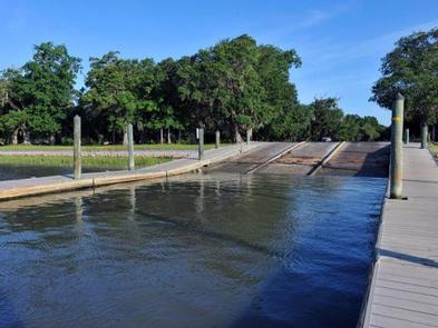
The campground provides access to boating and ocean sailing. Fishing boats and often very large pleasure boats can be seen as they travel the popular Intracoastal Waterway.
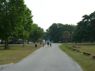
A long portion of the Palmetto Trail, which leads from the marshes of the ocean to the mountains of South Carolina, is accessible from the recreation area. Most of the trail is unpaved and can be used for hiking, biking or horseback riding, although a few sections are restricted to foot traffic only.
Facilities
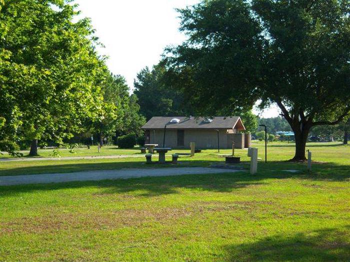
The recreation area boasts a large picnic area and multiple campsites for tent and RV camping. Full hookups are available. Each site is equipped with a table, lantern post and campfire ring with grill.
Accessible flush toilets, showers and drinking water are provided. The picnic area is equipped with tables, grills, an accessible walkway and fish cleaning stations. A lighted parking area and boat ramp are on-site.
Natural Features
The popular campground sits at sea level, alongside the Intracoastal Waterway. It is part of the Francis Marion National Forest in South Carolina. The campground itself is grassy and open, with very few trees and limited shade.
Nearby Attractions
Charleston, South Carolina is about 30 miles southwest of the campground.
Charges & Cancellations
Reservation Fees
In addition to camping fees a non-refundable reservation fee of $8.00 for telephone bookings and $6.00 for website bookings applies.
Cancellation Fees
Cancellations up to 2 days before a reservation start date incur a $10.00 cancellation fee in addition to the non-refundable reservation fee.
Late Cancellations
A cancellation the day before or on the day of arrival incurs a $10.00 cancellation fee and will also forfeit the first night’s use fee (not to exceed the total paid for the original reservation). Cancellations for single night’s reservation will forfeit the entire use fee but no cancellation will apply. Non-refundable reservation fees still apply.