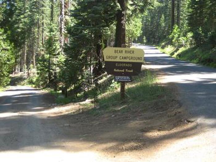
BEAR RIVER GROUP CAMPGROUND, CA Campground Reservation, Info, Images, Map, Directions

BEAR RIVER GROUP CAMPGROUND, California Campground Images, Info & Reservations

Listen

Directions

From Jackson, California, travel east on State Route 88 for 39 miles and turn right (south) on Bear River Road. Travel 2 miles to Y intersection and stay to the right side, going across the dam. Drive .5 miles past South Shore Campground to Bear Group Campground, which will be located on left side of road.

Phone

209-295-4360

Activities

BIKING, BOATING, CAMPING, FISHING, HIKING, SWIMMING SITE

Keywords

BGC1,Bear River Reservoir Group,Bear Group,ELDORADO NF – FS

Related Link(s)

Rec Area Info & Images

California State Tourism

California State Road Conditions

Forest Service Concessionaire

Overview

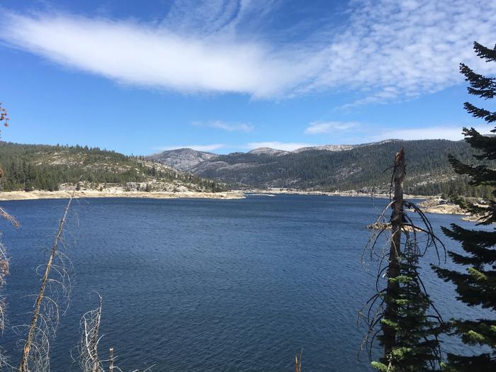
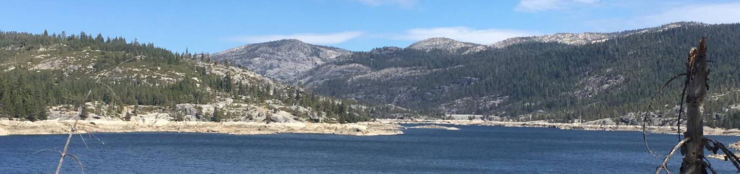
The Bear River Group Campground offers four separate group campsites on a site above the south side of the Lower Bear River Reservoir. The proximity to water and the mixed pine setting in the fresh Sierra Nevada air, makes this campground an excellent group retreat destination.

Upriver from the campground is the Upper Bear River Reservoir. This lake is smaller and spans 166 surface acres with 2.5 miles of shoreline.

Recreation

Lake activities include fishing, swimming, boating, canoeing and picnicking on the shores. Rainbow trout are found in abundance throughout the season, in addition to smaller populations of brown and mackinaw trout as well. A short distance past the Upper Bear River Reservoir is the Pardoe Trail, which borders the Mokelumne Wilderness. The trail runs up the top of Squaw Ridge to an elevation of over 9,000 feet, providing excellent views of the surrounding area.

Facilities

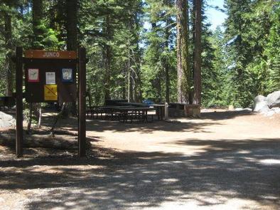
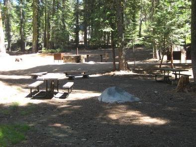
The campground is designed for tent camping only. Campstie 1 fits 50 people while the other three sites accommodate 25. Piped drinking water, vault toilets, picnic tables, campfire rings and a group cooking area are among the amenities.

Natural Features

Bear Group Campground is situated an elevation of 6,000 feet, just a short distance (approximately one mile drive) from the reservoir.

It is part of the Eldorado National Forest located in the central Sierra Nevada. A Mediterranean climate extends over most of the forest with warm, dry summers and cold, wet winters.

Nearby Attractions

Restaurants, boat rentals and a general store are within a few miles of the campground.

Reservation

More from CampingHiking.net:

ZIPS PLACE CABIN, Montana Campground Images, Info & Reservations

Listen Directions From Hungry Horse, travel east on U.S. Highway 2 for 48 miles, to mile marker 191. Travel south on Geifer Greek/Lodgepole Lane (a gravel road that veers left initially). Follow the signs to the cabin. During the winter months or when the road conditions are impassable, renters must

NORTH SANDUSKY CAMPGROUND, Illinois Campground Images, Info & Reservations

Listen Directions From I-57 take exit 77 and turn west on Route 154. After 4.5 miles turn south onto Rend City Road. Continue through the four-way stop and follow signs to the campground. Phone 618-724-2493 Activities BOATING, CAMPING, FISHING, SWIMMING SITE Keywords NSAN,REND LAKE,NORTH SANDUSKY,THE SANDUSKYS,PINTAIL,RINGNECK,WOODUCK,SHAGBARK,MAPLE,SWEETGUM,HICKORY,WHITE OAK,DUCK LOOPS,BY COY &

SOUTH KAWISHIWI RIVER, Minnesota Campground Images, Info & Reservations

Listen Directions From Ely, Minnesota, travel about 10.3 miles south on State Highway 1 toward Lake Superior. Turn left onto the campground road. Phone KAWISHIWI RANGER DISTRICT: 218-365-7600, CONCESSIONAIRE (SUMMER): 218-365-2963 Activities BIKING, BOATING, CAMPING, FISHING, HIKING, HUNTING, WILDLIFE VIEWING, SWIMMING SITE Keywords SOKR,SUPERIOR NATIONAL FOREST,KAWISHIWI FOREST SERVICE CAMP,KAWISHIWI RIVER,KAWISHIWI,KAWISHIWI

WHITE SPAR CAMPGROUND, Arizona Campground Images, Info & Reservations

Listen Directions From Phoenix, Arizona: Traveling Northbound on I-17 take Exit 262 onto Hwy 69 North to Prescott, cointnue on Hwy 69 for 41 miles until you arrive in downtown Prescott. Turn left on Montezuma Street (Highway 89) south for 2.7 miles. White Spar Campground is located on the left

OUTLET(MELVERN), Kansas Campground Images, Info & Reservations

Listen Directions From US-75, take the Melvern exit. Turn west onto Melvern Lake Parkway and continue 1/4 mile to the cut-off road, then another 1/4-mile west to River Pond Parkway and follow into the campground. Phone 785-549-3318 Activities BOATING, CAMPING, FISHING, HIKING, DAY USE AREA Keywords OULT,MELVERN LAKE,MELVERN PROJECT,MELVERN STATE

WEST SULLIVAN, Washington Campground Images, Info & Reservations

Listen Directions Campground is located 90 miles from Spokane. , From the junction of Highway 20, take Highway 31 north towards Ione for 3 miles.. About 1 mile south of Ione, turn onto the Sullivan Lake Road (County Road 9345). Travel 12 miles to the north end of Sullivan Lake.