
Directions
From Bakersfield or Porterville take Highway 65 to Highway 155 and travel east to the Jack Ranch Road. Turn left (north) on Old Stage Road (M3) and travel to the Sugarloaf Road (M9). Turn right on Forest Road 23S16 and continue through Portuguese Pass to Forest Road 24S50. Turn left on 24S50 and travel approximately 4.3 miles to the intersection with Forest Road 24S86. Turn right and travel approximately one-half mile to the cabin.
Phone
559-539-5230
Activities
BIKING, CAMPING, INTERPRETIVE PROGRAMS, HIKING, HUNTING, WILDLIFE VIEWING
Keywords
FRME,SEQUOIA NF – FS
Related Link(s)
California State Road Conditions
Overview
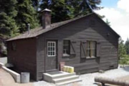
NOT CURRENTLY ACCEPTING RESERVATIONS. Frog Meadow Guard Station sits at a meadow’s edge at an elevation of 7,760 feet in the heart of the the Sequoia National Forest and Sequoia National Monument. The cabin is two hours northeast of Bakersfield, California. It was constructed in the mid-1930s by the Civilian Conservation Corps as a residence for Forest Service fire patrolmen stationed in the area. The cabin sleeps ten. For larger groups, Frog Meadow Campground is a quarter-mile away and has ten sites that are available on a first-come, first-served basis.
Recreation
Visitors enjoy hiking and biking on nearby trails, wildlife viewing, stargazing and picnicking.
Facilities
This one-bedroom, one story cabin sleeps a maximum of ten guests. It does not have electricity, so visitors should bring flashlights and lamps. Appliances, including the stove, refrigerator, heater and hot water, run on propane.
The bedroom contains two double beds and a roll-away bed, all with mattresses. The living area has two double-size futon couches as well as a folding dining table, chairs and a desk. The fully-equipped kitchen has table and chairs, pots and pans, dishes, glasses and utensils.
A flush toilet, sink and tub-shower are provided in the bathroom.
Natural Features
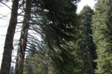
The cabin is situated among firs and pines overlooking the meadow. Cattle or deer can often be seen grazing in the field in the early morning and evening hours.
The lookout tower at nearby Tobias Peak, elevation 8,300 feet, has views of Mt. Whitney, the Golden Trout Wilderness and the Great Western Divide. The tower is a great spot for bird watching, and goshawks, golden eagles, red tail hawks, sparrow hawks, turkey vultures and the occasional condor can be seen.