
Directions
From John Day, Oregon, take U.S. Highway 26 east for approximately 9 miles. At the junction of County Road 18, travel north approximately 10 miles. At Forest Road 3620, turn left and drive approximately 1 mile to Forest Road 3618. The campground is 1 mile from the turnoff. The reservable group site is on the right, the shelter is in the day use area on the left. From Prairie City, Oregon, take U.S. Highway 26 approximately 3 miles west. At the junction of County Road 18, travel north approximately 10 miles. Turn right on Forest Road 3620 and travel approximately 1 mile to Forest Road 3618. The campground is about 1 mile from the turnoff. The reservable group site is on the right, the shelter is in the day use area on the left.
Phone
541-820-3800
Activities
BOATING, FISHING, HIKING, HUNTING, MOUNTAIN BIKING, BIRDING
Keywords
MAGO,MALHEUR NF – FS
Related Link(s)
Overview
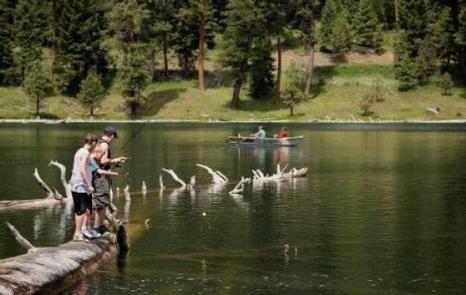
Magone Lake Campground is situated along its namesake lake in the northern reaches of Malheur National Forest in the Blue Mountains of eastern Oregon. Visitors enjoy fishing, canoeing, swimming and hiking.
Recreation
The Magone Lake area offers swimming, fishing, hiking and mountain biking opportunities. The lake contains eastern brook and rainbow trout. A boat ramp is available on-site. Visitors also enjoy viewing wildflowers and interesting geology throughout the region.
Facilities
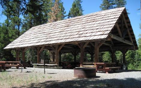
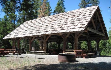
The campground offers both a picnic shelter and overnight campsite for groups to reserve. These sites can accommodate up to 75 people each. Individual family sites are available on a first-come, first-served basis.
Picnic tables and campfire rings with grills are provided, as are vault toilets and drinking water.
Natural Features
The campground is set in a forest of Engelmann spruce and ponderosa pine. Magone Lake covers about 50 acres and features both deep holes of up to 100 feet and shoals on the north side. Geologists believe Magone Lake was created by a landslide in the early 1800s. It is located in the southern reaches of the Malheur National Forest.