
Directions
Follow the mileage indications below and watch for signs when traveling to Grizzly Ridge Yurt. Leave with plenty of time to arrive at the yurt before dark. A high-clearance vehicle with four-wheel drive is required to access the yurt.
From Vernal, Utah, travel north on U.S. Highway 191 (Vernal Avenue) approximately 25.5 miles. Slow down when approaching the snowdrift fence along the curve in the road and look for the jeep road at the gap in the fence. Turn left (northwest) onto the jeep road/Forest Road 181. Once on Forest Road 181, reset travel odometer to zero. At 0.5 miles, continue on Forest Road 181 (look for blue Little Brush Creek sign). At 0.8 miles, continue straight (northwest) on Forest Road 181 (look for blue Grizzly Ridge sign). At 0.9 miles, continue on Forest Road 181/Trail 152B. At 1 mile, take the right fork and head north on Forest Trail 152B. At 1.5 miles, stay right to meet up with the ski trail. At 1.9 miles, go left to merge with ski trail that winds up the road. At 2.7 miles, look for yurt on left (south) side of road.
UTM = 626656E, 4511378N
Phone
4357891181
Activities
BIKING, CAMPING, HIKING, WINTER SPORTS, WILDLIFE VIEWING
Keywords
GRZZ,GRIZZLY PEAK YURT,GRIZZLY RIDGE CABIN,GRIZZLY YURT,GRIZZLY CABIN,GRIZZLY,RIDGE,YURT,ASHLEY NF – FS
Related Link(s)
Overview
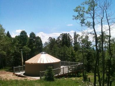
Grizzly Ridge Yurt is located on the Ashley National Forest, approximately 20 air miles north of Vernal, in eastern Utah. It provides year-round primitive lodging for guests. The yurt is open for reservations all months except November, April and May. Hiking, off-roading, skiing and snowshoeing are the most popular activities in the area.
Call the District Office at (435) 789-1181 three business days prior to a reserved visit to confirm door lock combination. Disrict Office is closed Saturday and Sunday. Lock combination is REQUIRED to enter yurt.
Recreation
Numerous hiking, biking and off-road trails crisscross the area. Guests enjoy hiking up the trail to 9,335-foot Grizzly Ridge. In winter months, endless cross country skiing and snowshoeing trails are right out the front door.
Facilities
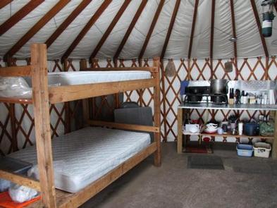
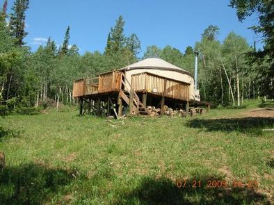
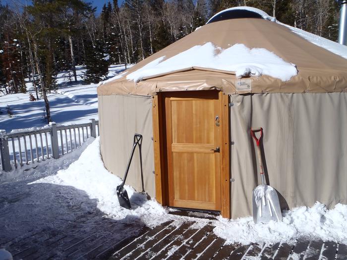
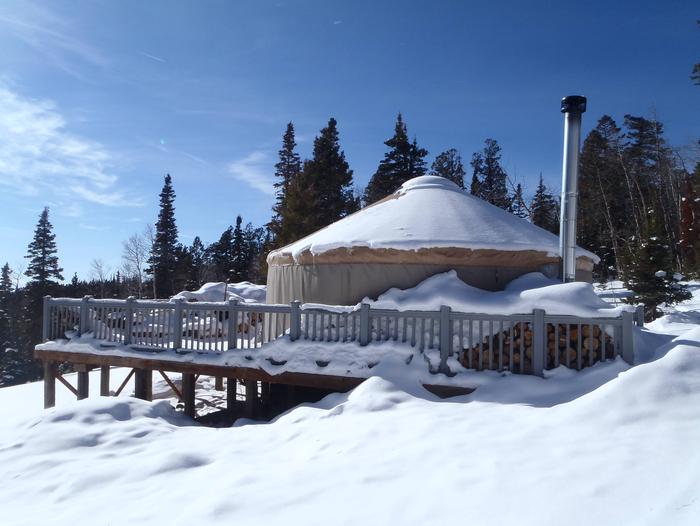
The yurt is approximately 314 square-feet (less than 20 feet in diameter) and has limited amenities. No plumbing, running water or electricity is provided. The maximum capacity of overnight guests at the yurt is (8) people. Tent camping is allowed outside.
Two double bunk beds with mattresses are provided that will sleep eight people. No linens, bedding or pillows are provided. The yurt is equipped with a heavy-duty propane camp stove for cooking, a wood-burning stove for heat, a folding table and chairs. Guests are encouraged to bring their own cooking supplies.
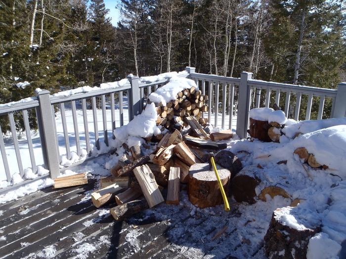
A portable propane Coleman lantern is supplied but guests must bring extra propane bottles and mantles. The Forest Service provides propane for the cook stove and firewood for the wood stove. A vault toilet is located outside the yurt.
Natural Features
The yurt is situated in a small clearing surrounded by pines and aspens, at an elevation of 9,200 feet. From the deck, guests are awarded beautiful views toward Red Fleet Reservoir and Vernal off in the distance. Wildlife and summer wildflowers are abundant.
Nearby Attractions
Flaming Gorge National Recreation Area is known not only for its beautiful red cliffs, but also for its world-class fishing for lake, brown and rainbow trout. Boating, water skiing, jet skiing, canoeing, kayaking, swimming and scuba diving are popular activities on the reservoir, which can be accessed within 25 miles of the yurt.
The Ashley-Karst National Geologic Recreation Area offers dramatic canyons, densely forested backcountry areas, and vast networks of caves.