
Directions
Follow the mileage indications below and look for signs on the ground when traveling to Paradise Guard Station. Leave with plenty of time to arrive at the guard station before dark.
From Vernal, travel west on Highway 121/Maeser-Lapoint Highway, toward Lapoint. After passing the landfill and descending the hill along the curved road, some houses come into view. While approaching Deep Creek Road, look for brown signs to Paradise Park Reservoir. Turn right (north) at Deep Creek Road (approximately 12.5 miles west of the Dry Fork Canyon Road junction with Highway 121). Continue north on Deep Creek Road for nearly 7 miles and watch for a fork in the road. Turn left (northwest) onto Paradise Park Road and continue approximately 8.5 miles, reaching the Ashley National Forest boundary. The paved road ends and turns to an unsurfaced road at the cattle guard. Paradise Park Road becomes Forest Road 104. Follow the road along the switchbacks and continue northwest for approximately 9.5 miles. The guard station will be visible on the left side, at the junction with Paradise Park Campground. Travel may require skiing or snowshoeing during winter months.
Phone
435-789-1181
Activities
BIKING, BOATING, CAMPING, FISHING, HIKING, HORSEBACK RIDING, WILDLIFE VIEWING
Keywords
PARG,Paradise Guard Station,Paradise Cabin,Paradise Park Cabin,Paradise Ranger Station,Paradise Park Reservoir Cabin,ASHLEY NF – FS
Related Link(s)
Overview
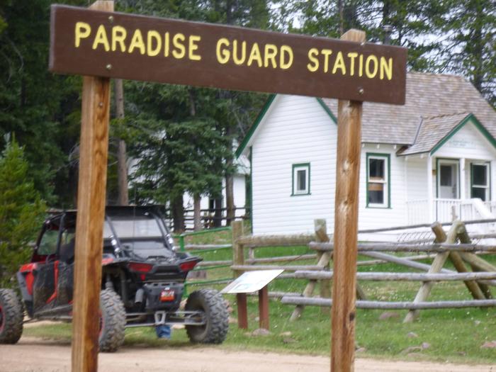
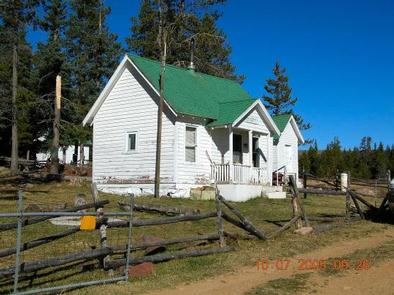
Paradise Guard Station is located on the Ashley National Forest, approximately 25 air miles northwest of Vernal, in eastern Utah. Folklore states the district ranger built the cabin in his spare time in 1922 and it has changed very little since then. In 1929, the Bartlett Sawmill was built just 75 yards south. It burned down in 1940, but some remnants of the old facility still remain.
The Ashley National Forest Vernal Ranger District has chosen to rent this guard station to the public so visitors can enjoy a rustic experience similar to that of the first rangers. Guests enjoy canoeing and fishing on Paradise Park Reservoir, and exploring local hiking, biking and off-road vehicle trails.
Recreation
Paradise Park Reservoir is nearby, covering just less than 60 acres. Canoeing and fishing for rainbow and cutthroat trout are popular activities. Dead Lake, Mill Pond and Julius Park Reservoir are within a short distance.
The Ashley-Karst National Geologic Recreation Area offers dramatic canyons, densely forested backcountry areas, and vast networks of caves.
A variety of hiking, biking, horseback riding and off-road vehicle trails crisscross the surrounding area, including the 8.4-mile Deadman Lake Trail, which begins at Paradise Campground.
Facilities
The guard station complex can sleep a maximum of nine overnight guests (four inside the cabin, five camped outside). The cabin contains two, twin-size bunk beds for four people, though no linens, bedding or pillows are provided. Level parking is provided for a maximum of one RV/camp trailer. Ample room for tent camping is available outside.
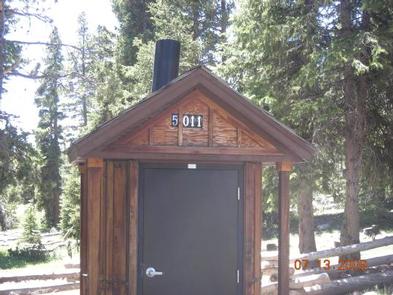
Please note that this cabin is rustic. There is no sink, stove, oven or refrigerator. The cabin has no water or plumbing, however there is a vault toilet outside for year-round use. A wood-burning stove is supplied for heat. A combination campfire ring and grill is located outside.
Natural Features
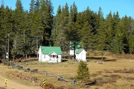
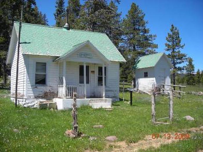
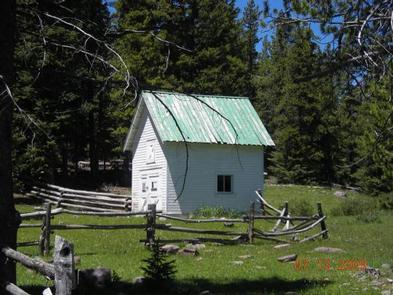
The small white cabin sits at the edge of a grassy meadow surrounded by a dense spruce-fir forest, at an elevation of 10,000 feet. Paradise Creek, a tributary of the Whiterocks River, flows lazily through the meadow in front of the cabin.