
Directions
There is no motorized access to this cabin. From Bozeman, MT: Drive west towards Four Corners, then south towards Big Sky/West Yellowstone on US Highway 191 for about 35 miles. Turn left (east) onto Portal Creek Road, FS 984. Travel for 3.5 miles to the FS Road 6959 and FS Road 984 junction. Take the right fork (southeast) and stay on FS Road 984 toward Upper Portal Creek/Windy Pass Trailhead and drive for 5.3 more miles. Stay to the left on FS Rd. 984 past the junction of FS Road 2686 (to the Hidden Lakes Trailhead). From the Windy Pass/Upper Portal Creek trailhead hike Trail 82 for 2.5 miles to the junction with Windy Pass Trail 420. Turn left unto Trail 420 and hike about 1/4 mile to the Windy Pass Cabin. Elevation gain: 1,300 ft. This cabin is closed from October 15 through June 15 each year. ROAD CLOSURE INFORMATION: (Please refer to the Motor Vehicle Use Map and the Interim Summer Trails of the Hyalite Porcupine Buffalo Horn Wilderness Study Area) Trails 82, 96, 420, and the area around the Windy Pass Cabin are closed to all motor vehicles year around.
Phone
406-522-2520
Activities
CAMPING, HIKING, HORSEBACK RIDING, HUNTING, WILDLIFE VIEWING
Keywords
WIPC,WINDY,PASS,GALLATIN NF – FS
Related Link(s)
Overview
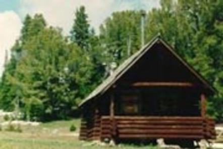
Windy Pass Cabin was built in 1934. It provides a rustic mountain retreat with few amenities, so guests need to bring most of their own supplies and gear to make their experience comfortable and enjoyable. The cabin is available from June 16th through October 14th each year. It is accessible via a 2.5-mile hike or horseback ride up the Windy Pass Trail with an elevation gain of 1,300 feet.
Recreation
The Windy Pass Trail passes by the cabin and takes hikers and equestrians along the ridge and down through the Gallatin Range. Several other trails crisscross the area, including the Gallatin Crest Trail. Hunting in designated areas is also a popular activity.
Facilities
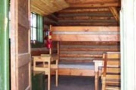
The cabin sleeps four people with a set of bunk beds with mattresses downstairs and two beds in the loft. A wood-burning stove provides heat. A table with chairs, cookware and utensils are available. A horse corral and outhouse with vault toilet are located outside. Drinking water, electricity and firewood are not provided. Guests needs to bring their own water supply. Trash bags are needed for packing out garbage, and guests are expected to clean the cabin before leaving. A cook stove is not provided. Visitors should bring items such as bedding, flashlights or lanterns, matches and extra toilet paper.
Natural Features
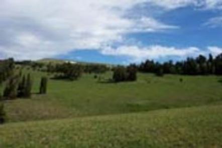
Windy Pass Cabin is located near the Gallatin Crest at approximately 8,900 feet in the Gallatin Mountains. A small stream flows just below it. High alpine meadows dotted with evergreens surround the cabin and fill with colorful wildflowers in July. A short walk to the top of the Gallatin Crest offers views of the distant snow-dusted peaks of the Absarokas and the Yellowstone River to the east and the Madison Range to the west. Grizzly bear, gray wolf, mountain lion, deer, elk, moose, bighorn sheep and the Canada lynx are some of the wildlife that inhabit this area. Birders may see a wide variety of bird species.