

Directions
From Hungry Horse, travel east on U.S. Highway 2 for 48 miles, to mile marker 191. Travel south on Geifer Greek/Lodgepole Lane (a gravel road that veers left initially). Follow the signs to the cabin.
During the winter months or when the road conditions are impassable, renters must park at the designated parking area and hike, snowmobile, ski or snowshoe about a mile to the cabin. Please respect the adjacent property owners and do not block the driveway.
Phone
406-387-3800
Activities
BOATING, CAMPING, FISHING, HIKING, WINTER SPORTS, WILDLIFE VIEWING
Keywords
ZIPC,ZIP,ZIP’S PLACE,AUNT ZIP’S PLACE,ZIP’S,AUNT ZIP,ZIP S PLACE CABIN,FLATHEAD NF – FS
Related Link(s)
Overview
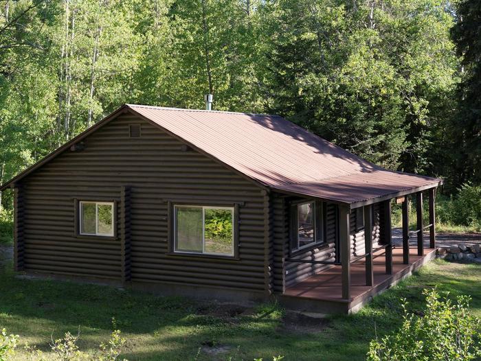
Zip’s Place Cabin is located 48 miles east of Hungry Horse, in northwestern Montana. It provides a beautiful setting on property that was originally a homestead granted in 1937. In 1945 the land was bought by the Kimmet family of Cut Bank, and in 1954 the family constructed the cabin that resides there today. Visitors enjoy a variety of recreational activities, including hiking, biking, winter sports and viewing wildlife.
The cabin can be accessed by vehicle during the summer months. During the winter months or when the road conditions are impassable, guests must park at the designated parking area and hike, snowmobile, ski, or snowshoe approximately one mile to the cabin. Guests are responsible for their own travel arrangements and safety, and must bring several of their own amenities.
Recreation
Hiking and mountain biking are popular activities in warmer months. Cross country skiing, snowmobiling and snow shoeing entertain visitors in winter. Elk and moose are among the native animals that may be spotted in the area.
Facilities
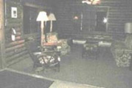
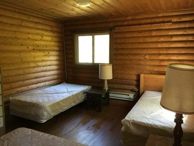
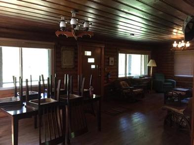
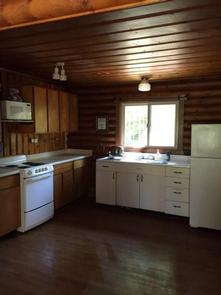
The rustic cabin can accommodate up to eight guests. Amenities include a vault toilet, electric stove, refrigerator, microwave oven, lights, electric and propane heat, pots and pans, utensils and cutlery, dishes and cleaning items. Pets are allowed, but cleaning up after them is required.
Electricity is provided but water is only available from a well hand-pump June 1 to November 30. Guests should bring food, bedding and basic camp gear, including a first aid kit.
Natural Features
The cabin entrance faces a large grassy lawn area. The rear backs up to a stand of lodgepole pine and Douglas fir trees. A small stream runs behind the cabin.
The Hungry Horse Ranger District is bordered on the east by the Middle Fork of the Flathead River and Glacier National Park. It also covers part of the 286,700-acre Great Bear Wilderness.
Nearby Attractions
The town of Hungry Horse, located an hour away, offers a variety of conveniences like grocery stores and gas stations.