
Directions
From Highway 96, turn onto Salmon River Road/Forest Highway 93 and continue about 13 miles to the campground.
Phone
530-627-3291
Activities
BIKING, BOATING, CAMPING, FISHING, HIKING, SWIMMING SITE
Keywords
NORD,Crystal Springs Group Sites,SIX RIVERS NF -FS
Related Link(s)
California State Road Conditions
Overview
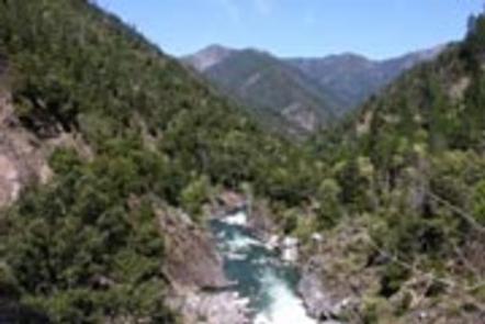
Nordheimer Group Sites sit near the Salmon River in the expansive Klamath National Forest of northern California. Visitors enjoy whitewater rafting, fishing and boating activities.
Recreation
The Salmon River is a popular area for swimming and sunbathing, rafting and kayaking. The region is also popular for hiking and biking. The Orleans Mountain Trail begins nearby.
Facilities
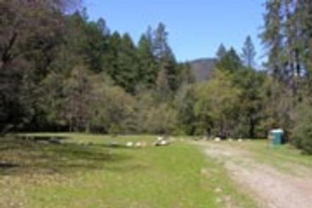
The campground offers four group sites, each able to accommodate up to 50 guests. The sites are equipped with picnic tables, campfire circles and grills. Vault toilets are within walking distance from each site. Roads and parking areas are gravel.
Natural Features
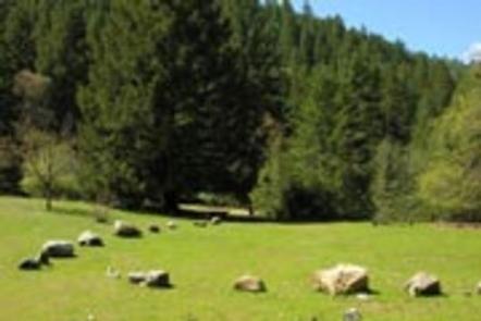
The campground is located in a Douglas fir and hardwood forest, which provides partial shade throughout the day. A few fruit trees remain from past homesteading activities. A variety of wildlife makes its home around the Salmon River area. Sites A, B, and C have large grassy meadows, surrounded by forest. Site D overlooks the Salmon River with easy walking access for boaters and swimmers. The Klamath National Forest lies northeast of Eureka in northeastern California, stretching southward from the Oregon border. The Marble Mountain wilderness is located nearby with beautiful views of the mountains and numerous trailheads to access them.
Nearby Attractions
The Marble Mountain Wilderness Area is adjacent to the campground, with ample hiking and horseback riding opportunities available, as well as high country fishing in any of the area’s 89 lakes.