
Directions
From Wisdom, travel west on Highway 43 for 26 miles, the parking area is located at the top of Chief Joseph Pass. The route has many signs. Maps of the area may be purchased by calling the Wisdom Ranger District.
Phone
406-689-3243
Activities
BIKING, HISTORIC & CULTURAL SITE, CAMPING, FISHING, HUNTING, WINTER SPORTS, WILDLIFE VIEWING
Keywords
GORD,CHIEF JOSEPH WARMING HUT,GORDON,REESE,GORDON CABIN,BEAVERHEAD-DEERLODGE NF -FS
Related Link(s)
Overview
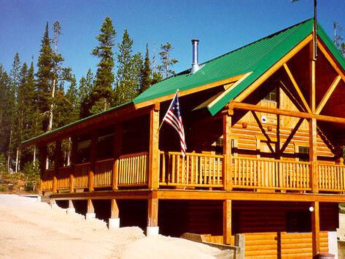
Gordon Reese Cabin provides a modern, well-equipped place to stay while enjoying the scenic western Montana mountain ranges. During the summer a variety of recreational opportunities exist in the surrounding area, including hunting, hiking and viewing abundant wildlife. The cabin is a feature along the Lewis and Clark Trail.
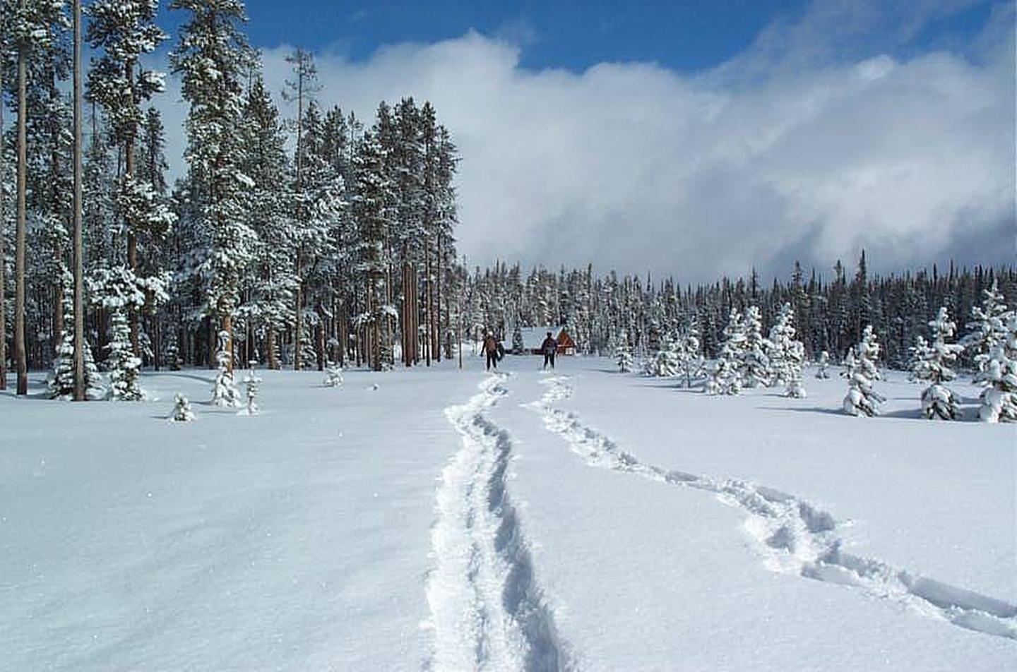
During the winter months the Gordon Reese Cabin and surrounding areas transform into a winter wonderland. Surrounding the cabin are 32 kilometers of cross-country ski trails for which visitors enjoy various levels of difficulty. Gordon Reese Cabin is available as a warming hut to the public during the day, meaning the renters of the cabin do not have exclusive use of the facilities and are expected to act in a welcoming manner. The upstairs sleeping area can be closed off to provide limited privacy during the day when the cabin is used as a warming hut.
In the summer, the cabin can be accessed by a short, level hike from a parking area less than a mile away. In the winter, the cabin is available by cross-country skiing the same distance. Guests are responsible for their own travel arrangements and safety, and must bring several of their own amenities.
Recreation
Popular activities include hiking, cross-country skiing and mountain biking on the area’s many trails. The cabin sits along the famous Lewis and Clark Trail, which led frontier explorers through the area in the early 1800s. The entire length of the trail covers 4,600 miles, showcasing some of the most beautiful and rugged areas of America.
Facilities
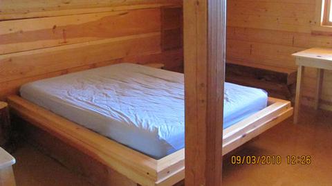
The cabin has two double beds and four twin beds with mattresses in the loft, and can sleep up to eight people. A wood stove is available on the main floor for heat and firewood is kept in the basement, along with emergency and solar power equipment and other supplies. The cabin is equipped with propane-powered lighting.
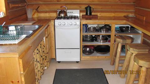
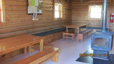
A main floor contains a well-equipped kitchen, two tables with benches, cupboard and counter space with stools and a variety of cooking and eating utensils. The kitchen has a propane cooking stove and a sink for waste water. Water is not available at the cabin. An outdoor vault toilet is provided.
Guests will need to bring their own water for drinking, cooking and cleaning, as well as bedding, towels, toilet paper, soap, matches, food and other necessities. Guests must bring their own garbage bags and are required to carry out all garbage. The cabin must be cleaned prior to departure. There is no cell phone service in the area.
Natural Features
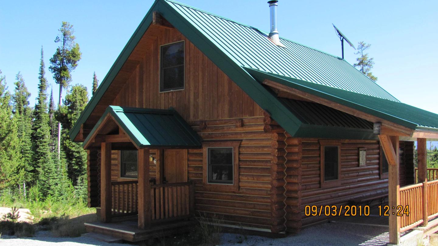
The Gordon Reese Cabin was built in 2001 and is located in the Picnic Meadows area near Chief Joseph Pass, along the Montana-Idaho border.
At the base of the Anaconda Mountain Range, the cabin sits in an evergreen forest with abundant wildlife in the area. Mountain lions, elk, deer, moose and bears can be found within the range (learn more about bear safety).
Nearby Attractions
Historic sites in the area include the Big Hole National Battlefield on the Nez Perce National Historic Trail. It is a commemorative site where war broke out in 1877 and is part of Big Hole National Battlefield, which is located about 15 miles east of the cabin.