


Directions
From Sheridan, travel south on Highway 287 for about 10 miles to Alder. Turn south on Ruby River Road and continue about 22 miles to Vigilante Station. The last 20 miles are on a gravel road, which can be slippery when wet or snow-covered. The gate lock code is the same as the cabin. Maps of the area may be purchased by calling the Madison Ranger District.
Phone
406 682-4253
Activities
CAMPING, FISHING, HIKING, HUNTING, WINTER SPORTS, WILDLIFE VIEWING
Keywords
VIGI,VIGILANTE GUARD STATION,BEAVERHEAD-DEERLODGE NF -FS
Related Link(s)
Overview
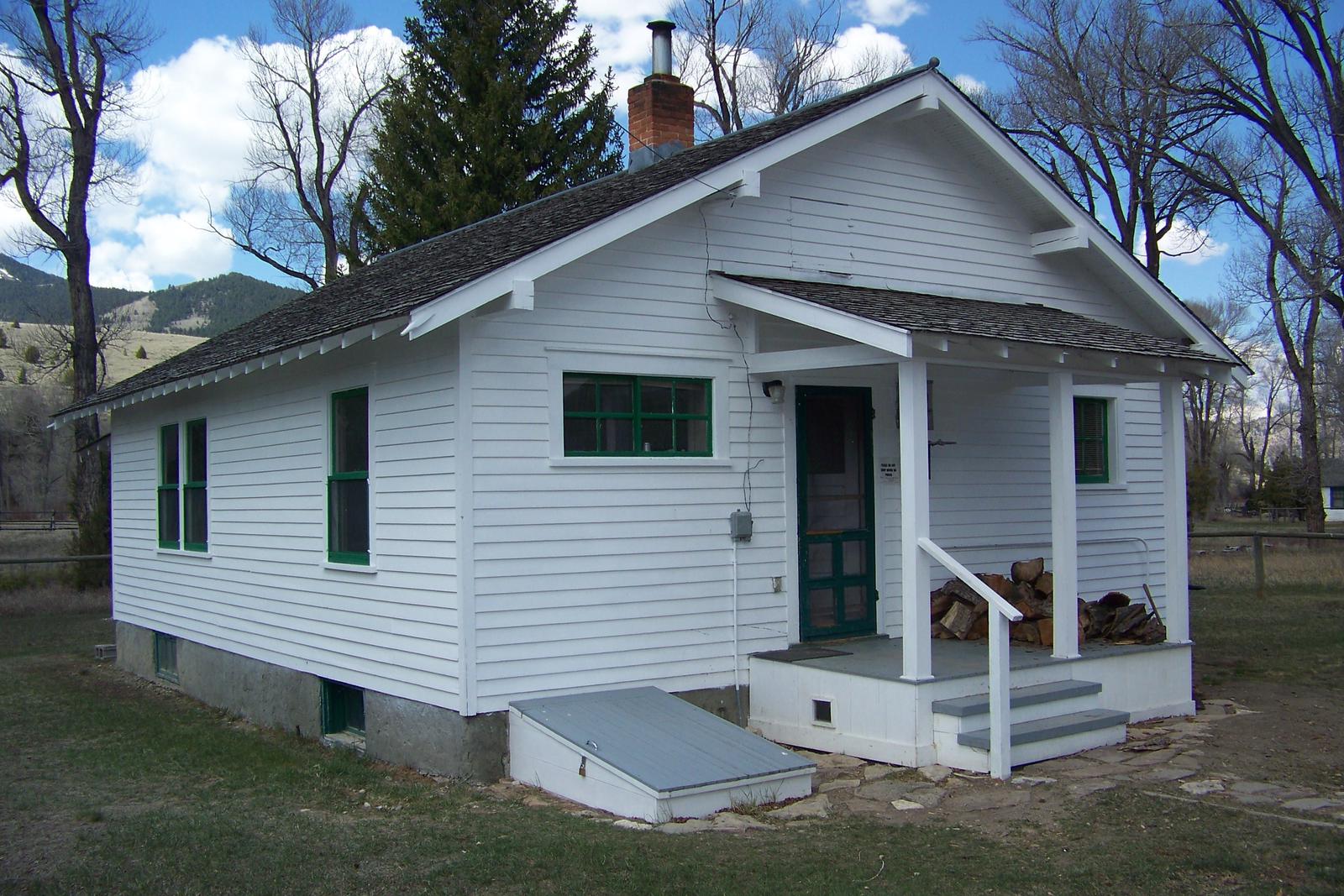
The Vigilante Cabin, also known as the Vigilante Middle House, offers a comfortable place to stay deep in the mountains of southwestern Montana. The cabin used to be a guard station and boasts two bedrooms, a kitchen, living room and electricity. It is close to many outdoor recreation opportunities, including fishing, hiking and hunting, as well as off-road vehicle trails and gold panning. The house and two adjacent buildings were built by the Civilian Conservation Corps on the site of a range experiment station. The white clapboard middle house is available for rent, while the two other houses on the property are still used by Forest Service personnel and volunteers throughout the year. Though usually quiet, this can be a busy site when work crews are using those adjacent facilities. The cabin is accessible throughout most of the year by vehicle; however, a portion of the road may be difficult to navigate when wet or snow-covered and may not be plowed. Guests are responsible for their own travel arrangements and safety, and must bring some of their own amenities.
Recreation
Guests can enjoy fishing the Ruby River for mountain whitefish and rainbow trout. Gold panning is also possible in a section of the river near the cabin.
Big game hunting is possible in designated areas. Appropriate licenses are required.
A variety of hiking trails and points of exploration exist around the cabin. Off-road vehicle trails are also available in the area. During winter months, guests enjoy snowmobiling and snowshoeing on the many nearby trails.
Facilities
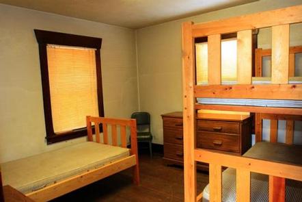
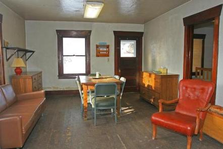
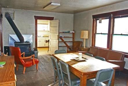
You must call the Madison Ranger District at 406-682-4253 Monday – Friday 8:00 am to 4:30 pm for the cabin combination. The office is NOT open on Federal Holidays. The large, two-bedroom cabin has a bunkbed and single bed with mattresses in each bedroom to sleep up to six people. It has electric lights and a water heater. The kitchen is equipped with a range, refrigerator, table and chairs, cookware and utensils. A wood stove heats the cabin, and firewood is provided. The living room is fully furnished, and there is a functioning bathroom during the summer months, with running water, a sink, shower and a flush toilet. The bathroom is sealed off when the water system at the cabin is winterized. The water system is winterized from October to May. A concrete outhouse with vault toilet is available east of the house. A picnic table and a fire ring are located nearby but firewood is not provided for campfires. Guests need to bring their own water from October to May. Other items to bring include bedding, pillows, towels, soap, matches, flashlight and garbage bags, among other necessities. Guests are asked to replenish the supply of split wood and kindling, pack out all food and garbage, and clean the cabin prior to leaving.
Natural Features
Located along the Ruby River, the facility stands at an elevation of about 6,100 feet between the Snowcrest and Gravelly mountain ranges. It sits in a mostly open and grassy area with just a few cotttonwood trees around it, offering views of the nearby peaks. A variety of wildlife makes its home in the area, including elk, mule deer, black and grizzly bears, mountain grouse, and other species ( learn more about bear safety ).