
Directions
From Hall, travel south on Highway 1 for about 3 miles to Douglas Creek. Take Forest Road 707 and continue approximately 7 miles to the cabin. Maps may be purchased by calling the Pintler Ranger District.
Phone
406-859-3211
Activities
BIKING, CAMPING, HIKING, HUNTING, WINTER SPORTS, WILDLIFE VIEWING
Keywords
DCAB,BEAVERHEAD-DEERLODGE NF -FS
Related Link(s)
Overview
Douglas Creek Cabin offers a great way to access the various seasonal activities available in the Beaverhead-Deerlodge National Forest in western Montana. While hunting enthusiasts enjoy the cabin during bow and rifle seasons, it is popular for snowmobiling in the winter and hiking in the summer. The cabin is in a very remote location, giving anyone an outdoor recreational experience they will never forget.
Access to the cabin is limited by weather conditions. Four-wheel drive and high-clearance vehicles are necessary year-round. Excessive snowfall prohibits any vehicles from accessing the cabin and visitors will need to plan for cross-country skiing or snowmobiling three or more miles. Guests are responsible for their own travel arrangements and safety, and must bring their own amenities.
Recreation
Douglas Creek is a small stream at this location and does not support any sizeable fish but fishing is popular in any of the mountain lakes in the vicinity. Access to the lakes will require extensive hiking or driving. The area is home to a variety of trails for hiking, but there are no designated trails near the cabin. A big game winter range and elk calving grounds are nearby, offering great wildlife viewing potential. Hunting for deer, elk and upland game birds is popular in the area.
Guests also enjoy snowmobiling, cross-country skiing and snowshoeing in the surrounding areas during the winter. Various weather conditions can increase avalanche danger in the area and visitors are encouraged to carry proper backcountry equipment, including a beacon, shovel and probe, while recreating.
Facilities
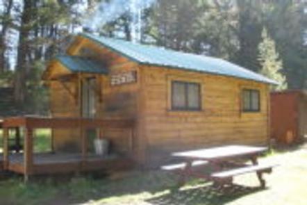
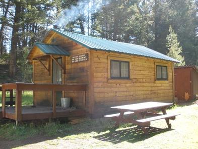
The primitive, one-room cabin has bunkbeds that sleep up to four people. It has a table and chairs, minimal cooking utensils, and a wood stove for heat. Firewood is provided but cannot be guaranteed. There is no electricity, plumbing or water available at the cabin. An outhouse with a vault toilet is located just steps behind the cabin.
Guests will need to bring water for cooking, cleaning and drinking, as well as bedding, towels, soap, dishes, cooking equipment and fuel, toilet paper, garbage bags and an axe or chainsaw. A broom and dust pan are provided and guests are required to carry out all trash. Guests are also required to clean the facility prior to departure. Cell phone service is sometimes available depending on your provider.
Natural Features
The rustic, remotely located cabin is adjacent to Douglas Creek, in the north end of the Flint Creek Range. It is situated in a grassy meadow, surrounded by mature evergreen trees. The cabin was built in the 1960s and was used as an administrative location for crews working in the area.
The small and narrow Douglas Creek runs about 50 feet from the cabin through the cabin site. It is an ideal place to relax or build childhood memories.
The Flints have typical Rocky Mountain fauna, including a few mountain goats. The area is popular for hunting of deer, elk and blue grouse. Dozens of alpine lakes in the range provide good fishing. Bears may also frequent the area.
Nearby Attractions
Interesting day trips might include touring the Grant-Kohrs Ranch, which is operated by the National Park Service just outside of Deer Lodge, which is about 25 miles from the cabin. In Deer Lodge, visitors can tour the old Montana Territorial Prison, which was built by convict labor in 1871. Both are on nationally recognized historic sites.
Charges & Cancellations
Reservations are nonrefundable unless extenuating circumstances warrant otherwise. Determination will be made on a case by case basis.