


Directions
From I-5, take California State Highway 36 West. From US-101 take California State Highway 36 East. Once on CA-36, there are two options. Option 1 is a bit longer but the majority of the trip is on paved Forest roads. Option 2 is shorter, but all of the trip is on gravel Forest roads. Call the Ranger Station before you go for more information on road conditions. DO NOT rely on any sort of GPS devices or online mapping programs to get you to Post Creek Guard Station. They are not accurate and may get you lost. There is no cell service at the cabin or on the roads leading to it. Make sure you have accurate directions before leaving home. Option 1 – From CA-36, turn south (left if coming from the east; right if coming from the west) onto Forest Road 30 (29N30), also known as Wild Mad Road. Follow Forest Road 30 until it intersects with Forest Road 35 at Pine Root Saddle (approximately 8 miles). Turn left on Forest Road 35. Continue on Forest Road 35 until it intersects with Forest Road 28N10 (approximately 11 miles; if you get to Stuart Gap, you have gone just slightly too far). All roads are paved until this point where the roads become gravel. Turn left on Forest Road 28N10. Go less than a mile and turn right on Forest Road 28N36 – watch carefully for this junction and do not miss it! Continue on Forest Road 28N36 for approximately 4 miles). You will drive through private property and then over Post Creek about 1/4 mile from the cabin. Turn south at the green gate which states “Road Closed”. Open gate, and drive through to the cabin. Option 2 – From CA-36, turn south (left if coming from the east; right if coming from the west) onto Forest Road 45 (29N45), also known as Tedoc Road. This is a gravel road. Continue to the intersection with Forest Road 28N36 (approximately 12.5 miles). At the intersection of the 27N13, 28N05, and 29N45 roads, be sure to verr to the right to stay on the 29N45 road. Turn right on 28N36 and follow it until you see the green gate on the right (not quite 2 miles. Turn right at the green gate which states “Road Closed”. Open gate, and drive through to the cabin.
Phone
(530) 623-2121
Activities
HISTORIC & CULTURAL SITE, CAMPING, HIKING, WILDLIFE VIEWING, WILDERNESS, FIRE LOOKOUTS/CABINS OVERNIGHT, SWIMMING SITE, PHOTOGRAPHY, BACKPACKING
Keywords
POSC,POST,POST CREEK,CREEK,GUARD,SHASTA-TRINITY -FS
Related Link(s)
California State Road Conditions
Overview
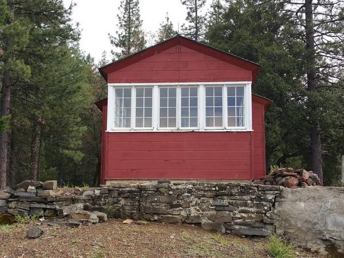
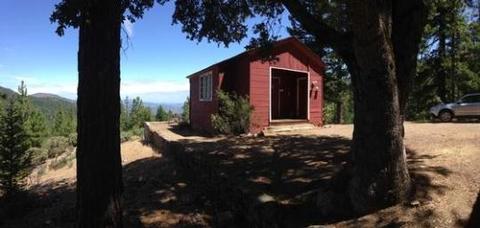
Post Creek Guard Station was built in 1934 by the Civilian Conservation Corps for use as a wildfire lookout. It is now available for recreational use. This historic guard station is eligible for inclusion to the National Register of Historic Places. Guests can drive to Post Creek Guard Station, though much of the trip is on gravel Forest roads, depending upon which route is chosen. This charming cabin offers beautiful views of the nearby mountains and forest. Some amenities are provided, but guests will have to bring supplies and gear. Post Creek Guard Station offers the chance to relish the peace and quiet in a beautiful, secluded location.
Recreation
Post Creek Guard Station is an ideal location to relax and enjoy the view. Guests who want to do something a bit more active can find hiking and other recreational activities in the nearby wilderness. On hot days guests can take a dip in the swimming hole at Post Creek, located a quarter mile from the guard station.
Facilities
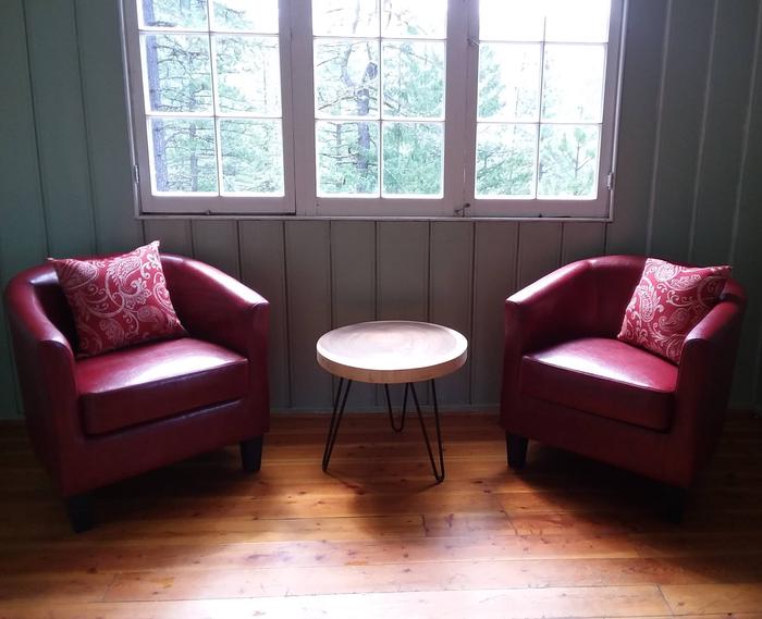
This 19×30 cabin accommodates up to six people and has two rooms. The kitchen is equipped with a table and chairs and is fully stocked with pots, pans, dishes, and utensils. There are two barrel chairs and a coffee table in the living area. Sleeping accommodations include a queen bed, a twin bed, and a single rollaway bed on which guests can put a camp mattress, and sleeping bags can be placed on the floor to accommodate a total of six people in the cabin. There is a portable restroom located outside. There is no running water at the cabin. A fire pit and picnic table are located outside. The cabin does not have electricity, heat, a stove or refrigerator. Guests should bring their own potable water for drinking, cooking and washing; all linens including sheets, blankets, sleeping bags and/or blankets, and pillows; kitchen linens; and a camp cook stove with fuel. The use of portable stoves using gas, jellied petroleum or pressurized liquid fuel are allowed outside with a valid California Campfire Permit.
Natural Features
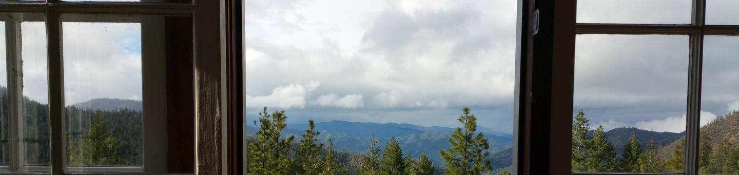
The guard station is located in the Hayfork area of the Shasta-Trinity National Forest on a ridgeline above Beegum Gorge. Beegum Creek, which is just to the north of the cabin, is a major waterway in this area. The Yolla Bolly Mountains in the Yolla Bolly-Middle Eel Wilderness are to the south.
Nearby Attractions
Guests may wish to explore the many hiking trails and mountain lakes in the nearby Yolla Bolly-Middle Eel Wilderness or dip in the cold water at Beegum Creek.