
Directions
From White Sulphur Springs, head east on Highway 12 for 3 miles and turn left (north) on Highway 89. Continue about 15 miles, then head west (left) on Road 119 for 9 miles to the cabin. From Great Falls, head east on Highway 87/89 about 23 miles to the rest area just past Belt. Turn right (south, to White Sulphur Springs) onto Highway 89. Go past Monarch and Neihart to Kings Hill Pass (about 75 miles from Great Falls), and down Highway 89 about 13.5 miles past Kings Hill Pass to Road 119 and turn right (west). Drive 9 miles to the cabin. The last 7 miles of the road is closed from December 1st through May 15th. It is a designated groomed snowmobile trail. During this timeframe travel the last 7 miles must be made by skiing, snowmobiling or walking. Due to snow conditions, travel on Forest Service Road #119 may be limited through the end of May. Please call (406) 547-3361 or (406) 236-5511 to verify the road condition.
Phone
406 236-5511 OR 406-547-3361
Activities
CAMPING, FISHING, HIKING, HUNTING, WILDLIFE VIEWING, MOUNTAIN BIKING, CROSS COUNTRY SKIING, SCENIC DRIVE, BACKPACKING, SNOWMOBILE TRAILS, WOOD CUTTING
Keywords
CALC,CALF,CREEK,LEWIS AND CLARK NF – FS
Related Link(s)
Overview
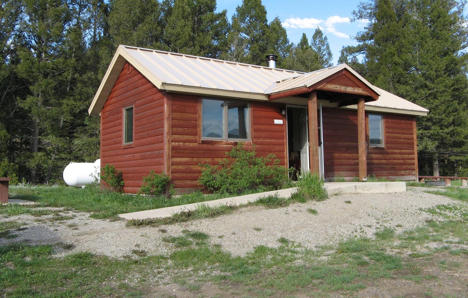
Calf Creek Cabin sits in the Helena-Lewis and Clark National Forest. The cabin offers a prime location for fishing, hiking and horseback riding and OHVing. Running water is not included, but the nearby creek provides fresh water. A hitching rack is also available for horses.
Access from December 1 to May 15 is via snowmobile, snowshoes or skis on a groomed 7 mile trail. (Wheeled vehicles aare prohibited during the December 1 to May 15 time frame).
Recreation
Nearby hunting, fishing and off-road vehicle riding trails are abundant. Horseback riders and hikers horses enjoy the climb north along East Fork Calf Creek to Bubbling Springs in the Tenderfoot Experimental Forest. Calf Creek tempts anglers with mountain whitefish, cutthroat, brook and rainbow trout.
Winter recreation includes cross country skiing, snow shoeing and snowmobiling.
Facilities
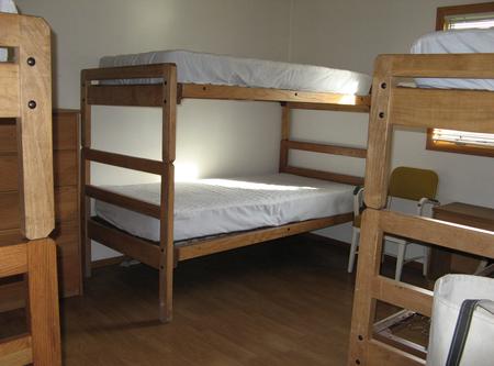
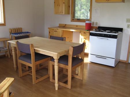
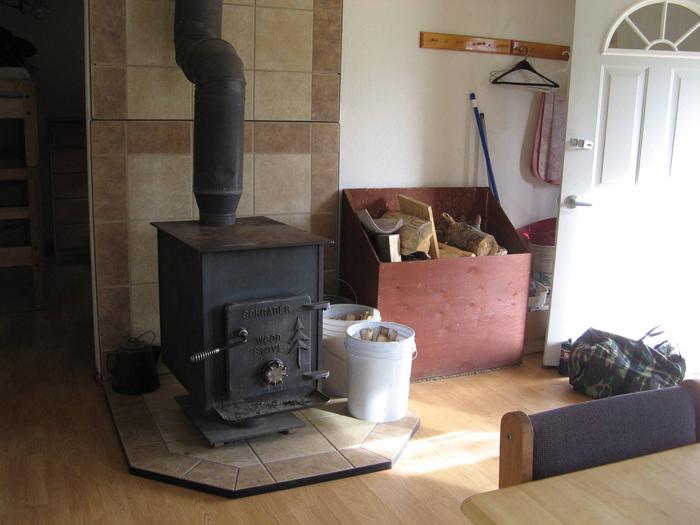
The cabin fits six guests and provides propane lights and a propane cooking stove. Both the cabin and the outdoor modern vault toilet are wheelchair accessible. A wood stove for heating and firewood is included. Pots, pans, dishes and limited cleaning supplies are also on hand. Though no electricity is available, the cabin comes with electrical outlets, and guests are allowed to bring a generator to hook up to the cabin.
Visitors should plan to bring water, food, toilet paper, flashlights, bedding, towels, cleaning equipment and warm clothing. (Click here for more cabin details.)
Natural Features
The cabin sits along Calf Creek at an elevation of 5,400 feet in the Little Belt Mountains. The region boasts a dense coniferous forest with mixed fir, spruce and pine trees. The Helena-Lewis and Clark National Forest offers many streams and fishing opportunities. Native wildlife includes black bears, mule-deer white-tailed deer, bald eagles, elk, bears and mountian lions.
Nearby Attractions
White Sulphur Springs, 1 hour south, provides the nearest food, fuel, and other conveniences.