
Directions
From Troy, Montana: Follow Highway 2 west for 9.5 miles to Yaak Highway 508. Follow Yaak Highway 508 north for 30 miles to the town of Yaak. Continue on Yaak Highway 92 to French Garver Road 276, turn right and follow road to junction with road 5857. Follow 5857 to the gate to Garver Mountain. The road continues beyond the gate for approximately 3 miles. There is a sign on the trail to the lookout.
Note: The trail to the lookout is approximately 1/4 mile.
Phone
406-295-4693
Activities
CAMPING, HIKING, HUNTING, WINTER SPORTS, WILDLIFE VIEWING
Keywords
GMLR,GARVER MTN LOOKOUT RENTAL,KOOTENAI NF – FS
Related Link(s)
Overview
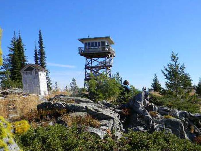
Garver Mountain Lookout is perched on top of Garver Mountain at an elevation of 5,874 feet. The lookout is located in the Yaak area of the Kootenai National Forest, characterized by its minimal services and rugged beauty. This destination is ideal for visitors with an adventurous attitude, looking for a plethora of outdoor activities.
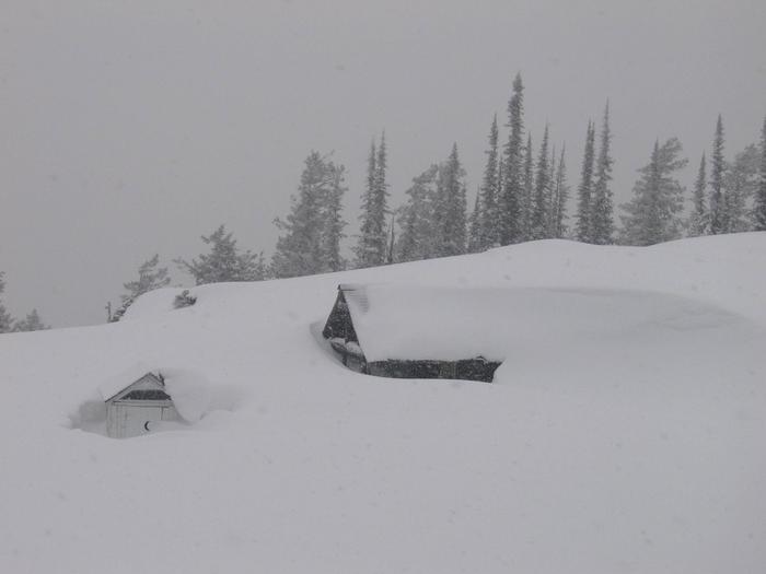
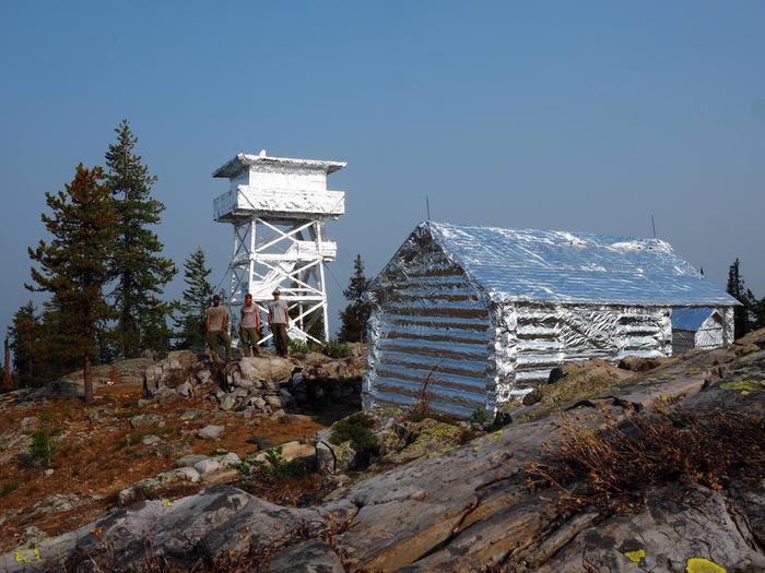
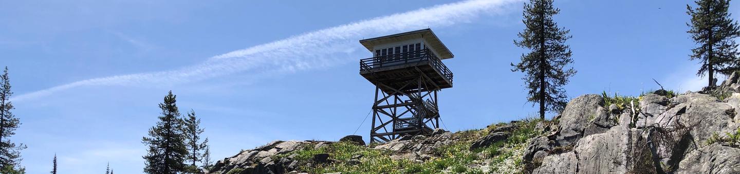
Garver Mountain Lookout has been used as an observation point for detecting forest fires since 1929. The first lookout was a one-story log cabin, which is still on the site. The current lookout was built in 1963 and is available for rent for up to four people.
Recreation
Garver Creek is located near the lookout and offers opportunities for trout fishing. Day hiking is another popular pastime in the area around the lookout. The Lookout is situatied along the Pacific Northwest National Scenic trail, and through hikers may visit you in the lookout.
Facilities
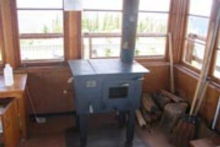
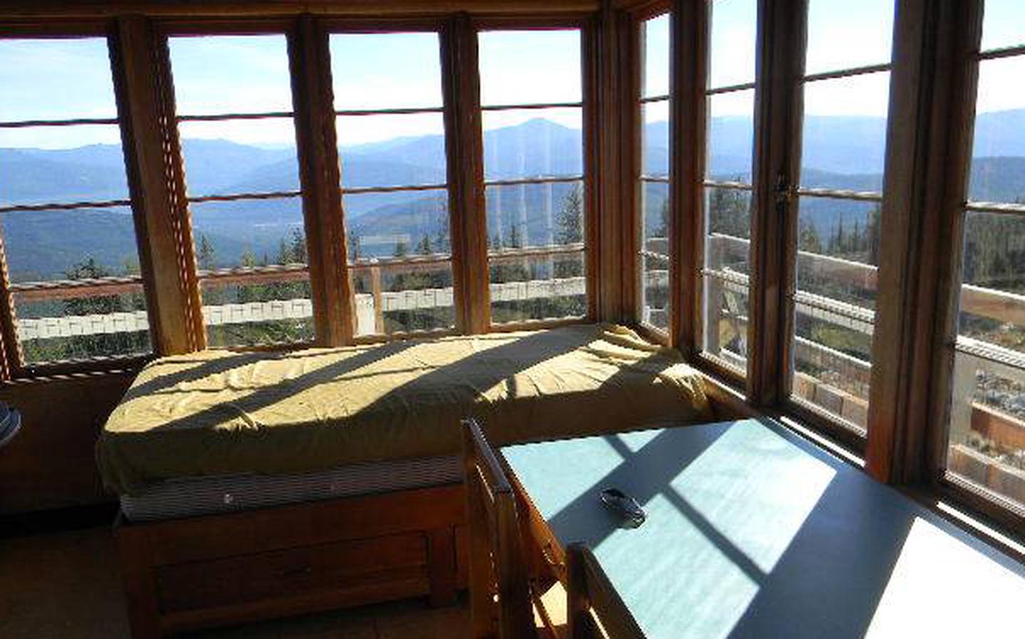
The current lookout is 144 square feet and 40 feet tall. The lookout is equipped with 2 twin beds with 4 mattresses, a wood stove, table, chairs, shovel bucket and cleaning gear. Due to vandalism, however, these items are not guaranteed. The lookout tower is a short but steep hike from the end of the road parking.
The lookout is not wired for electricity and water sources are limited. There is a pit toilet located outside.
Although there are a few amenities provided, guests will need to bring their own supplies such as drinking water, sleeping bags, pillows, toilet paper, matches, food and cooking utensils, to ensure a comfortable stay.
Natural Features
The Yaak area is home to grizzly bears, wolves, elk, deer and a variety of smaller mammals and birds. The Yaak River and its many tributaries provide habitat for cutthroat, rainbow, brook and bull trout. There are also several lakes scattered at varying elevations for hikers and fisherman to enjoy.