


Directions
From Great Falls, travel aproximately 23 miles east on Highway 87/89 and turn right (south) at the rest area/weigh station just past Belt, onto U.S. Highway 89 toward Monarch and Neihart. Drive approximately 50 miles to Kings Hill Pass. The cabin is on the left side of the highway just before the pass (within 300 feet of the pass). The total distance form Great Falls is about 75 miles. During the summer season, visitors can drive directly to the cabin. During the winter season, there is parking on the wide spot along the highway, which is plowed. From White Sulphur Springs, go about 3 miles east on Highway 12 and turn left (north) onto Highway 89. The cabin is just past Kings Hill Pass on the right. Total distance from White Sulphur Springs is 28.5 miles.
Phone
406-236-5511 OR 406-547-3361
Activities
CAMPING, FISHING, HIKING, HORSEBACK RIDING, HUNTING, WILDLIFE VIEWING, MOUNTAIN BIKING, BIRDING, CROSS COUNTRY SKIING, SCENIC DRIVE, SNOWSHOEING, DOWNHILL SKIING, SKIING, SNOWMOBILE TRAILS, SNOWBOARDING
Keywords
KINH,KINGS,HILL,LEWIS AND CLARK NF – FS
Related Link(s)
Overview
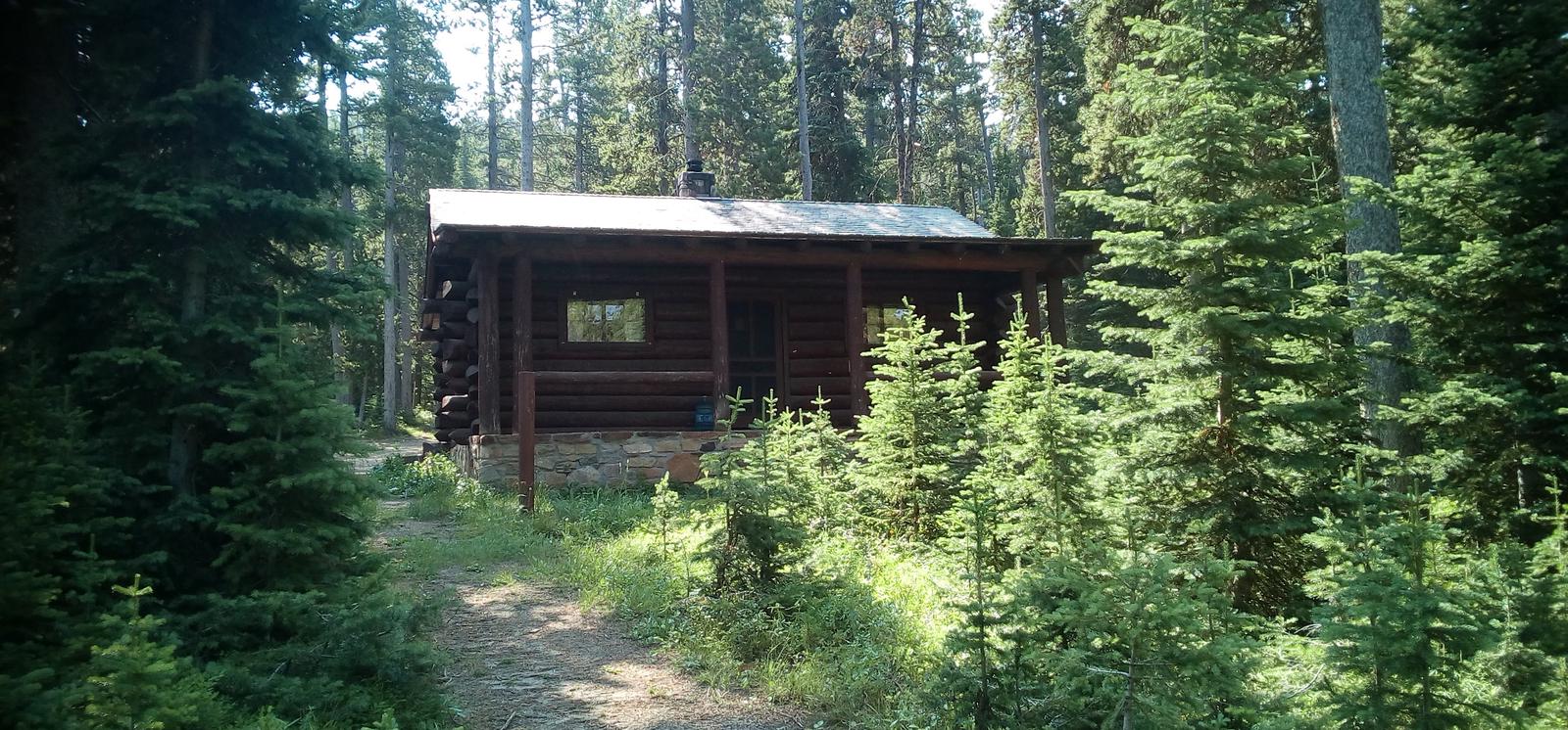
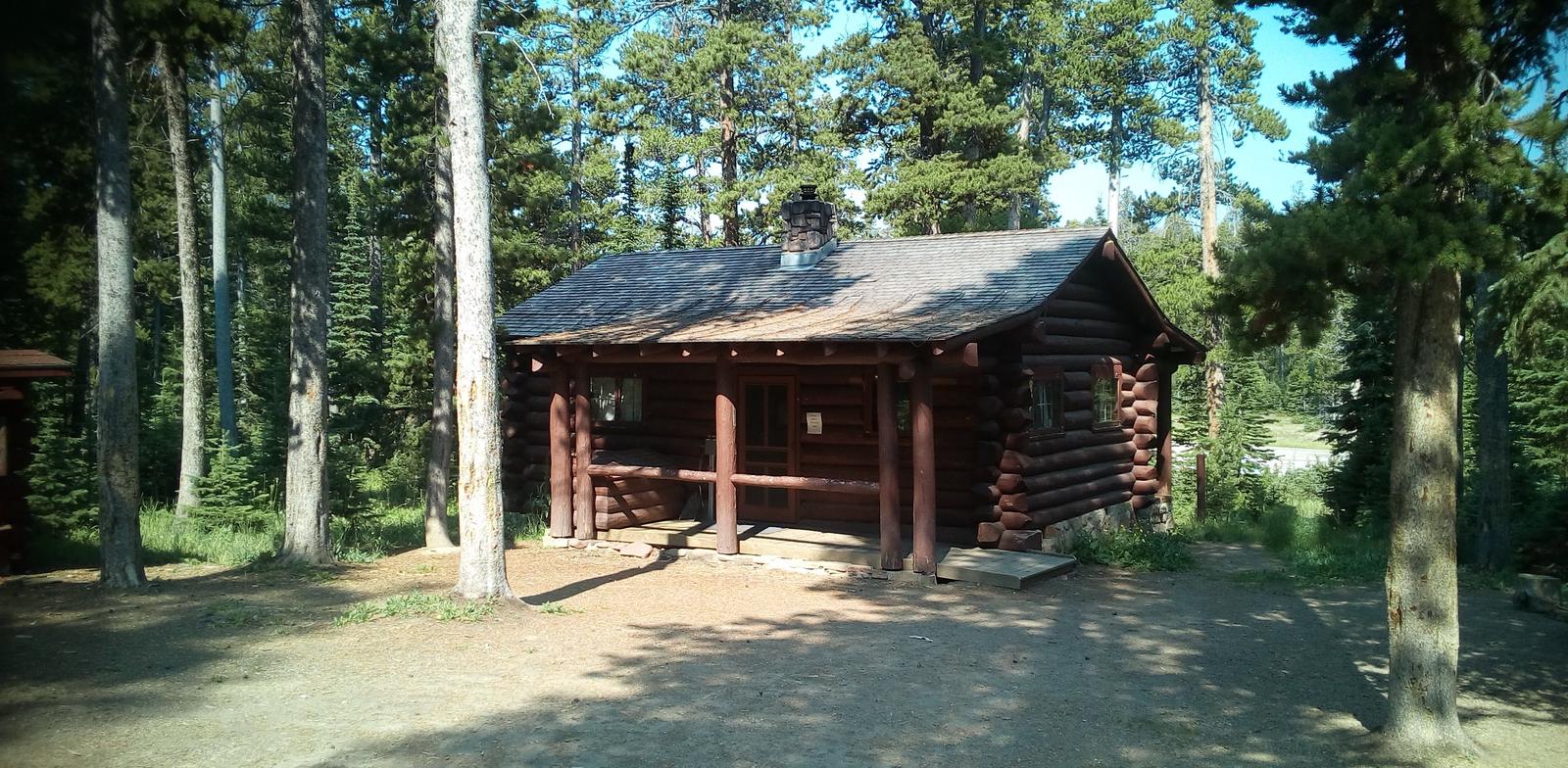
Kings Hill Cabin, perched on Kings Hill Pass, presents the opportunity to stay in a historic log cabin built by the Civilian Conservation Corps in the 1930s. The hideaway is very quiet, with minimal highway noise. Open year-round, the cabin provides access to a mix of summer and winter recreation activities: Summer recreation opportunities include hiking, OHV’ing, birding, sight seeing. Winter activities include snowmobiling, snowshoeing, downhill sking at Showdown Ski Area which is just across US HWY 89 and Silver Crest Cross Country Groomed groomed trail system, located approximatley 2 mile north of the cabin off US HWY 89
Access to cabin is on an easy-to-drive paved road. However, visitors should expect to hike 100 yards from a parking area to the cabin in winter months.
Recreation
Small and big game hunting are popular in the area. Hiking and OHV trails are nearby and wildlife watching is a pleasing activity. In winter, snowshoes are available for loan at the Belt Creek Ranger Station, and cross country skiing is a popular activity. The cabin is across the highway from the Showdown Ski Area and approximately 2 miles from the SIlver Crest Groomed Cross Country ski trail system with 8 miles of groomed cross country ski trails.. The cabin is also a main take off point to access approximately 260 miles of groomed snowmbile trails.
Facilities
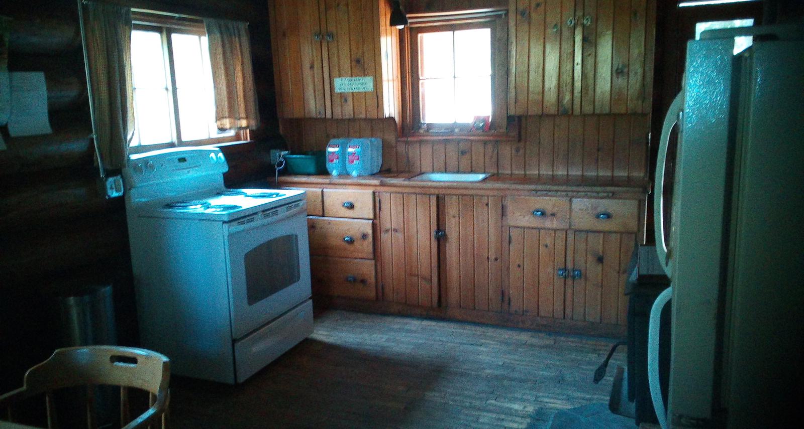
The two-room cabin accommodates up to six guests and provides electricity. Amenities include lights, a refrigerator and a stove. A wood stove and firewood are provided. The firewood supplied is only for use in the wood stove for cabin heating. DO NOT USE THE SUPPLIED FIREWOOD FOR OUTSIDE FIRES. The bedroom is furnished with three bunk beds. The kitchen has a dining table and chairs, pots, pans and dishes. A vault toilet is located outside for year-round use.
No running water is available. Recommended items to bring include plenty of water for drinking, cooking and cleaning supplies (although some are provided); food, bedding, towels,warm clothing and all other basic camping items. Click here for more cabin details.
Natural Features
The cabin sits just 100 yards off the highway in a deep woods setting of lodgepole pine,at an elevation of 7,600 feet. Showdown Ski Area is to the west. Sheep Creek flows to the south and Belt Creek flows to the north of the Cabin location.
Nearby Attractions
Groceries and fuel can be found in White Sulphur Springs, a 28.5-mile drive from the cabin. A small grocery store is located in Neihart, MT, approximately 12 miles north of the cabin.