SHOSHONE PARK KITCHEN, ID Campground Reservation, Info, Images, Map, Directions

SHOSHONE PARK KITCHEN, Idaho Campground Images, Info & Reservations

Listen

Directions

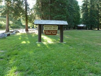
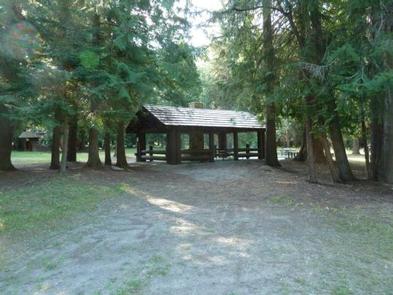
From Mullan, drive east on Friday Ave, which turns into Larson Road. Total trip is about 3 miles. Look for signs to Shoshone Park. The West Kitchen is the first shelter when entering the park.

Phone

208-783-2363

Activities

BIKING, CAMPING, FISH HATCHERY

Keywords

SHOS,IDAHO PANHANDLE NF – FS

Related Link(s)

Rec Area Info & Images

Idaho State Tourism

Idaho State Road Conditions

Overview

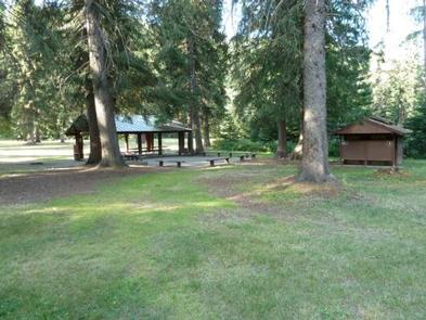
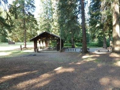
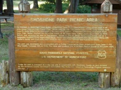
Shoshone Park is a pristine forested park with a stream running through the area. It features two reservable kitchen shelters suitable for groups of all types. Perks of the family-friendly site include a large field and the Hale Fish Hatchery on the east end of the park. A point of particular interest is the Captain John Mullan historic cabin. Mullan was a 19th Century military commander who built a wagon road, which is used today as a hiking trail and snowmobiling route.

Recreation

Groups enjoy playing baseball on the open field, pitching horseshoes and barbecuing. Bird watching is a rewarding pastime here, and a visit to the fish hatchery always fun.

Facilities

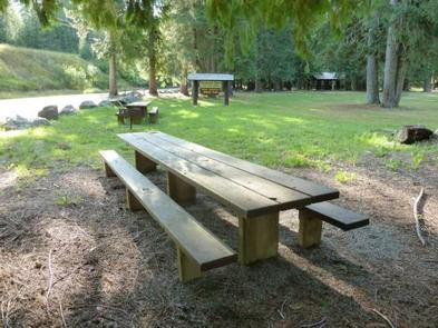
The park includes 21 first-come first-served picnic tables in addition to the group kitchen facilities. Both kitchen shelters come with large grills and piped drinking water. The West Kitchen Shelter has electric hookups.

Natural Features

At 3,600 feet, Shoshone Park sits in a valley at the base of Runt Mountain, a peak in the Bitterroot Mountains. The park is part of Idaho Panhandle National Forests, located near the border of Montana.

Nearby Attractions

A few miles west is the historic mining town of Mullan, Idaho.

Reservation

More from CampingHiking.net:

KALALOCH, Washington Campground Images, Info & Reservations

Listen Directions Kalaloch Campground is on Highway 101, 34 miles south of Forks, Washington, and 73 miles north of Aberdeen, Washington. Phone 360-565-3130 Activities CAMPING, HIKING, VISITOR CENTER, WILDLIFE VIEWING Keywords Clay-lock,Clay Lock,Olympic National Park Related Link(s) Rec Area Info & Images Washington State Tourism Washington State Road Conditions Overview

WINKLER PARK, Texas Campground Images, Info & Reservations

Listen Directions From Interstate 35 in Temple, Texas take State Highway 53/36 west towards Gatesville (approximatey 10 miles). Just after Leon River Bridge, turn right on White Flint Park Road. Turn left on Winkler Park Road and follow it to the park entrance. Phone 254-986-1579 Activities BIKING, BOATING, CAMPING, FISHING,

CHUTE GROUP, Utah Campground Images, Info & Reservations

Listen Directions The campground is located about 26 miles west of Huntington, Utah, along Utah Highway 31. Phone 435-384-2372 Activities BIKING, CAMPING, FISHING, HIKING, HUNTING, WILDLIFE VIEWING Keywords CHUT,MANTI-LASAL NF -FS Related Link(s) Rec Area Info & Images Utah State Tourism Utah State Road Conditions Overview Chute Group Campground is

EDGEWOOD, Arkansas Campground Images, Info & Reservations

Listen Directions From Interstate 30, take exit 78 and merge onto State Highway 7 north for 6 miles. Turn left on Edgewood road and continue 2 miles to the campground. Phone 870-246-5501 Activities BOATING, CAMPING, FISHING, SWIMMING SITE Keywords EDGE,DEGRAY LAKE,DEGRAY LAKE Related Link(s) Rec Area Info & Images Arkansas

ROBINSON CREEK NORTH, California Campground Images, Info & Reservations

Listen Directions Take U.S. Highway 395 through Bridgeport. Turn south on Twin Lakes Road at the Shell gas station. Travel 9.3 miles on Twin Lakes Road, then turn left into the campground. Phone 760-932-7092 Activities CAMPING, FISHING, HIKING, WILDLIFE VIEWING Keywords ROBI,HUMBOLDT-TOIYABE NF-FS Related Link(s) Rec Area Info & Images