
Directions
From Philipsburg, travel south on Highway 1 for just over 6 miles. Turn right onto Skalkaho Highway/Highway 38 and travel west for about 13 miles. The entrance to the cabin is on the left, behind a locked gate, which uses the same key code as the cabin. The last 200 yards of the road may be closed due to snowfall during the winter months. Maps may be purchased by calling the Pintler Ranger District.
Phone
406-859-3211
Activities
BIKING, CAMPING, FISHING, HIKING, HUNTING, WINTER SPORTS, WILDLIFE VIEWING
Keywords
WROC,West Fork Guard Station,West Fork,West Fork Station,BEAVERHEAD-DEERLODGE NF -FS
Related Link(s)
Overview
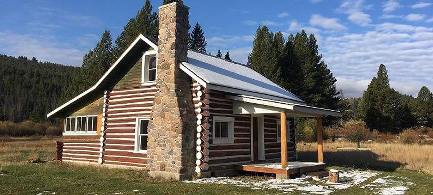
The West Fork of Rock Creek Cabin is located on the western edge of the Beaverhead-Deerlodge National Forest and is open for reservations year-round. It is a large cabin that provides a great experience in the mountains of southwestern Montana. The cabin offers access to numerous trails and wildlife viewing, as well as a comfortable place to picnic and spend the nights.
There are three structures at the site, which was once used as a Forest Service Guard Station and later as a youth camp. Only the large cabin has been restored and is available to the public. The smaller cabins are damaged and are not available to rent.
The site can typically be accessed by vehicle, depending on conditions. Excessive snowfall may require renters to walk about 200 yards from the plowed highway to the cabin. Guests are responsible for their own travel arrangements and safety, and must bring all of their own amenities.
This is a historic structure and is brought to you as a rental by the US Forest Service Historical Preservation Committee, the Beaverhead-Deerlodge National Forest and the Pintler Ranger District. Please help us keep it nice for future generations and respect the historic nature of this cabin.
Recreation
A variety of hiking is available in the area, as well as ample wildlife viewing. Visitors enjoy cross-country skiing and snowshoeing in the winter.
Fishing is popular in the many clear mountain streams adjacent to the cabin. Anglers may see plentiful trout populations, as the area is known for some of the world’s finest trout streams.
The cabin is located along the scenic Skalkaho Highway 38, which links Hamilton and Philipsburg, in southwestern Montana. The drive into the Sapphire Mountains is primitive and was once a trail widely used by Native Americans. The roadway was built to provide access between mining areas and agricultural communities in the Bitterroot Valley. The road leads to Skalkaho Falls in the nearby Bitterroot National Forest; however, the road is closed to wheeled vehicle traffic in the winter but is easily accessible by snow machine.
Facilities
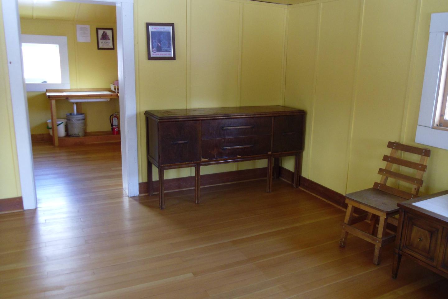
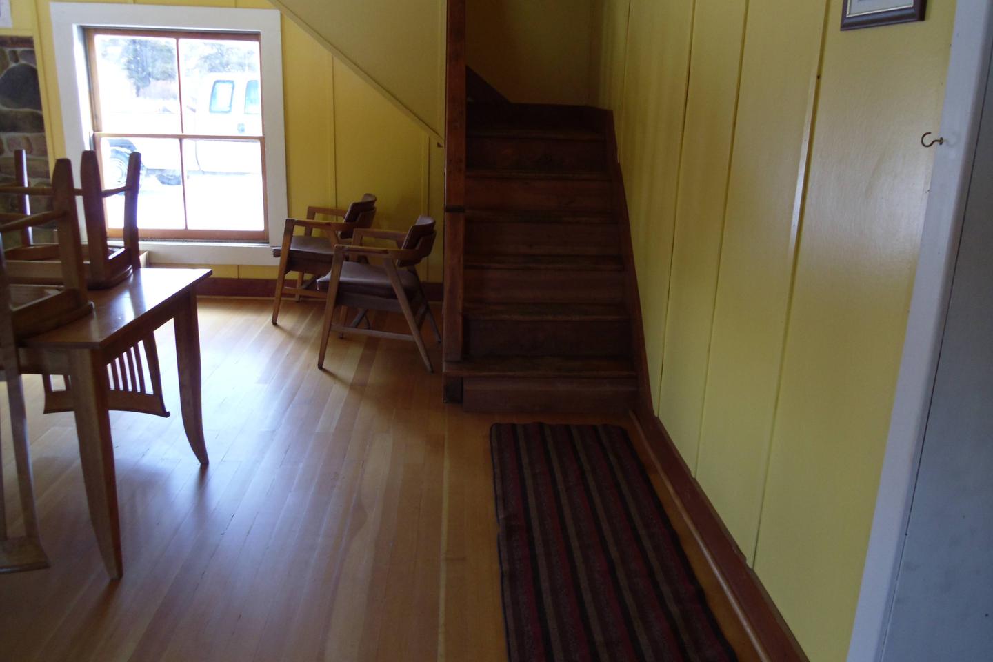
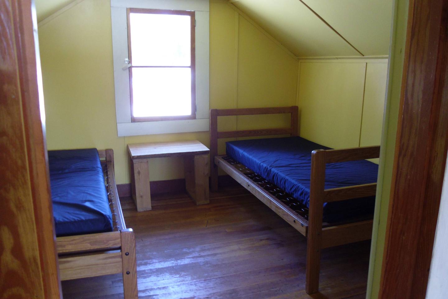
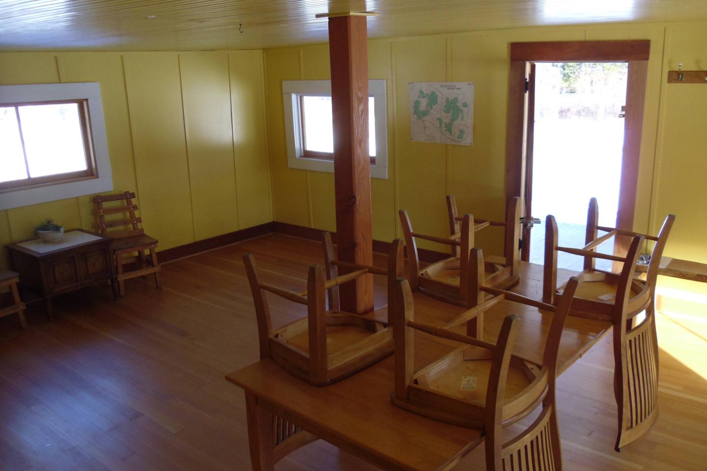
The cabin is equipped with five beds with mattress pads that can sleep up to five people. It is a large cabin so feel free to bring more cots. The cabin is two stories and will comfortably accomodate several people. It has a table and chairs and a wood stove is provided for heat. Firewood is available, but not guaranteed.
There is a very large parking area and circle driveway beside the cabin that will easily accomodate RV’s and Travel Trailers. (There are NO hook-ups) The whole cabin complex is behind a locked gate.
An accessible outhouse with a pit toilet is located a short distance north of the cabin.
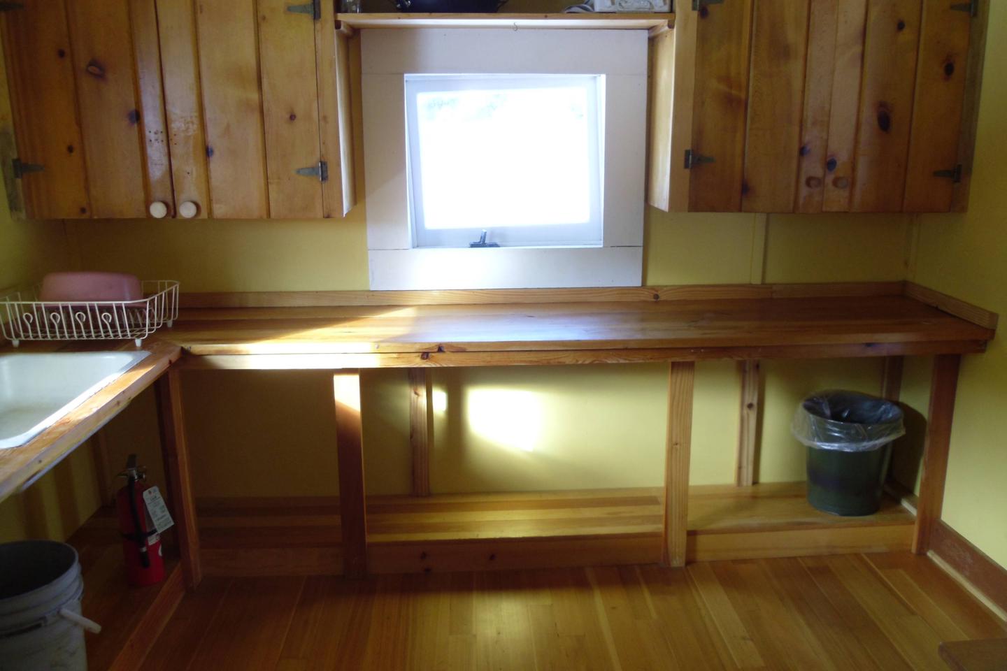
There is no electricity or plumbing and the well is only open seasonally.
There is little to no cell phone service available in the area.
Guests need to bring their own Cook Stove and utensils, sleeping bags, pillows, lanterns and flashlights, matches, food, toilet paper and garbage bags. Firewood is sometimes provided but cannot be guaranteed. Guests are asked to replenish the supply of split wood and kindling, pack out all trash and food, and clean the cabin before leaving.
PLEASE be extremely careful with gas operated lanterns and stoves
Natural Features
The log cabin is situated near the Anaconda Pintler Wilderness in an open meadow surrounded by evergreens. The area is known for its high, rugged and beautiful mountain scenery, where hundreds of mountain goats make their home. The cabin is close to some scenic, clear mountain streams and ponds, where a number of wildlife species, including elk, moose, deer, mountain lions and bears, come to water (learn more about bear safety.
The cabin is in a large pasture and horses may be turned loose but you must check the fence for damage before using it. As a reminder, pelletized or certified weed seed free feed and straw is required in all National Forests in Montana; please plan accordingly.
Nearby Attractions
Gem Mountain Sapphire Mine https://gemmountainmt.com/
The Town of Philipsburg http://www.visitphilipsburg.com/ , 20 minute drive
Skalkaho Pass and Skalkaho Falls, 30 minutes west on Skalkaho highway
Main fork of Rock Creek, Middle fork of Rock Creek, and North Fork of Rock Creek are all within 10 minutes
Charges & Cancellations
Reservations are nonrefundable unless extenuating circumstances warrant otherwise. Determination will be made on a case by case basis.