PONDEROSA PICNIC AREA, UT Campground Reservation, Info, Images, Map, Directions

PONDEROSA PICNIC AREA, Utah Campground Images, Info & Reservations

Listen

Directions

From Beaver, Utah, travel east on paved State Route 153, the Beaver Canyon Scenic Byway, for approximately 9 miles, to the picnic area.

Phone

435-438-2436

Activities

BIKING, CAMPING, FISHING, HIKING, DAY USE AREA

Keywords

POND,Ponderosa campground,Ponderosa,FISHLAKE NF – FS

Related Link(s)

Rec Area Info & Images

Utah State Road Conditions

Utah State Tourism

Overview

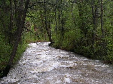
Ponderosa Picnic Area is located along the Beaver Canyon Scenic Byway. It is next to the Beaver River, at an elevation of 7,000 feet. Visitors enjoy fishing and relaxing along the river.

Recreation

The Beaver River offers great rainbow and brook trout fishing. Hiking and biking trails begin a short drive east. Horseshoe pits and a volleyball court are available, but picnickers must bring their own equipment (horseshoes, net and a ball).

Facilities

The picnic area is a day-use site for large groups, making it a perfect place for family reunions and church outings. Site 1, called East, can accommodate up to 120 people, while site 2, called West, can accommodate up to 80 people. Reservations can be made for either individual sites or the whole area at once.

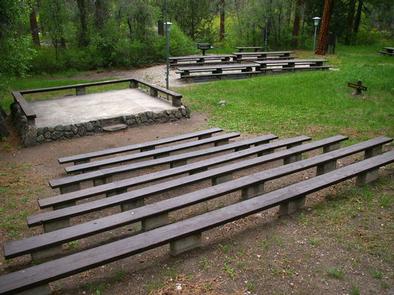
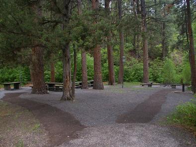
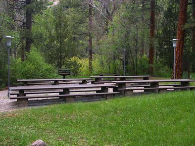
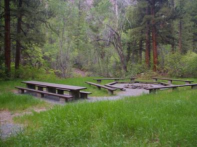
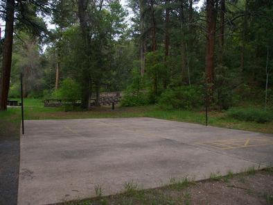
Each site contains tables, grills, campfire circles, electric lights and asphalt site pads. Vault toilets and drinking water are provided. An amphitheater with bench seating is also located on-site.

Natural Features

Towering ponderosa pines, cottonwoods, aspens and maples provide partial shade in the grassy, gently sloping picnicking site. Between the trees are scenic views of the canyon.

Nearby Attractions

Beaver Canyon Scenic Byway curves past the picnic area, offering 17 miles of scenic driving through the beautiful Tushar Mountains. Numerous lakes and streams throughout the area provide fishing, boating and canoeing opportunities.

Reservation

More from CampingHiking.net:

BIG SPRINGS – CARIBOU, Idaho Campground Images, Info & Reservations

Listen Directions Just east of Lava Hot Springs, Idaho, look for "Pebble Area" sign and turn left onto Blaser Highway/Old Highway 30. Go north on the paved highway 9 miles to Pebble Creek Road, known locally as Mike’s Place or Whiskey Mike’s. Turn left across railroad tracks on gravel Forest

EAST SULLIVAN, Washington Campground Images, Info & Reservations

Listen Directions Campground is located 95 miles north of Spokane, Washington. From the junction of State Highway 20, follow State Highway 31 three miles north to the junction of the Sullivan Lake Road (County Road 9345). Follow the Sullivan Lake Road for 12.5 miles to the junction of Forest Road

BERRY MOUNTAIN PARK SHELTER, North Carolina Campground Images, Info & Reservations

Listen Directions From Charlotte, North Carolina, take I-77 North (approximately 60 miles) before merging onto Highway 421 North towards Wilkesboro/Boone. Continue to Exit 286B (approximately 20 miles), turn left onto Highway 268 and continue for approximately 4 miles. Berry Mountain Park will be on the right. From Winston-Salem, North Carolina,

GIRD POINT, Montana Campground Images, Info & Reservations

Listen Directions From Hamilton, Montana, travel east on Highway 38 for about 7 miles. Turn north onto Gird Road/Forest Road 714 and continue for about 13 miles to the Gird Point Lookout Trailhead. The tower is approximately 1/2 mile hike from the parking area. Phone 406-821-3913 Activities BIKING, CAMPING, HIKING,

HOODVIEW, Oregon Campground Images, Info & Reservations

Listen Directions From Sandy, Oregon, travel east on Highway 26 for approximately 40 miles to Skyline Road/Road 42. Turn right on Skyline Road and continue south for about 9 miles. Turn right on Forest Service Road 57 and travel west for 2 miles, then turn right again at the Hoodview