

Directions
From Naches, Washington, follow US Highway 12 west for approximately 23 miles to paved Forest Road 1200. Turn left and follow FR 1200 for approximately 3 miles, then turn left and take FR 1203 for 3/4 mile. Finally, turn right and follow FR 517 for 0.2 miles into the campground.
Phone
509-653-1401
Activities
CAMPING, WILDLIFE VIEWING, SWIMMING, BIRDING
Keywords
SOUW,RIMROCK LAKE,OKANOGAN – WENATCHEE NF -FS
Related Link(s)
Washington State Road Conditions
Overview
South Fork Group Campground is located in the Okanogan-Wenatchee National Forest along the South Fork of the Tieton River. Nestled in in the eastern Cascade Mountains, the campground offers warm summer days and access to a multitude of recreational activities, making it an ideal setting for large family and group gatherings.
Recreation
South Fork Group Campground offers outdoor enthusiasts the opportunity to hike, fish, ski, raft and enjoy a multitude of outdoor recreational activities throughout the year. Rimrock Lake lies less than a mile from the campground. Whether casting a line out for kokanee salmon or trout or paddling a kayak along the shore, visitors will enjoy the mountainous terrain as a backdrop for a myriad of water-based activities. River enthusiasts may enjoy a whitewater rafting trip on one of the many scenic rivers in the area. The Tieton River is especially exciting in September, when the Bureau of Reclamation floods the Tieton Valley, releasing fast and furious water.
Facilities
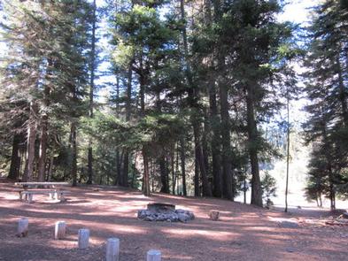
South Fork Group Campground offers nine designated spurs and can accommodate up to 80 people and 20 vehicles. The site is equipped with picnic tables, vault toilets and a group campfire ring.
Natural Features
The Okanogan-Wenatchee National Forest offers stunning scenic views, with high, glaciated alpine peaks, valleys of old growth forest and rugged shrub-steppe country making up the diverse landscape. Elevations range from below 1,000 feet to more than 9,000 feet.
Precipitation varies greatly throughout the area, ranging from approximately 140 inches along the Cascade Crest to only 10 inches along the eastern edge. Visitors can expect many days of warm, sunny weather in the summer, and winters with clear skies and plenty of snow.
The Tieton River, adjacent to South Fork Group Campground, is a tributary of the Naches River. Its headwaters originate in Goat Rocks Wilderness, collecting water from snowmelt and glaciers in high rugged peaks. These peaks are remnants of an extinct volcano, taking the name “Goat Rocks” in honor of the fantastic mountain goats traversing this isolated region.
Nearby Attractions
Visitors enjoy Mt. Rainer National Park, where interpretive programs and exhibits offer education about the diverse landscape and history of the area. The spectacular Pacific Crest Trail (PCT), one of the world’s premier National Scenic Trails, showcases some of North America’s most fantastic scenery, winding its way its way from Mexico to Canada through California, Oregon and Washington, and is accessible near the campground. Other hiking trails are within 5 miles of the campsite, and an accessible boat ramp is within 10 miles.