
Directions
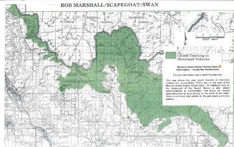
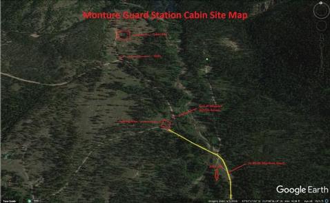
From Clearwater Junction (Highway 83 and Highway 200), travel east on Highway 200 for about 13 miles. Turn north on Forest Service Road 89 and continue for 8 miles. Cross the bridge over Monture Creek and proceed, veering slightly to the left for about 100 yards, to a small parking area. Maps are available online or for purchase by calling the Seeley Lake Ranger District.
The total distance from the parking area to the cabin is approximately a mile. The winter entrance to the cabin is on the rear (east side) of the cabin.
Phone
406-677-2233
Activities
CAMPING, WINTER SPORTS, WILDLIFE VIEWING
Keywords
MGSC,LOLO NF – FS
Related Link(s)
Overview
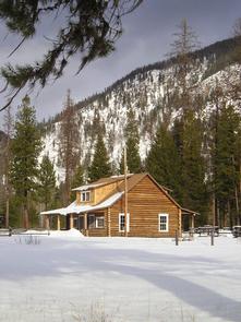
Monture Guard Station sits in the Lolo National Forest in western Montana, offering excellent winter recreation for visitors.
Recreation
Monture Guard Station offers modern amenities and furnishings just like home, but it also provides access to a variety of outdoor winter recreation opportunities that can only be enjoyed in a National Forest. A system of groomed trails surrounds the cabin and the nearby Seeley Lake, leaving lots of land for exploration.
The area also offers plentiful opportunities for cross country skiing, snowshoeing and snowmobiling.
Facilities
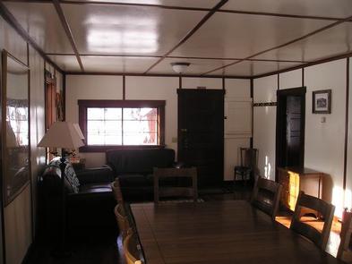
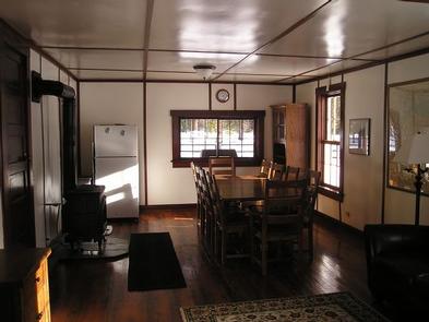
The two-story cabin is fully furnished and can accommodate up to eight people. Beds with mattresses are available on the second floor, while the first floor contains the kitchen, dining room and living room areas. A vault toilet outhouse is located approximately 75 yards northeast of the cabin.
The kitchen is equipped with a propane stove and oven, a small microwave, refrigerator and a variety of cooking and eating dishes and utensils, as well as pots and pans. There is a large table and ten chairs, as well as couches and other seating. The living space has electricity, rugs and wood floors throughout. Heat is provided by a propane heater. Propane fuel is provided.
Guests should bring their own bedding, towels, food, water, garbage bags, toilet paper and other necessities. Cleaning supplies and equipment are provided and guests will need to clean the cabin prior to leaving.
The cabin is only available in the winter and guests will need to hike, snowmobile or ski about a mile to the cabin. Guests are responsible for their own travel arrangements and safety, and must bring several of their own amenities.
Natural Features
The cabin is located about 8 miles north of the town of Ovando at an elevation of 4,200 feet. The surrounding forest contains a wide variety of trees, plants and wildlife. The area is home to mountain goats, bighorn sheep, elk, moose, deer and grizzly and black bears. Both the bald and golden eagle reside in the forest, along with trumpeter swan, herons and dozens of varieties of ducks.
Nearby Attractions
The nearest gas and groceries is available about 10 miles from the cabin.