

Directions
From Afton, WY, take Highway 89 north about 31 miles to Alpine, Wyoming. At Alpine, turn right (south) onto Greys River Road (Forest Road 10138) and travel about 13 miles. The cabin is located on the left (east) side of the road, just past Murphy Creek Campground.
Access is along a low-speed gravel road.
Phone
307-886-5300
Activities
BIKING, BOATING, HISTORIC & CULTURAL SITE, CAMPING, FISHING, HIKING, HORSEBACK RIDING, HUNTING, WILDLIFE VIEWING
Keywords
DRCC,DEER CREEK CABIN,DEERCREEK CABIN,DEER CREEK,BRIDGER-TETON NF – FS
Related Link(s)
Overview
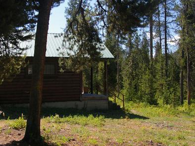
Deer Creek Cabin is a historic Forest Service guard station located 13 miles from Alpine, Wyoming. The quaint, rustic structure offers a backcountry experience with conveniences like a propane stove and a heater. The cabin compound is a free graze area for Forest Service horses to roam during the summer months.
Winter access is by snowmobile only on a groomed trail.
Recreation
Greys River flows just across the road from the cabin, offering prime fishing opportunities. Hiking, biking, horseback riding and off-road vehicle trails begin nearby.
Facilities
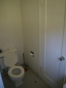
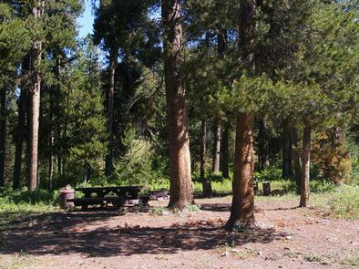
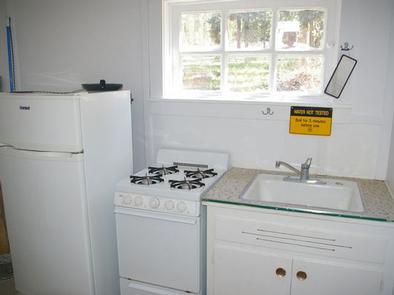
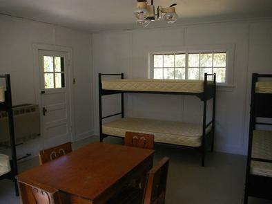
The two-room cabin sleeps six guests. Propane heating and lights are provided. Indoor plumbing is available during the summer months only, from around mid-June through Labor Day weekend. A vault toilet is available next to the cabin for colder months. A picnic table and campfire ring sit next to the cabin. A flush toilet, shower, and sink with drinking water are offered inside the cabin from approximately mid-June to Labor Day. Furnishings include a sink, propane cooktop, propane refrigerator, a table and chairs and three bunkbeds with mattresses. A wood stove and a propane heater are both available. Cooking and eating utensils are not provided. Recommended items to bring include bedding, dishes, pots and pans, utensils, garbage bags, dish soap, dish towels, toilet paper, a flashlight and cleaning products such as bleach or disinfectant.
Natural Features
Lodgepole pine trees cover the complex, offering partial shade. Scenic views of the Bridger-Teton National Forest abound.
Nearby Attractions
The closest town for groceries is in Alpine, just 13 miles away.