
Directions
From Afton, WY, take Highway 89 north about 31 miles to Alpine, WY. At Alpine, turn right (south) onto Greys River Road (Forest Road 10138) and travel about 46 miles. The cabin is located on the right (west) side of the road. Access is along a low-speed gravel road.
Phone
307-886-5300
Activities
BIKING, CAMPING, FISHING, HIKING, HORSEBACK RIDING, HUNTING, WILDLIFE VIEWING
Keywords
CAZI,CAZIER GUARD STATION,CORRAL CREEK CABIN,CORRAL CREEK GUARD,STATION,BRIDGER-TETON NF – FS
Related Link(s)
Overview
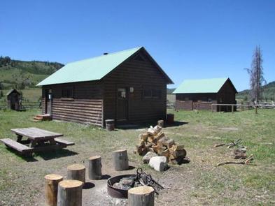
Cazier Cabin is a historic Forest Service guard station built by the Civilian Conservation Corps in 1933. Located near the Greys River about 46 miles from Alpine, Wyoming, the cabin offers fishing, hiking, horseback riding, mountain biking and cross-country skiing opportunities. Solar powered lights are one of the modern features of the rustic dwelling. In winter, access is by snowmobile on a groomed trail.
Recreation
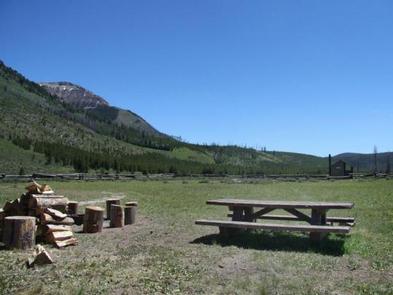
The Corral Creek Trail is easily accessed from the cabin and connects to Corral Creek Lake and the Swift, Dry and Cottonwood Creek drainages on the west side of the range. Popular activities include hiking, mountain biking, horseback riding and off-road vehicle riding on designated routes. In winter, cross country skiing is available right out the front door of the cabin. Greys River offers trout fishing.
Facilities
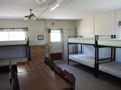
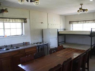
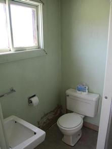
This rustic two-room guard station sleeps eight people on four bunkbeds with mattresses. Five additional guests may camp just outside the cabin.Drinking water, flush toilet and showers are available approximately mid-June to Labor Day. In winter, an outdoor vault toilet must be used.
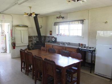
The cabin has a wood stove for heat and solar-powered lighting. The kitchen comes with basic amenities including a sink, propane range top, propane refrigerator, a dining table and chairs.
Cooking utensils and pots are not provided. Recommended items to bring include dishes, pots and pans, utensils, garbage bags, dish soap, dish rags, toilet paper, a flashlight, sleeping bags, pillows and cleaning products, such as bleach or disinfectant. In winter, guests must also bring drinking water.
Natural Features
The cabin sits in the valley of Greys River near Corral Creek at an elevation of 7,600 feet, and offers spectacular views up the Corral Creek drainage. The cabin sits in an open space with a few tall trees. A pine forest sweeps up the nearby mountain slopes.
Nearby Attractions
The cabin is rather remote. The closest town for groceries is in Alpine, a 46-mile drive north on a low-speed gravel road.