SIERRA, CA Campground Reservation, Info, Images, Map, Directions

SIERRA, California Campground Images, Info & Reservations

Listen

Directions

From Sierra City travel north on Highway 49, in about 7 miles turn right into the campground.

Phone

(530)478-6253

Activities

CAMPING, FISHING, HIKING, HUNTING, WATER ACCESS, SCENIC DRIVE, GOLD PANNING

Keywords

SRRA,TAHOE NF – FS

Related Link(s)

Rec Area Info & Images

California State Road Conditions

California State Tourism

Overview

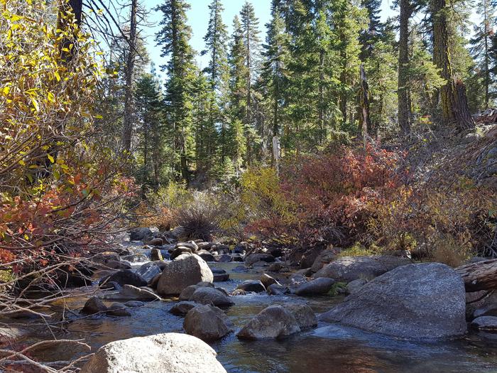
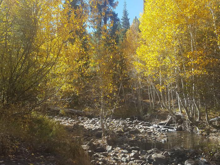
Sierra Campground is located on the north bank of the North Yuba River between Sierra City and Yuba Pass. Visitors enjoy a wide variety of recreational activities in the area, including hiking, hunting, fishing, canoeing and gold panning.

Recreation

A large network of trails is available in the area, including the Pacific Crest Trail. Boating, fishing, and swimming are available at nearby Sardine Lakes, about 5 miles from the campground. Sardine Lakes Resort offers boat rentals.

Facilities

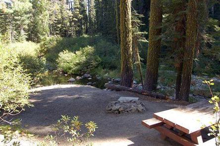
The campground offers single-family tent-only sites. Each site has a picnic table and campfire ring. Vault toilets are provided.

Natural Features

The campground is situated between the highway and the creek-sized North Yuba River in a forest of mature fir trees. Many sites overlook the river.

Nearby Attractions

Lakes Basin offers many opportunities for boating, fishing, swimming, and hiking. Sardine Lakes Resort offers boat rentals, lodging, and a restaurant. Anglers will find rainbow and brook trout in many of the lakes, streams, and rivers throughout the basin. A developed boat ramp is located at Gold Lake and accomodates launching of larger boats. Over 30 miles of maintained trails for hiking, mountain biking, and motorcycle singletrack branch out across the area and the Pacific Crest Trail can be accessed at a few spots in the Lakes Basin area. The historic towns of Sierra City and Downieville offer historic and cultural attractions, restaurants, shops, churches, and vistor information.

Reservation

More from CampingHiking.net:

BICENTENNIAL CAMPGROUND, California Campground Images, Info & Reservations

Listen Directions Upon entering the Marin Headlands follow the signs to the Visitor Center. The campground is less than 1/2 mile drive from the Visitor Center. Phone 415-331-1540 Activities BIKING, HISTORIC & CULTURAL SITE, CAMPING, INTERPRETIVE PROGRAMS, VISITOR CENTER, MOUNTAIN BIKING, BERRY PICKING Keywords Related Link(s) Rec Area Info &

REEDER BAY, Idaho Campground Images, Info & Reservations

Listen Directions From I-90 at Post Falls, turn north onto Highway 41 to Newport. Turn right on Highway 2/200 east to Priest River. Turn north (left) on Highway 57 to Nordman 37 miles, then turn right at Y junction and drive 3 miles to Reeder Bay. Phone 435-245-6521 Activities BIKING,

NORTH MILLS RIVER, North Carolina Campground Images, Info & Reservations

Listen Directions From Asheville, take U.S. Highway 280 west to North Mills River Road. Follow North Mills River Road to the campground. Phone (828) 552-8040 Activities CAMPING, INTERPRETIVE PROGRAMS, FISHING, HIKING, WATER SPORTS, SWIMMING SITE Keywords NOMR,NFs IN NORTH CAROLINA – FS Related Link(s) Rec Area Info & Images North

SYCAMORE CABIN, Arizona Campground Images, Info & Reservations

Listen Directions From Phoenix, take I-17 north about 80 miles to Exit 268, the Dugas/Orme Road exit. Go east toward Dugas. You will be on Forest Service Road 68. Travel east 8 miles continuing past Dugas for half a mile and then turn right (south) at the "Sycamore A.S." (Forest

FLATROCK (TEXAS), Texas Campground Images, Info & Reservations

Listen Directions From Coleman, TX, take Highway 153 west for 8 miles to the main entrance of Hords Creek Lake. Follow signs into the campground. Phone 325-625-2322 Activities BIKING, BOATING, CAMPING, FISHING, RECREATIONAL VEHICLES, SWIMMING SITE, PADDLING, MOTOR BOAT, PADDLE BOATING, WATER ACTIVITIES, KAYAKING, CANOEING, NON-MOTORIZED BOATING, WATER ACCESS, JET

LONG BRANCH, Tennessee Campground Images, Info & Reservations

Listen Directions From I-40, take exit 268 and merge onto US-96 west. Continue for 5 miles to the end of Center Hill Dam, then turn right on SR-141. Follow signs into campground. Phone 615-548-8002 Activities BOATING, CAMPING, FISHING, KAYAKING, CANOEING Keywords LONB,CENTER HILL LAKE,DAMSITE,CENTER HILL LAKE Related Link(s) Rec Area