
Directions
From Interstate 85, take exit 14 to Highway 187 north. Immediately after passing Clemson Research Center, turn left on Fants Grove Road and follow directional signs to the park. 189 SHELTER DRIVE, Pendleton, SC 29670
Phone
888-893-0678 HARTWELL PROJECT OFFICE
Activities
BOATING, FISHING, PICNICKING, DAY USE AREA, SWIMMING SITE, WATER ACCESS
Keywords
TWI3,HARTWELL LAKE PROJECT
Related Link(s)
South Carolina State Road Conditions
Overview
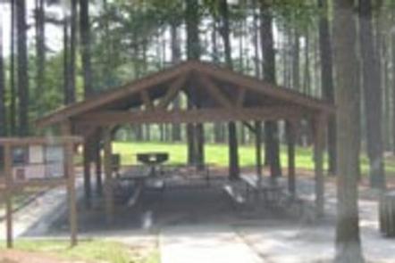
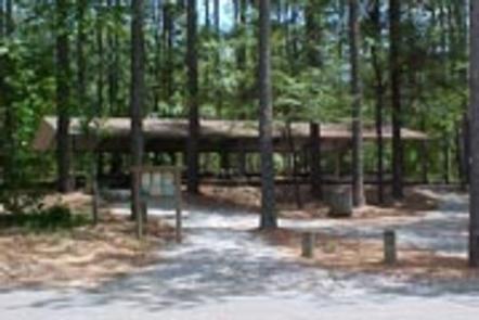
Twin Lakes Recreation Area is a 152-acre site consisting of a dense overstory of pines and mixed hardwoods. Day Use facilities presently include a new gatehouse/entrance installed in 2017, 1 volunteer host campsite, 27 picnic sites, 2 standard picnic shelters with water and electric service, 1 two lane boat ramp, 1 courtesy dock, 2 comfort stations, 1 playground, 2 designated swim areas/beaches, and associated paved roads and parking areas throughout. This area experiences moderate to high levels of intense public use during the peak recreation season, especially the ramp area that is heavily used during Spring and Summer and is a popular launch point for numerous fishing tournaments.
Recreation
Boating and water sports top the list of popular activities. A boat ramp is provided for easy lake access. A large sandy swimming beach with panoramic views of the lake, offers a scenic and spacious area for visitors to cool off in the South Carolina summer.
Facilities
Day Use facilities presently include a new gatehouse/entrance installed in 2017, 1 volunteer host campsite, 27 picnic sites, 2 standard picnic shelters with water and electric service, 1 two lane boat ramp, 1 courtesy dock, 2 comfort stations, 1 playground, 2 designated swim areas/beaches, and associated paved roads and parking areas throughout.
Natural Features
Hartwell Lake is a man-made lake bordering Georgia and South Carolina on the Savannah, Tugaloo and Seneca Rivers. The dam and lake area boasts 8 campgrounds and 11 day-use facilities that are operated by the US Army Corps of Engineers. The Hartwell Project was originally authorized for hydro-power, flood control, and navigation. Later, recreation, water quality, water supply and fish and wildlife management were added. Surrounding vegetation allows for plenty of shade, and the 962 miles of shoreline provide numerous swimming beaches, picnic areas and boat ramps.
Nearby Attractions
Twin Lakes is located just 5 miles from Clemson, South Carolina and Clemson University, offering additional tourism opportunities, along with grocery stores, gas stations and restaurants.
Charges & Cancellations
A $10 service fee will apply if you change or cancel your reservation more than 14 days in advance of arrival date. If you cancel a reservation within 14 days of your scheduled arrival date, you will forfeit the reservation fee.