MAHOGANY COVE CAMPGROUND, UT Campground Reservation, Info, Images, Map, Directions

MAHOGANY COVE CAMPGROUND, Utah Campground Images, Info & Reservations

Listen

Directions

From Beaver, Utah, travel east on paved SR-153/Beaver Canyon Scenic Byway approximately 12 miles to campground.

Phone

435-438-2436

Activities

CAMPING, FISHING, HIKING, WILDLIFE VIEWING

Keywords

MAHC,Mahogany Campground,Mahogany Cove,Mahogany,FISHLAKE NF – FS

Related Link(s)

Rec Area Info & Images

Utah State Road Conditions

Utah State Tourism

Overview

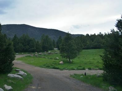
Mahogany Cove Campground is located in a grassy meadow along the Beaver Canyon Scenic Byway just 12 miles from Beaver, Utah, at an elevation of 7,200 feet. Visitors enjoy hiking, mountain biking and fishing in the nearby Beaver River.

Recreation

Fishing for rainbow and brook trout is popular on the Beaver River, which is just a short drive below the campground. Hiking, mountain biking and hunting are popular activities in the area.

Facilities

The campground consists of one group site made up of seven individual sites that can accommodate a total of 150 people and 20 vehicles. Reservations are posted at the campground in advance. If the entire site is not reserved, the individual sites can be used on a first-come, first-served basis.

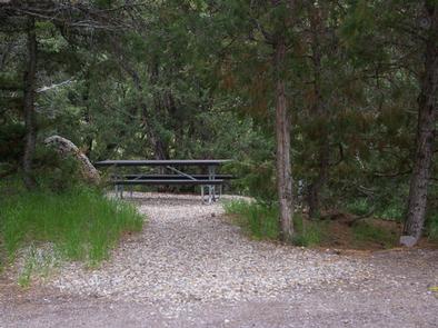
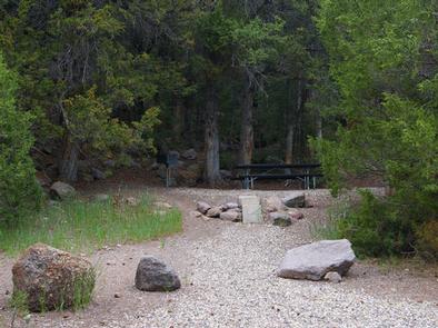
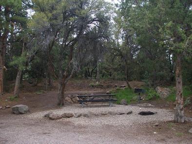
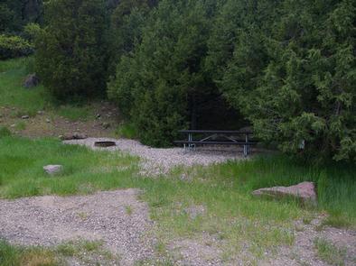
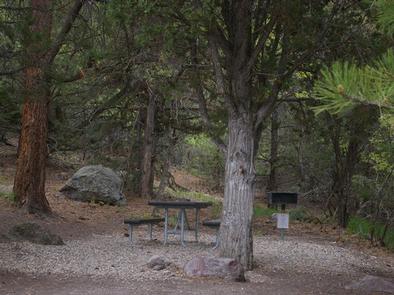
The first site has several picnic tables, a large grill and campfire circle. The other six sites each contain one picnic table, fire ring and grill. Vault toilets and drinking water are provided. Roads and parking spurs are gravel. A large play field is located just inside the entrance.

Natural Features

Stands of mahogany, pinion, juniper and ponderosa pine trees provide partial shade. The campground offers pretty views of the Tushar Range. An overlook just outside the campground has views of Beaver Canyon.

Nearby Attractions

Beaver Canyon Scenic Byway curves past the campground, offering 17 miles of scenic driving through the beautiful Tushar Mountains. Numerous lakes and streams provide fishing, boating and canoeing opportunities.

Reservation

More from CampingHiking.net:

FIREFIGHTERS CAMPGROUND, Utah Campground Images, Info & Reservations

Listen Directions From Vernal, Utah, take U.S. 191 north about 41 miles. From Manila, Utah, take Highway 44 for 28 miles. Turn left on U.S. 191 and travel approximately 3 miles north. From Rock Springs, Wyoming, take I-80 west toward Green River about 6 miles to the junction with U.S.

RAGLAND BOTTOM, Tennessee Campground Images, Info & Reservations

Listen Directions From Smithville, Tennessee, take US-70 east for 8 miles. Turn left on Ragland Bottom Road and follow signs to the campground, located one mile from Sligo Bridge. Phone 931-761-3616 Activities BOATING, CAMPING, FISHING, HIKING, SWIMMING, WATER ACCESS, WATER SKIING Keywords RAGL,CENTER HILL LAKE,CENTER HILL LAKE Related Link(s) Rec

ADAMS RANGER STATION, Idaho Campground Images, Info & Reservations

Listen Directions There are two ways to access this cabin in the summer: 1) From the town of Grangeville, turn south on the Grangeville-Salmon Road and follow the signs toward Gospel Hump and Salmon River. At mile marker 29, turn left (east) onto Hungry Ridge Road #309 and drive approximately

LODGEPOLE AT HEBER, Utah Campground Images, Info & Reservations

Listen Directions From Heber City, Utah, take Highway 40 east for 15 miles. Campground is on the right side of the highway. Phone HEBER RANGER DISTRICT 435-654-0470 OR UTAH RECREATION COMPANY 385-273-1100 Activities CAMPING, FISHING, HIKING, PICNICKING, WILDLIFE VIEWING Keywords LODC,UINTA NF – FS Related Link(s) Rec Area Info &