HUNGERFORD EQUESTRIAN GROUP CAMPSITE, MI Campground Reservation, Info, Images, Map, Directions

HUNGERFORD EQUESTRIAN GROUP CAMPSITE, Michigan Campground Images, Info & Reservations

Listen

Directions

From Big Rapids on US-131: Take M-20 west 8.5 miles to Cypress Ave. Go 0.5 miles north on Cypress Ave. Turn right on Hungerford Lake Drive and proceed 0.5 miles. Turn north on FR5134 and travel 2 miles to the group campsite.

Phone

231-745-4631

Activities

BIKING, CAMPING, HIKING

Keywords

HUNGERFORD EQUESTRIAN GROUP CAMPSITE (MI)

Related Link(s)

Rec Area Info & Images

Michigan State Road Conditions

Michigan State Tourism

Overview

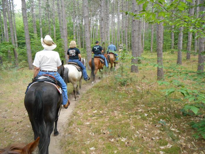
The Hungerford Recreation Area offers access to over 50 miles of trails for horseback riding, hiking and mountain biking.

The horse trails connect to the group campsite. There are a few small lakes located nearby, including, Hungerford Lake, Toogood Lake and Mud Lake.

Recreation

Forty-seven plus miles of horseback riding trails and 10 miles of mountain biking trails make the campground an ideal place for both equestrian campers and outdoors enthusiasts.

Hungerford Lake is located a half mile south of the Hungerford Family Campground and one and a quarter miles south of the Hungerford Equestrian Group Campsite. The area offers fishing and boating opportunities. Horses are not allowed in or around the lake area, but visitors interested in fishing are welcome to cast for bass, pike and pan fish. There is a boat ramp located at the lake.

Facilities

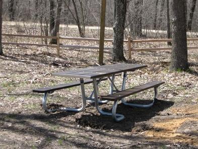
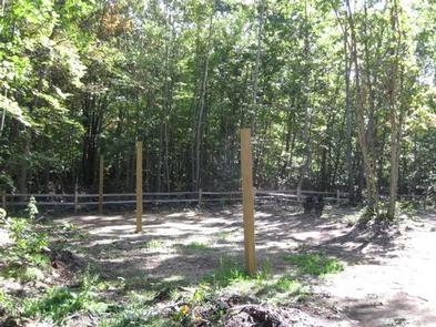
There are eight individual sites within the group camp area. Each site can accommodate one large horse trailer, two vehicles and eight people.

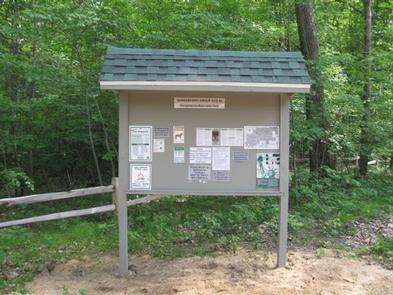
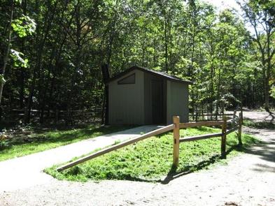
Picnic tables, lantern posts, fire rings, and picket poles to highline horses are provided at each of the eight sites. A vault toilet, manure disposal area, trash disposal, and large group campfire ring are provided for the campground. Drinking water is available at the Hungerford Campground, located 1.25 miles south of the site.

The group site’s check in and check out time is 12 noon.

Natural Features

The campground is perched along lightly rolling hills in the Manistee National Forest. It is about a mile north of Hungerford Lake and the 48 site Hungerford Campground.

The lake spans 30 acres and is a favorite spot to see fall colors. The Manistee National Forest comprises 540,000 acres and meets the eastern shore of Lake Michigan.

Nearby Attractions

Visit the city of Big Rapids, Michigan, or the Loda Lake Wildflower Sanctuary. Benton, Indian, Brush, and Shelley lakes are also nearby.

Reservation

More from CampingHiking.net:

LONG POINT (CA), California Campground Images, Info & Reservations

Listen Directions Located 30 miles northeast of Taylorsville, on the Genesee-Antelope Lake Road. From Janesville, take County Road 208 for 4 miles and turn onto Forest Service road 28N01 for 9 miles, then turn right on Forest Service road 28N03 and continue for 2 miles. Phone 530-283-0555 Activities BIKING, CAMPING,

DIFFICULT CAMPGROUND, Colorado Campground Images, Info & Reservations

Listen Directions Take Highway 82 for 5 miles southeast of Aspen, Colorado. Look for USFS Difficult Campground sign on the right, past Mile Marker 45. Phone 970-927-0107 Activities CAMPING, FISHING, HIKING, WILDLIFE VIEWING Keywords DIFF,ASPEN COLORADO,INDEPENDENCE PASS,DIFFICULT CAMPGROUND GRP SIT,WHITE RIVER NF -FS Related Link(s) Rec Area Info & Images

SUNSET-UNION VALLEY, California Campground Images, Info & Reservations

Listen Directions On Highway 50, east of Placerville, travel for 21 miles to the Icehouse Road turnoff on your left. Continue north for 16 miles to the campground. Phone 831-245-6891 Activities BIKING, BOATING, CAMPING, FISHING, HIKING, SWIMMING SITE, SAILING Keywords SUNP,PENINSULA,SUNSET,UNION VALLEY,YELLOWJACKET,WOLF CREEK,LOON LAKE,SUNSET UNION VALLEY,ELDORADO NF – FS Related

COSBY PICNIC PAVILION, Tennessee Campground Images, Info & Reservations

Listen Directions Seasonal phone is 423-487-2683 From Cosby, TN, proceed south on TN 32 about 1.5 miles from junction with US 321. Turn right at Cosby sign. Group camp is another 2.2 miles. Phone 423-487-2683 Activities HISTORIC & CULTURAL SITE, CAMPING, FISHING, HIKING, HORSEBACK RIDING, VISITOR CENTER, WILDLIFE VIEWING, DAY

LYNX CAMPGROUND, Arizona Campground Images, Info & Reservations

Listen Directions From Phoenix, Arizona: Traveling Northbound on I-17 take Exit 262 onto Hwy 69 North to Prescott and cointnue on Hwy 69 for 30 miles to S Walker Rd. Turn left and proceed South on S. Walker Rd. (by Costco, Petsmart, and AM/PM gas station). Drive about 3 miles

LITTLE CRATER CAMPGROUND, Oregon Campground Images, Info & Reservations

Listen Directions From Bend, travel 23.5 miles south on Hwy 97, then 14.5 miles east on Road 21, and 0.5 miles north on Forest Road 2100 570. Phone 541-383-5300 Activities CAMPING Keywords Related Link(s) Rec Area Info & Images Oregon State Road Conditions Oregon State Tourism Overview Situated on the