
Directions
Spence Cabin is located near Elkmont Campground. Drive south from Gatlinburg, TN on Newfound Gap Road (U.S. 441) for 1.7 miles and turn right onto Little River Road toward Cades Cove. Proceed 5 miles to Elkmont Campground road and turn left. Go 1.4 miles and turn left just before the campground office (sign says Elkmont Nature Trail 0.3, Little River Trail 0.6 and Jakes Creek Trail). After crossing the bridge, take the second left into the parking lot. Parking for Spence Cabin will be on your right as you make the loop through the parking lot. (The nearest street address is 500 Elkmont Road, Gatlinburg, TN.)
Phone
865-436-1261
Activities
HISTORIC & CULTURAL SITE, CAMPING, FISHING, HIKING
Keywords
None
Related Link(s)
Tennessee State Road Conditions
National Park Services Concessionaire
Overview
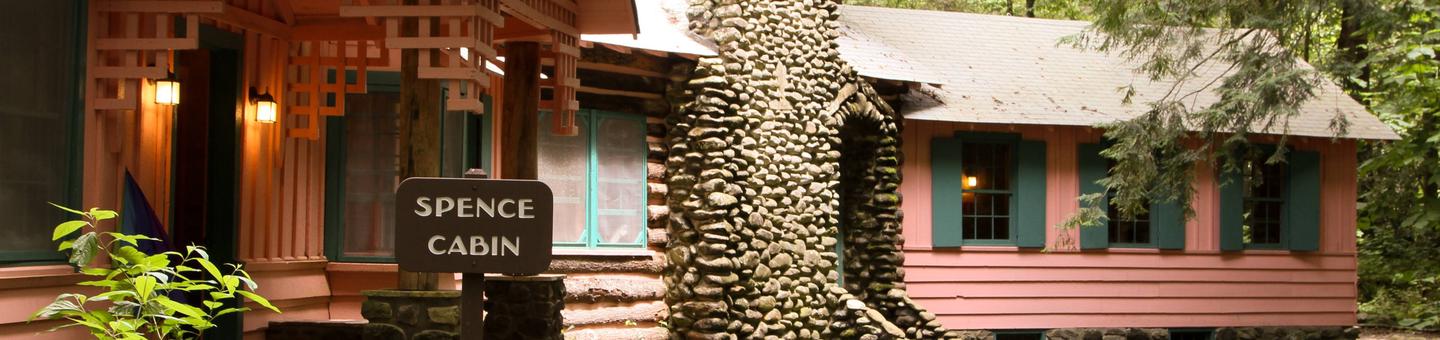
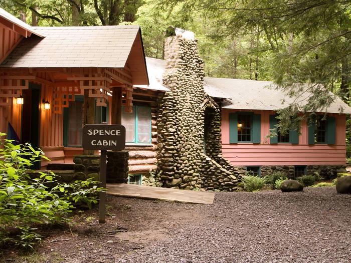
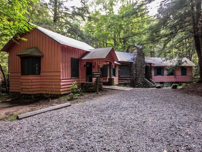
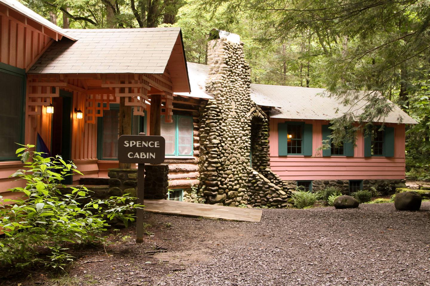
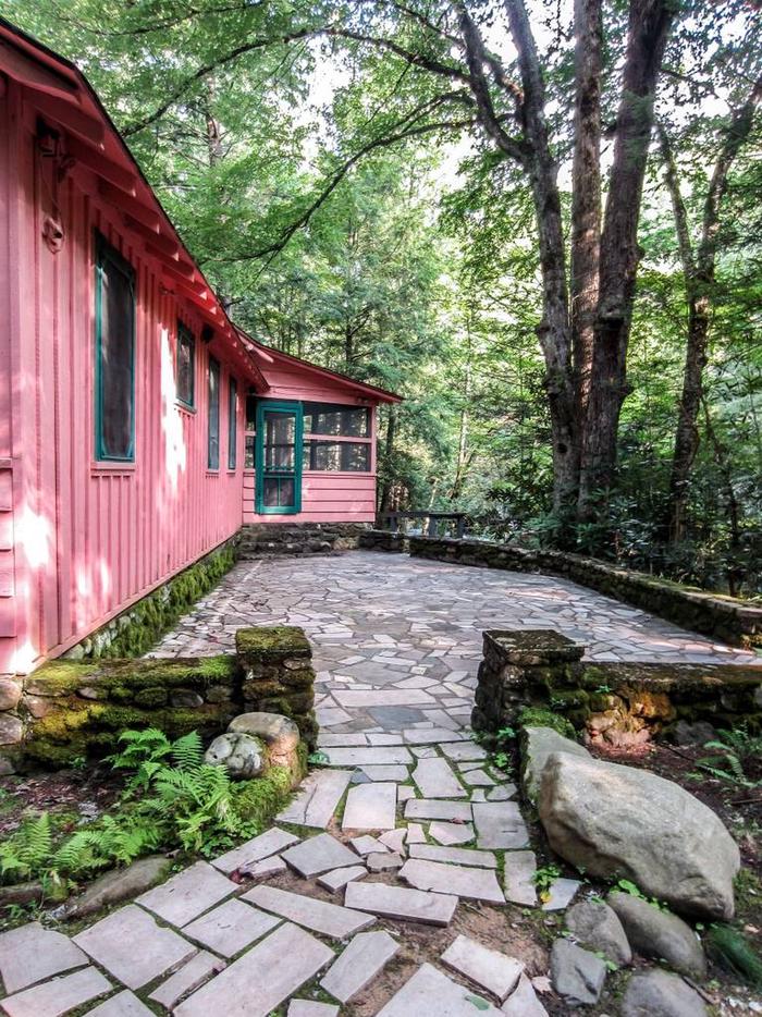
Spence Cabin is an ideal place to hold a small family gathering or family reunion away from the hustle and bustle of nearby towns. It is also an excellent location for a meeting or training session for a small group of people, or for a small wedding or reception. The outdoor patios are great places to relax and enjoy the beautiful atmosphere of the Great Smoky Mountains.
The cabin is situated within the Elkmont Historic District, which was placed on the National Register of Historic Places in 1994.
Recreation
There are numerous hiking trails within or near Elkmont, including the Little River, Jakes Creek and Laurel Falls Trails. The lower section of the Little River Trail is an old roadbed and relatively easy to hike. The Laurel Falls Trail is paved and accessible.
The self-guided Elkmont Nature Trail is nearby. The most unique feature of the area is the Elkmont Historic District with a number of cabins still standing.
Fishing is popular both above and below Elkmont.
Facilities
The cabin has four small meeting rooms ranging in size from 118 to 165 square feet. One larger room is 432 square feet, and has a gas fireplace. The rooms have between two and six electric outlets. There is also a warming kitchen, which contains a refrigerator and microwave oven. No cook stove is available, but electrical outlets can be used for warming devices such as slow cookers. The lighting is consistent with the historic use of the cabin and is rather dim.
The building has no heat or air conditioning, but it does have ceiling fans in the main room and screened porch, as well as a gas fireplace in the main room.
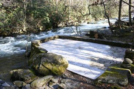
Most of the cabin is accessible, with the exception of the riverside patio. Two bathrooms are available, one of which is accessible. A 192 square foot screened outdoor porch faces the Little River, as does a nice stone patio. A smaller patio is located on the bank of the Little River. Parking for nine cars is located about 100 yards from the cabin, with an additional two spaces located at the cabin.
Furnishings are limited to 40 folding chairs, four 6-foot diameter round tables, eight 2.5-by-6 foot rectangular tables and six rocking chairs. Guests may set up the furniture in any configuration that will suit their needs. Guests may also wish to bring additional items such as a portable gas barbecue grill, slow cookers and lawn chairs.
Natural Features
The Elkmont Historic District sits in a relatively flat and narrow valley at the confluence of Jakes Creek and the Little River. It encompasses a tract in a montane alluvial forest, which occurs primarily within the floodplains of the Little River and its tributary, Bearwallow Creek.
The valley is surrounded by steep ridges, including Sugarland Mountain to the east, Meigs Mountain to the west, Blanket Mountain to the south and Cove Mountain to the north.