DEMOTTE, AZ Campground Reservation, Info, Images, Map, Directions

DEMOTTE, Arizona Campground Images, Info & Reservations

Listen

Directions

From Kanab, UT the facility is 40 miles (35 miles from Fredonia, AZ) south on U.S. Route 89A to AZ State Route 67, at Jacob Lake. Then south 25 miles on AZ State Route 67 to DeMotte campground.

From Bitter Springs intersection of U.S. 89 and 89A. Take 89A north 55 miles to Jacob Lake. Then south 25 miles on AZ State Route 67 to DeMotte campground.

Phone

(928) 638-1960

Activities

CAMPING

Keywords

Related Link(s)

Rec Area Info & Images

Arizona State Road Conditions

Forest Service Concessionaire

Arizona State Tourism

Overview

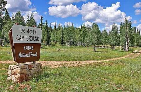
The DeMotte Campground is located within the North Kaibab Ranger District just seven miles north of the entrance to the Grand Canyon National Park’s North Rim. This is about 25 miles south of the Kaibab Plateau Visitor Center on Arizona’s Highway 67.

Recreation

Visitors to the DeMotte Campground enjoy camping and picnicking, sight-seeing and wildlife viewing. Enjoy a visit to the North Rim from mid-May through mid-October; the road is closed during winter. Hiking trails, spruce-fir and Ponderosa pine forests and unparalleled views of one of the Seven Natural Wonders of the World.

Facilities

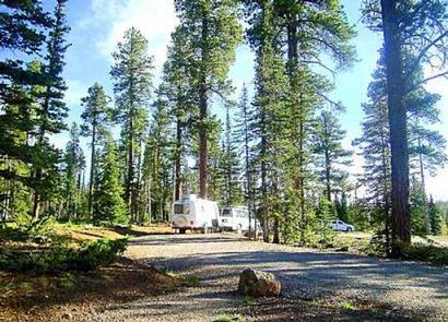
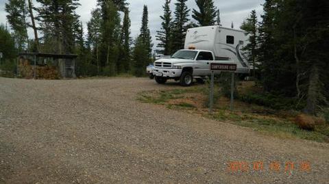
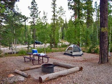
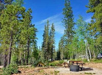
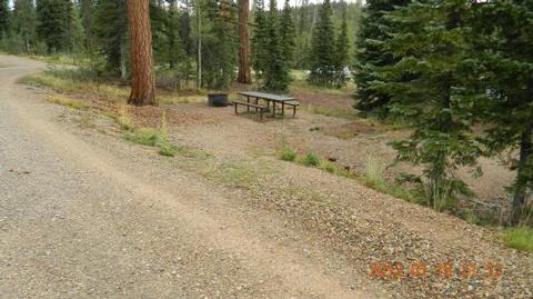
The campground offers 38 single-family campsites with tables and cooking grills. DeMotte’s campsites can accommodate tents, trailers and small motor homes. No utility hookups are available at this campground. Drinking water is available.

Natural Features

Many species of wildlife call the Kaibab home, including the tassel-eared Kaibab squirrel, found nowhere else in the world, and numerous species of birds.

Nearby Attractions

The North Rim of the Grand Canyon National Park.

Reservation

More from CampingHiking.net:

LAKE SPRINGS, Georgia Campground Images, Info & Reservations

Listen Directions From Augusta, GA, travel 22 miles west on GA-104, then 4 miles north on US HWY 221. Phone 800-533-3478 Activities BIKING, BOATING, FISHING, HIKING, PICNICKING, DAY USE AREA, SWIMMING SITE, SWIMMING, ACCESSIBLE SWIMMING, LOOKOUT TOWER Keywords LASC,J STROM THURMOND LAKE Related Link(s) Rec Area Info & Images Georgia

PARKSIDE, Montana Campground Images, Info & Reservations

Listen Directions From U.S. Highway 212, turn off at Rock Creek Road (Forest Road 2421). Go 0.3 miles to the campground entrance on the right. Phone 406-587-9054 Activities BIKING, BOATING, CAMPING, FISHING, HIKING Keywords PKSD,CUSTER NF – FS Related Link(s) Rec Area Info & Images Overview Parkside Campground is located

Axolotl Cabin, Montana Campground Images, Info & Reservations

Listen Directions From Ennis – Most Direct Route – 4 WD/High Clearance Vehicle Strongly Recommended -Take State Highway 287 towards Virginia City – About 1/4 mile east of mile marker 11 (or 3/4 mile west of mile marker 10) turn South into the paved parking area near the top of

SMITH SPRINGS, Tennessee Campground Images, Info & Reservations

Listen Directions From downtown Nashville, TN, take I-40 east 5 miles to exit 219. Turn right on Stewarts Ferry Pike, then left on Smith Springs Road. The recreation area is on the left after about 2 miles. Phone 615-889-1975 Activities BOATING, FISHING, PICNICKING, WILDLIFE VIEWING Keywords SMSP,J. PERCY PRIEST,PERCY PRIEST

UPPER LITTLE TRUCKEE, California Campground Images, Info & Reservations

Listen Directions From either east bound or west bound Interstate 80 in Truckee take exit 188, Highway 89 north to Sierraville. In aproximately 12 miles turn left into the campground. Phone (530) 994-3401 Activities BIKING, CAMPING, FISHING, HIKING, HUNTING, WATER ACCESS, SCENIC DRIVE Keywords UPLI,TAHOE NF – FS Related Link(s)