
Directions
The Dolly Copp Picnic Area is located on NH Route 16 about 5 miles south of Gorham, New Hampshire, and 13 miles north of Jackson, New Hampshire.
Phone
603-466-2713
Activities
HISTORIC & CULTURAL SITE, CAMPING, FISHING, WILDLIFE VIEWING
Keywords
Related Link(s)
New Hampshire State Road Conditions
Overview
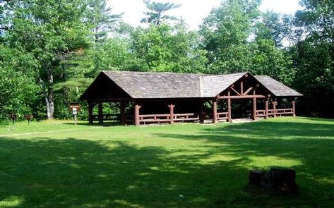
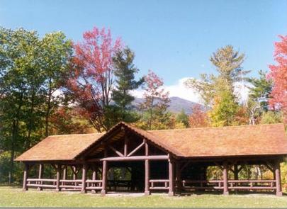
Located along the Peabody River in the heart of the White Mountains, the Dolly Copp Picnic Pavilion is a wonderful location for a family reunion, wedding reception, or any large group gathering.
Recreation
The Peabody River is a popular fishing destination and can be accessed from the Dolly Copp Picnic Pavilion. A large field directly in front of the Pavilion offers room for games and socializing. The Dolly Copp Campground, with over 170 campsites, is located conveniently across the river from the Picnic Area.
Facilities
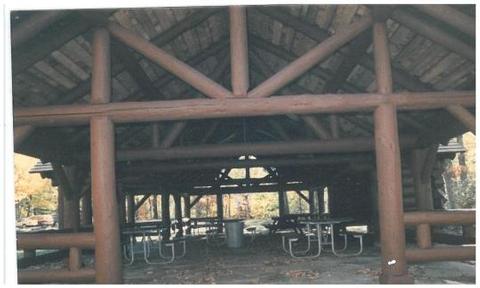
Originally constructed in 1936 by the Civilian Conservation Corps (CCC), the pavilion was reconstructed in 1996 using some of the original timbers and new timbers harvested from trees planted by the same 1936 CCC crew. The pavilion has eight accessible picnic tables, a large stone fireplace and a flag stone floor. Two charcoal grills are available next to the pavilion. The Dolly Copp Picnic Area has a dumpster, running water, and a flush toilet.
Natural Features
The Dolly Copp Picnic Pavilion, located in the Dolly Copp Picnic Area, sits along the pristine waters of the Peabody River. Surrounded by forested land, visitors will enjoy exploring along the outskirts of the Picnic Area.
Nearby Attractions
The Dolly Copp Picnic Area is about five miles south of the town of Gorham and 13 miles north of Jackson, New Hampshire. Attractions between the two towns include Wildcat Ski Area, the Mount Washington Auto Road, and the Appalachian Mountain Club’s Pinkham Notch Visitor Center. White Mountain National Forest visitors can explore the Great Gulf Wilderness, hike to Tuckerman Ravine and Mount Washington, visit Glen Ellis Falls Scenic Area, or stop by the Androscoggin Ranger District Visitor Center by driving a only a few miles from the Picnic Area.