
Directions
From Phoenix, Arizona: Traveling Northbound on I-17 take Exit 262 onto Hwy 69 North to Prescott and cointnue on Hwy 69 for 30 miles to S Walker Rd. Turn left and proceed South on S. Walker Rd. (by Costco, Petsmart, and AM/PM gas station). Drive about 3 miles and then turn East (left) into Lynx Campground.
Alternate route from Flagstaff, Arizona: Traveling Southbound on I-17 take Exit 278 onto Westbound Highway 169 and continue for 15 Miles until reaching the junction of Hwy 69, turn right onto Northbound Hwy 69 and continue for 12 miles to S. Walker Rd. Turn left and proceed South on S. Walker Road (by Costco, Petsmart, and AM/PM gas station). Drive about 3 miles and then turn East (left) into Lynx Campground.
Phone
1 (877) 444-6777
Activities
BIKING, BOATING, HISTORIC & CULTURAL SITE, CAMPING, INTERPRETIVE PROGRAMS, FISHING, HIKING, HORSEBACK RIDING, VISITOR CENTER, WILDLIFE VIEWING, HOTEL/LODGE/RESORT PRIVATELY OWNED
Keywords
LYNX CAMPGROUND,LYNX LAKE CAMPGROUND,LYNX LAKE,LYNX
Related Link(s)
Overview
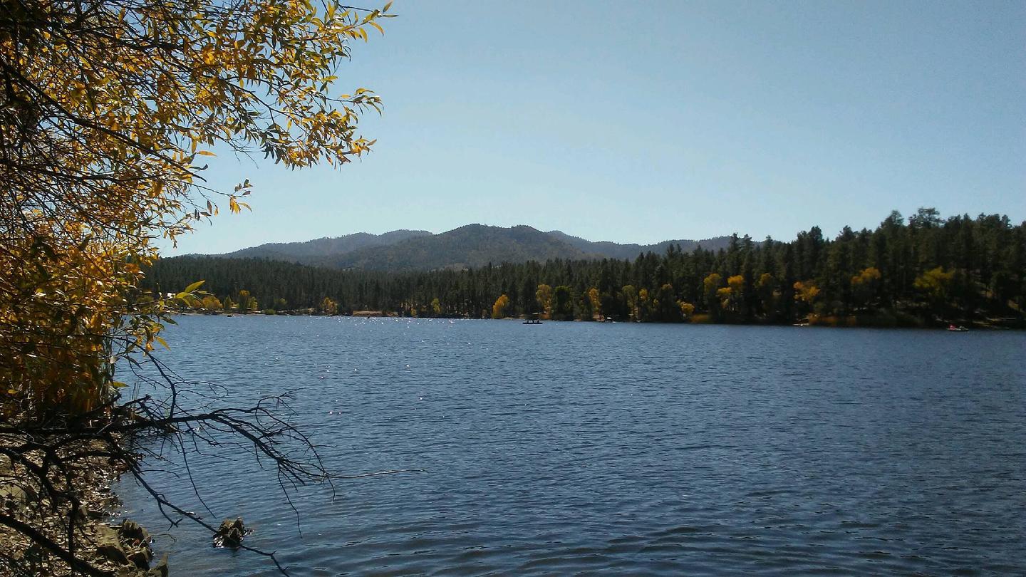
Lynx Campground is located in the Lynx Lake Recreation Area at 5,600 feet in elevation. Within 1/4 mile of the popular Lynx Lake, the campground is situated along the lake’s west shoreline. The facility is about seven miles southeast of the city of Prescott, Arizona. To make reservations click on the availability button to the right to book on this site or call 1 (877) 444-6777. For general campground questions contact the Bradshaw Ranger District at 1 (928) 443-8000.
Recreation
Several trail systems trails are within the Lynx Lake Recreation Area. Most trails allow for multiple modes of travel. The exceptions are Lynx Creek Ruin Trail #301 and Loop Trail #311 that allows hiking only. Wildlife viewing is a grand event when a bald eagle, osprey, or great blue heron has been seen flying effortlessly above Lynx Lake or skimming the water surface. Recreational panning is allowed on the Prescott National Forest, as long as any natural feature is not harmed and no motorized or mechanical equipment or mining aids are used. Lynx Lake is one of the most popular recreation spots in central Arizona and attracts more than 90,000 visitors each year. The lake offers a boat ramp and allows for boats with 10 HP motors or less. Oar, paddle, or sail-powered boats are also permitted. Swimming and wading are not allowed in Lynx Lake. Horseback riders, mountain bikers, and hikers can be found on most trails. Forest Service Day-Use Facilities in the Prescott Basin are accessible at no additional fee. See the Volunteer Host for a complimentary pass validated for your length of stay. Visiting a Day-Use facility requires a pass visibly displayed on the vehicle’s dashboard, driver’s side.
Facilities
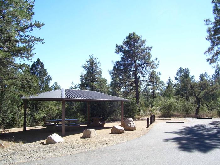
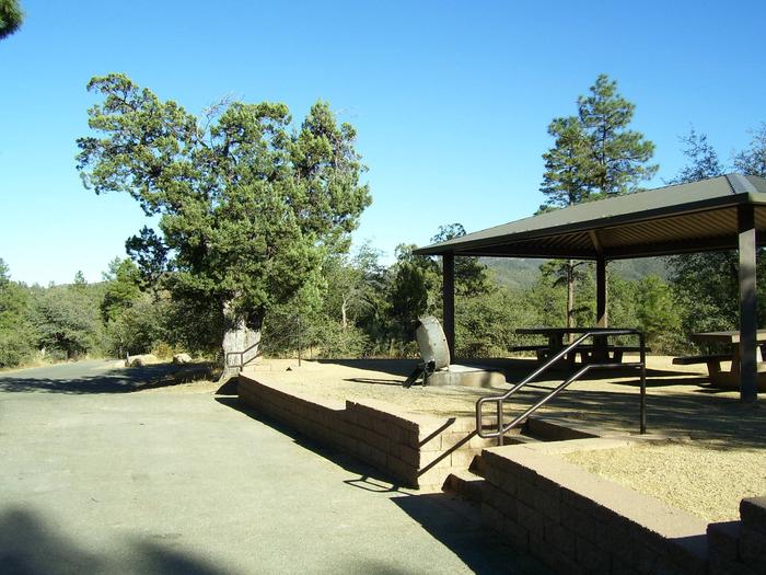
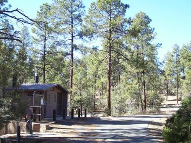
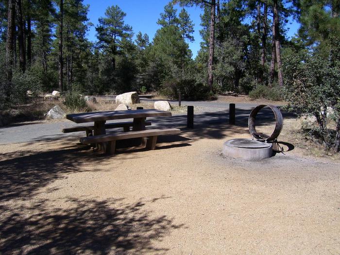
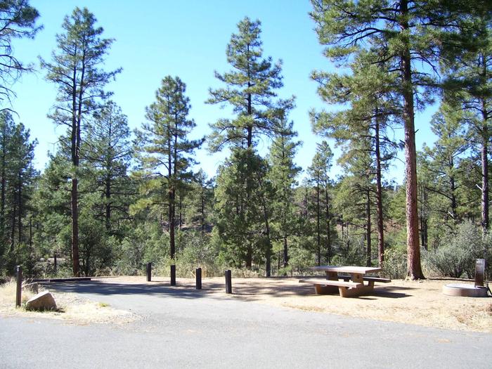
Each of the 35 campsites in Lynx Campground has a picnic table, steel fire ring, and either an established tent pad or an area with room for one to two tents. Two campsites also have a lantern hanger. A steel ramada is present on select campsites. Campsite driveways are either parallel, pull-through, or back-in and all have asphalt surfacing. Some campsite driveways allow a camp unit and an extra vehicle quite easily while others may be snug. A few campsites are a short walk-in. Four vault toilets, two flush toilets, six trash dumpsters, and eight water faucets service the campground. There are no RV hook-ups or dump station in the campground.
Campsites 10-19, 22-23, and 28-34 have steps.
Campsites 20, 21, and 35 are fully accessible to persons with disabilities.
Natural Features
Lynx Campground offers visitors pleasant summer temperatures and cool breezes. The campground is situated in a ponderosa pine ecosystem mixed with alligator juniper, oak species, and a variety of forbs and native grasses. The 55-acre Lynx Lake skirts the campground’s east boundary. Several species of colorful wildflowers bloom in the spring and during the summer monsoon seasons. Day-time and overnight temperatures are pleasant and afternoon thunderstorms are likely from late June through mid-September.
The forest is home to a wide variety of wildlife. Visitors may see deer, osprey, great blue heron, bald eagle, mountain lion, bobcat, coyote, fox, skunk, rabbit, and several species of snakes, lizards, and birds.
Nearby Attractions
The Highlands Center for Natural History, in partnership with the Prescott National Forest, is only a few minutes from Lynx Campground. A learning center, trail system on 80 acres, and scheduled interpretive programs are but a few of the exciting activities the Center offers through the spring, summer, and fall. Lynx Lake Store and Marina near the North Shore Day-Use Area offers a restaurant, store, boat rentals, firewood, fishing and camping supplies. The City of Prescott is a few minutes drive from Lynx Campground. Many activities including arts, crafts, and music festivals are scheduled throughout the summer. Watson Lake, islocated within a 20-minute drive from Lynx Campground, is managed by the City of Prescott. The City of Prescott recreation pass and day-use fee should not be confused with the Prescott National Forest Day-use Passes or Day-Use fee. Fain Lake, in Prescott Valley, is a private enterprise and a short 20-minute drive from Lynx Campground. Fishing and picnicking can be found there.