

Directions
Driving:
Westbound on Highway I-70 towards Grand Junction, Exit 31 (Horizon Drive): Follow signs through Grand Junction to the east entrance. The visitor center and campground are 19 miles from the east entrance.
Eastbound on Highway I-70 take Exit 19 (Fruita): Turn south on Highway 340 to the west entrance, which is approximately three miles from Fruita. The visitor center and campground are four miles up from the west entrance.
Phone
970-858-3617 EXT. 300
Activities
BIKING, CAMPING, INTERPRETIVE PROGRAMS, HIKING, HORSEBACK RIDING, WILDLIFE VIEWING, PHOTOGRAPHY, RANGER STATION, STAR GAZING, BIRDING, CROSS COUNTRY SKIING, SCENIC DRIVE, ROCK CLIMBING, AMPHITHEATER, EDUCATIONAL PROGRAMS
Keywords
SADDLEHORN CAMPGROUND,SADDLEHORN
Related Link(s)
Colorado State Road Conditions
Overview
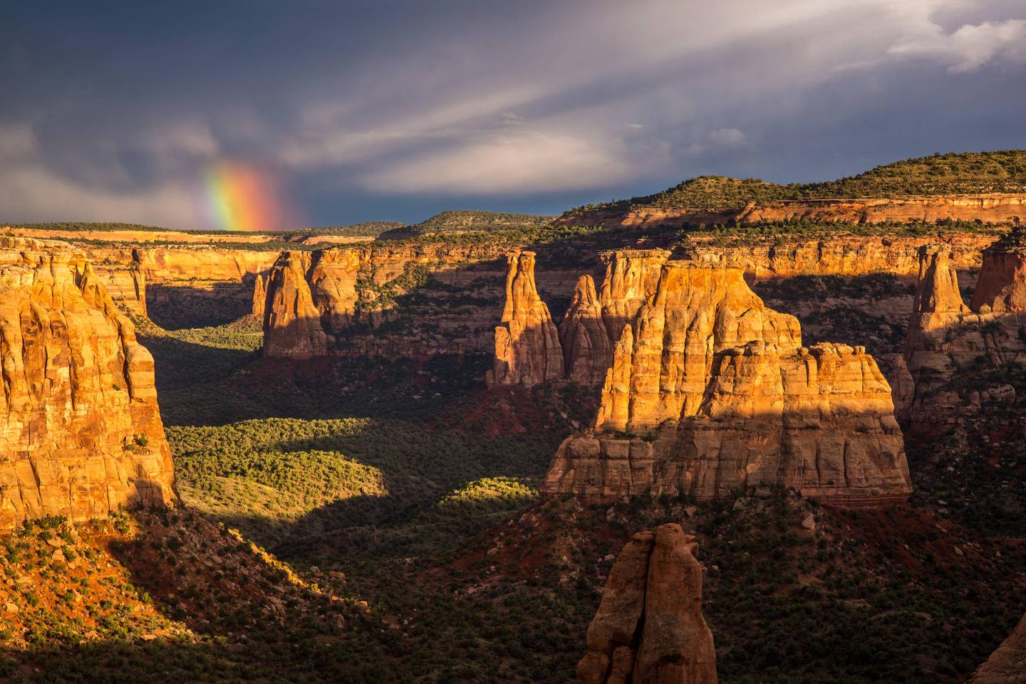
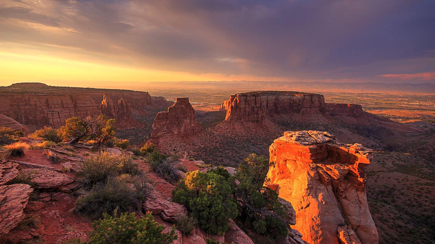
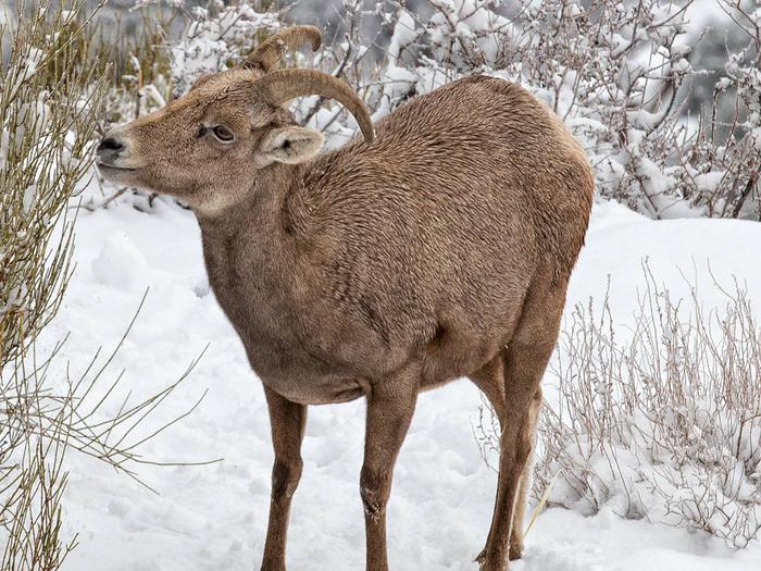
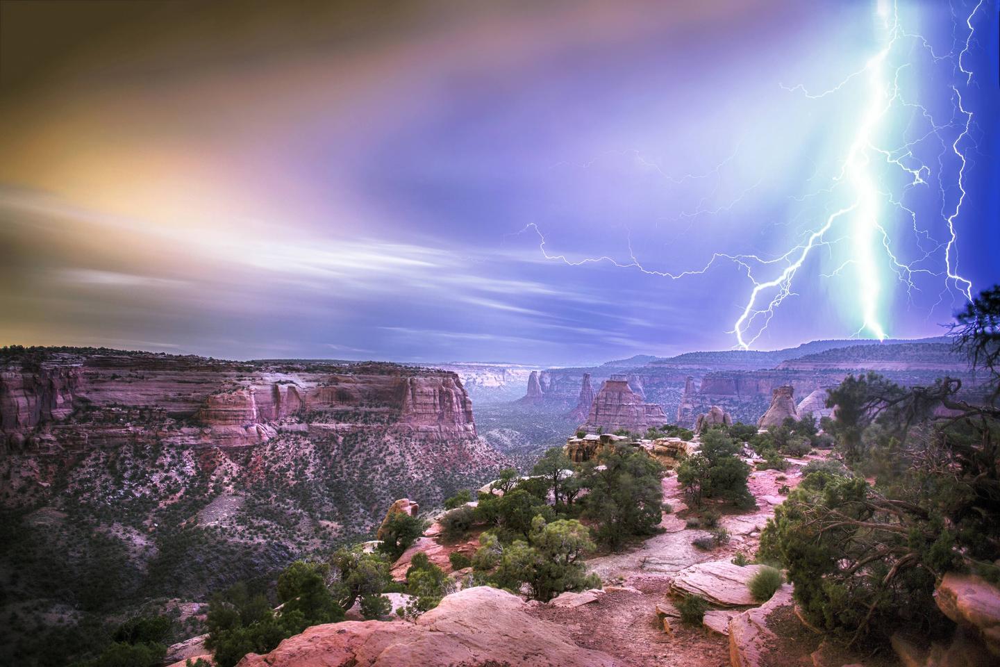
Saddlehorn Campground is located within Colorado National Monument which preserves one of the grand landscapes of the American West. Much more than a monument, towering monoliths exist within a vast plateau and canyon panorama. You can experience sheer-walled, red rock canyons along the twists and turns of Rim Rock Drive, where you may spy bighorn sheep and soaring eagles.
Recreation
Colorado National Monument is famous in cycling communities for its majestic views and challenging climbs, but Historic Rim Rock Drive is also a popular motor tour. Hikers flock to the miles of maintained trails, photographers come year round to capture the spectacular views, and geologists study the unique landscape for its scientific value. Climbers come for the towering sandstone, and wildlife lovers may spot Desert Bighorn sheep, golden eagles, collared lizards, and many other special creatures.
Facilities
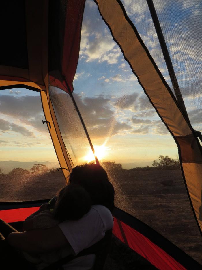
Saddlehorn Campground is located near the Saddlehorn Visitor Center, four miles from the west entrance (near Fruita, Colorado) and nineteen miles from the east entrance (near Grand Junction, Colorado), and is the only established campground within the Monument. There are 79 campsites with three camping loops within the Saddlehorn Campground (Loop’s A, B, and C). Loop A is open year round and is first come first serve (sites suitable for both tents and RVs), Loop B (both tents and RVs) is reservation & one-night only, Loop C is first come first serve (tents and small vehicles). Loop’s B & C are open March 17th through October 31st. Restrooms have flush toilets and water available during the summer, and each site has a picnic table and charcoal-only grill. There are no electric hookups or showers.
Natural Features
The campground is nestled within large red rock formations, with pinyon and juniper trees providing adequate shade. There are spectacular views of the Grand Valley to the northwest, and some of the park’s most scenic monoliths and canyons to the southeast
Nearby Attractions
The cities of Grand Junction, Fruita, and Palisade boast many urban and agricultural attractions, but there are also abundant recreation areas surrounding the Monument. Among these are McInnis Canyons National Conservation Area, James M. Robb Colorado River State Park, Highline Lake State Park, and many Bureau of Land Management and Forest Service areas.