
Directions
Please follow the directions provided below and do not use other navigation applications. From Idaho Springs and Interstate 70, take Exit 240 (Colorado Highway 103) and drive south over the bridge on Colorado 103 for 19 miles. Turn right onto Forest Road 192.1, a dirt road and continue for one mile where you will come to parking area before a locked gate. Proceed on foot one mile up the road past the locked gate to the Lookout Tower. Do not block access to any of the gates. Winter Access: Interstate 70, take Exit 240 and drive south over the bridge on Colorado 103 for 19 miles to Forest Road 192.1. Park at pull off or along the right hand shoulder of the highway and continue on foot on the road heading up for one mile where you will come to a gate. Pass around the gate and continue for one more mile to the Lookout Tower.
Phone
303-567-4382
Activities
CAMPING
Keywords
Squaw Mountain Fire Lookout,Squaw Peak Lookout
Related Link(s)
Colorado State Road Conditions
Overview
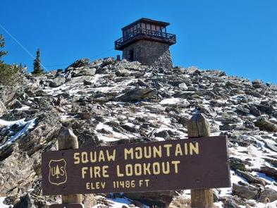
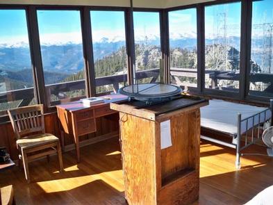
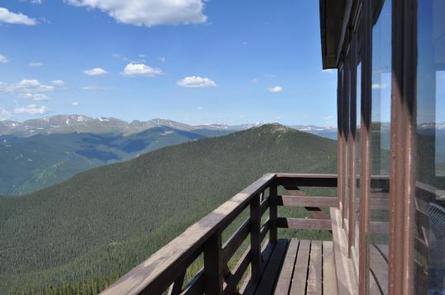
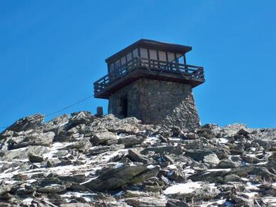
The Squaw Mountain Lookout is located directly off of Colorado Highway 103 west of Bergen Park and sits at the summit of Squaw Mountain, which is an active communication tower site in Clear Creek County. In addition to being an active communication site, the Squaw Mountain area is a popular dispersed recreation use area with hiking, recreational shooting, cross country skiing, snowshoeing, and camping. The lookout is a unique structure constructed of native granite which is situated at over 11,000 feet elevation and was built in the 1940s by the Civilian Conservation Corps. The cab measures 14 feet by 14 feet and is completely lined by windows on each side and surrounded by a catwalk, all of which sit on top of a one story stone base.
Recreation
Hiking, wildlife viewing, scenic driving, picnicking, snowshoeing, and cross-country skiing are all easily accessible while staying at the lookout.
Facilities
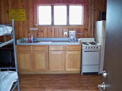
The lookout contains an electric stove, refrigerator, and heat; beds; table and chairs; cookware and dishes; and an exterior incinerating toilet. Please be aware that visitors are expected to clean and maintain the incinerating toilet to ensure proper operation of the unit. The lookout can accommodate four people per night. Guests will need to bring their own water for drinking, cooking and cleaning purposes, as well as their own sleeping bags/bedding. This is a pack it in, pack it out facility; guests will need to carry out all trash and clean the facility prior to leaving.
During the winter months, the facilities will be cold. In the lookout, there are two small wall heaters, and one space heater. However, with the weather conditions, its not always possible for them to keep the place consistently warm. At 11,000 feet it can also be extremely windy. Please come prepared for the extreme winter weather conditions that can happen during your stay.
Natural Features
Besides offering the unique experience of staying in a fire lookout, Squaw Mountain Lookout will provide visitors outstanding panoramic views of the Great Plains, Denver, Mount Evans, Pikes Peak, Longs Peak and other snow-capped peaks.
Nearby Attractions
Mount Evans Recreation Area, Mount Evans Wilderness Area