
Directions
From Meeker, take Colorado Highway 13 east for 1 mile, then turn right on Rio Blanco County Road 8 and follow this for 39 miles to Trappers Lake Road #205. Turn south on Trappers Lake Road #205, and continue for 10 miles just past the Outlet Trailhead. The Shepherds Rim Campground is on the right.
Phone
970-927-0107
Activities
BIKING, CAMPING, INTERPRETIVE PROGRAMS, FISHING, HIKING, WILDLIFE VIEWING
Keywords
Related Link(s)
Colorado State Road Conditions
Overview
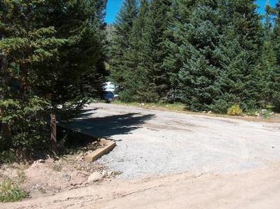
Surrounded by mountains and nestled near the wilderness, the Shepherds Rim Campground at Trappers Lake has 15 scenic campsites. Located at 9,720 feet in elevation, visitors can locate this campground on the right side of the road as you travel south from the Trappers Lake Outlet area.
Recreation
Trappers Lake is known as the Cradle of Wilderness. At approximately 302 surface acres, the lake contains a strain of native cutthroat trout and the Colorado Parks and Wildlife operates a spawn collection station at the Cabin Creek inlet during May and June.
Trappers Lake lies completely within the Flat Tops Wilderness; motorized boats and wheeled carts for boat transport are prohibited.
Facilities
Shepherds Rim Campground has one tent site, and 15 standard sites suitable for tents, trailers and RVs. The sites are equipped with picnic tables and campfire rings. Guests also have access to vault toilets and drinking water, but electrical hook-ups are not available.
Natural Features
In the heart of the Rocky Mountains, the 2.3 million acre White River National Forest is a place of serenity and adventure, boasting eight wilderness areas, four defined seasons, and 10 peaks surpassing 14,000 feet in elevation.
Wildlife in the area abounds. Bighorn sheep navigate rocky ridges and bull elk bugle at dusk. Scenic rivers sustain populations of cutthroat, rainbow, and brown trout. Alpine regions provide habitat for pika and ptarmigan. These species, along with many others, depend on surrounding undeveloped wilderness, clean streams, and diverse forests to live.
Nearby Attractions
There is an RV dump station within the Trappers Lake complex.