EDSON CREEK GROUP CAMPGROUND, OR Campground Reservation, Info, Images, Map, Directions

EDSON CREEK GROUP CAMPGROUND, Oregon Campground Images, Info & Reservations

Listen

Directions

Edson Creek campground is located off of Highway 101 between Bandon and Port Orford, Oregon. From U.S. Highway 101, turn east onto Sixes River Road. Travel approximately four miles, and turn left into the campground just before you cross the Edson Creek Bridge.

Phone

541-756-0100

Activities

BOATING, CAMPING, FISHING, DAY USE AREA, SWIMMING

Keywords

Edson Creek Group Campground,Edson Creek Campground,Edson Creek

Related Link(s)

Rec Area Info & Images

Oregon State Tourism

Oregon State Road Conditions

Overview

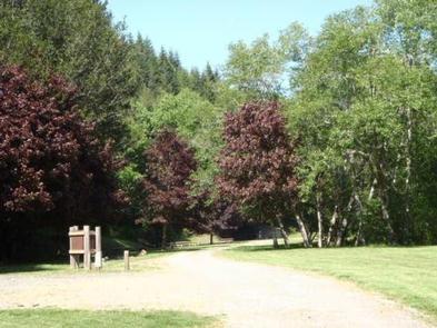
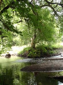
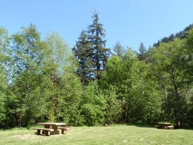
Edson Creek Campground features open meadow style camping. It is located near a beautiful meandering creek that flows into the Sixes River.

Recreation

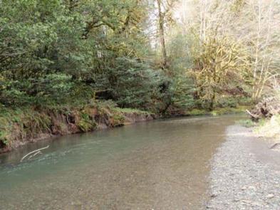
Camping, fishing, boating, site-seeing, and water play are all popular activities at the campground. A day use area and boat ramp are located across the road from the main campground, providing a place to launch boats and fish the Sixes River.

Facilities

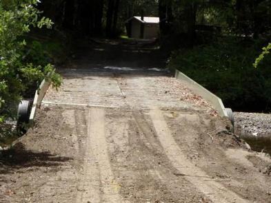
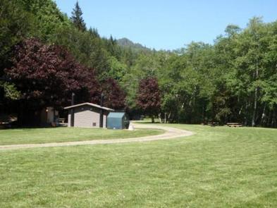
Edson Creek provides 27 campsites and 5 group sites. All five of the group sites are reservable. Four of the group sites are located across the creek from the main campground via a seasonal bridge, group site A is near the main campground. This provides a private camping area for groups of 25 in each site. Campground includes picnic tables, fire rings, and accessible toilets.

Natural Features

Tall alder and myrtle trees flank the open meadows at Edson. The water and forest that surrounds the campground are home to many fish and wildlife species.

Nearby Attractions

The area provides warm temperatures and easy access to nearby coastal attractions. Cape Blanco Lighthouse, Oregon State Parks, and several coastal beaches are nearby.

Reservation

More from CampingHiking.net:

MYSTIC LAKE CABIN, Montana Campground Images, Info & Reservations

Listen Directions There is no motorized access to this cabin. 1. Sourdough Canyon Trailhead: From Bozeman, MT. Drive south on S. 19th Ave. for 5.1 miles to Nash Rd. Turn left (east) onto Nash Rd. Drive 1.7 miles to Sourdough Canyon Road, turn right (south), and drive for 0.9 miles

PICNIC POINT (WI), Wisconsin Campground Images, Info & Reservations

Listen Directions From Medford, take State Highway 13 north 4 miles. Turn left (west) onto County Highway M for about 7 miles. Turn right (north) onto County Highway E and continue for about 8 miles. Turn right (east) onto Forest Road 1563 and continue for 1 mile, then turn right

FAWN, California Campground Images, Info & Reservations

Listen Directions From I-5 in Redding, take California State Highway 299 West to State Highway 3 at Weaverville. Go north on Highway 3 for 14.5 miles. Campground is on the right. Phone 530-275-8113 Activities BOATING, CAMPING, SWIMMING SITE Keywords FAWN,SHASTA-TRINITY -FS Related Link(s) Rec Area Info & Images California State

BIG BEND (WV), West Virginia Campground Images, Info & Reservations

Listen Directions Follow 28/55 from Petersburg, West Virginia, for 8 miles. Turn left onto Smoke Hole Road, Route 28/11, and travel for 13 miles to County Route 2. Turn left onto the Smoke Hole Road, County Route 2, and follow for approximately 3 miles to Big Bend Campground. Phone 304-358-3253

SURRY MOUNTAIN LAKE BEACH, New Hampshire Campground Images, Info & Reservations

Listen Directions Surry Mountain Lake Beach is located on Route 12A in Surry, New Hampshire. Phone 603-352-4130 Activities BOATING, FISHING, HUNTING, PICNICKING, WILDLIFE VIEWING, DAY USE AREA, PHOTOGRAPHY, SWIMMING, KAYAKING, CANOEING, ICE FISHING Keywords Surry Mountain Lake Beach,Surry Mountain Lake,Surry Mountain Dam Related Link(s) Rec Area Info & Images New