
Directions
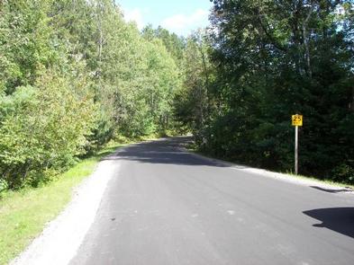
From the intersection of Highway 32 and County Road T in Townsend, drive south on T 5.6 miles to the campground.
Phone
715-276-6333
Activities
BOATING, CAMPING, FISHING, HIKING, WINTER SPORTS, WATER SPORTS, WILDLIFE VIEWING
Keywords
Related Link(s)
Wisconsin State Road Conditions
Overview
Strong winds and rain caused significant damage to portions of the Lakewood-Laona Ranger District on the Chequamegon-Nicolet National Forest on July 19, 2019. Forest Service personnel began surveying the damage Saturday morning and will be continuing to assess recreation sites, roads, trails and the Forest this week.
The Forest has issued an emergency closure order for National Forest System lands in Oconto County including all roads, trails, dispersed and developed recreation sites including Boot Lake and Bagley Rapids Campgrounds. This order will be updated as often as needed to reflect changes as areas are cleared and reopened for the public to use. Please check the Forest website or our Facebook or Twitter pages for the latest information.
We do not anticipate Boot Lake Campground to reopen in 2019, so the Forest has begun cancelling and refunding all reservations at this site. We encourage affected parties to look for alternative camping options at near by Boulder Lake, Laura Lake or Richardson Lake Campgrounds unaffected by storm.
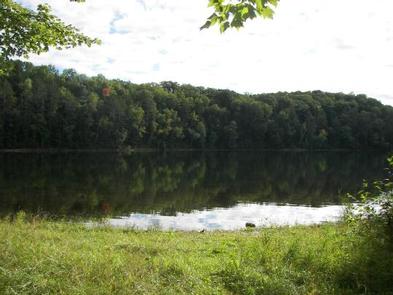
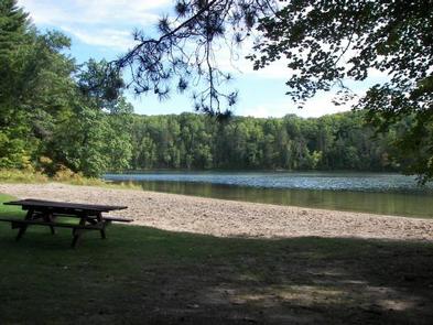
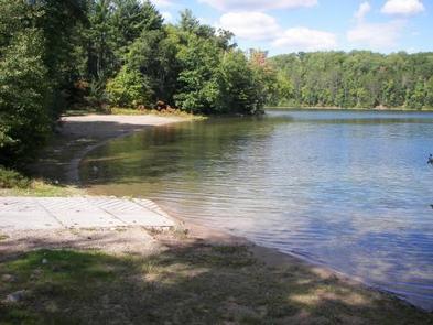
Boot Lake Campground overlooks its namesake — 263-acre Boot Lake. Bask in the sun on the beautiful beach and then take a relaxing dip in the lake, or enjoy the fishing. Boot Lake contains walleye, northern pike, bass, musky, and panfish. In addition, several nearby streams offer excellent trout fishing, and the Wolf River provides fishing, kayaking, rafting, and first-class canoeing opportunities. The Jones Spring Non-Motorized Area is nearby, and offers hiking, hunting, and cross-country skiing. Generally, use at this popular campground is heavy throughout the summer.
Recreation
The Chequamegon-Nicolet National Forest has an abundance of outdoor recreation opportunities. Those most enjoyed at Boot Lake are fishing, swimming, kayaking, and canoeing. Due to the clarity of the water Scuba diving has become increasingly popular.
Facilities
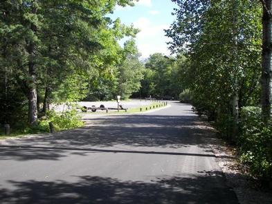
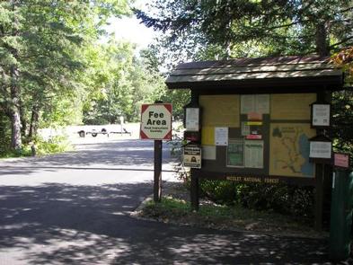
Boot Lake Campground has 34 sites. More than half of the sites can accommodate campers of 30 and some of the sites are tent only. Drinking water, vault toilets, swim beach, picnic area, and a boat landing are also provided at this location. All roads are paved.
Natural Features
This campground sits on the northwest corner of Boot Lake, in a quiet finger of the lake. The campground is a mix of hardwoods and pine. Boot Lake is a high quality clear lake and has a maximum depth of 38 feet.
Nearby Attractions
Jones Springs Non-Motorized Area is just west of Boot Lake. It offers opportunities for hiking, hunting and cross-country skiing in the winter. There is a trail in the campground that connects into the Jones Springs hiking trails. The nearby Wolf River provides excellent opportunities for rafting and white water canoeing, and kayaking. The local community of Townsend is just north of the campground. The Cathedral Pines Trail is approximately four miles from the campground — a must see at any time of the year.