
Directions
1007 Hwy T15 Knoxville, Iowa 50138 From Pella, Iowa, take County Highway T-15 southwest for 3 miles, then follow signs to North Overlook Picnic Shelter.
Phone
641-828-7522
Activities
CAMPING, PICNICKING, BIRDING
Keywords
Related Link(s)
Overview
North Overlook Picnic Shelter is located adjacent from North Overlook Campground on Lake Red Rock, Iowa’s largest lake. It is just 10 minutes from Pella, known for its Dutch heritage, and 15 minutes from Knoxville, the Sprint car capital of the world. Visitors enjoy boating, fishing, hiking, biking and viewing wildlife.
For more information regarding the Army Corps of Engineers and the Lake Red Rock Project, click here:
Lake Red Rock Website
For a virtual tour of Lake Red Rock click here:
Lake Red Rock – Virtual Tour
Recreation
Lake Red Rock offers excellent boating, water skiing and swimming opportunities. Miles of water trails for kayakers and canoeists are designated along the shoreline. Anglers will find crappie, walleye, largemouth and striped bass, channel and flathead catfish, northern pike and bluegill. Several miles of trails for hiking and biking are in the area. The 15 mile paved Volksweg Trail stretches west from Pella to the Des Moines River and to the Cordova Recreation Area,
Facilities
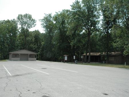
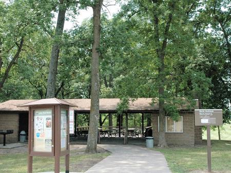
North Overlook Picnic Shelter is a conventional open shelter that offers 20 amp electrical service, picnic tables, an outdoor grill, fire ring, water fountain and nearby flush toilets.
If your event is open to the public, greater than 100 people, involves live or amplified music, or if alcohol will be available to attendees, you may need an event permit. Click the link below to apply for an event permit:
Special Event Permit
If shelter is not reserved, it is available free of charge on a first-come, first-served basis.
Shelter occupancy is permitted until dusk.
Natural Features
Lake Red Rock is situated on the Des Moines River. Hardwood forests cover the lake shore at North Overlook, offering shade and scenic views. Wildlife is abundant around the lake. A wide variety of waterfowl, including the American White Pelican, migrates through the area in spring and fall. Bald eagles can be observed from November through March. White-tailed deer, turkeys and other small animals are commonly viewed around the lake.
Nearby Attractions
Des Moines, Iowa’s capital, is an hour away, with numerous shopping and dining opportunities, museums and the Blank Park Zoo.
Charges & Cancellations
A $10.00 service fee will apply if you change or cancel your reservation. The $10.00 service fee will be deducted from the refund amount. Cancel or change reservations through recreation.com or by calling 1-877-444-6677. Late cancellations are subject to additional fees.